
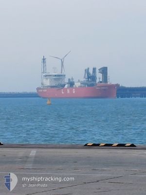
CORAL NORDIC
Tanker
Current Trip
| Time Travelled | 6 h, 44 mins |
|---|---|
| Remaining Time | 3 days |
| Distance Travelled | 98.17 nm |
| Remaining Distance | 1221.50 nm |
| AVG Speed | 15.3 Knopen |
| MAX Speed | 16 Knopen |
| AVG Wind | 7.7 knots |
| MAX Wind | 9.7 knots |
| MIN Temp | -1.4°C / 29.48°F |
| MAX Temp | -0.1°C / 31.82°F |
| Diepgang | 7.8 M |
| Positie ontvangen | Nu |
Current Position
| Lengtegraad | 25.77487° |
|---|---|
| Breedtegraat | 59.91590° |
| Status | Under way using engine |
| Snelheid | 15.9 Knopen |
| Koers | 253.3° |
| Gebied | Gulf of Finland |
| Station | T-AIS |
| Positie ontvangen | Nu |
Info
Information
The current position of CORAL NORDIC is in Gulf of Finland with coordinates 59.91590° / 25.77487° as reported on 2025-02-07 14:17 by AIS to our vessel tracker app. The vessel's current speed is 15.9 Knopen and is heading at the port of ZEEBRUGGE. The estimated time of arrival as calculated by MyShipTracking vessel tracking app is 2025-02-10 20:24 LT
The vessel CORAL NORDIC (IMO: 9919890, MMSI: 246133000) is a Tanker It's sailing under the flag of [NL] Netherlands.
In this page you can find informations about the vessels current position, last detected port calls, and current voyage information. If the vessels is not in coverage by AIS you will find the latest position.
The current position of CORAL NORDIC is detected by our AIS receivers and we are not responsible for the reliability of the data. The last position was recorded while the vessel was in Coverage by the Ais receivers of our vessel tracking app.
The current draught of CORAL NORDIC as reported by AIS is 7.8 meters
Weather
| Temperature | -0.1°C / 31.82°F |
|---|---|
| Wind Speed | 6 knots |
| Direction | 157° SSE |
| Pressure | 1052.9 hPa |
| Humidity | 76.8 % |
| Cloud Coverage | 95 % |
Featured Company
Last Port Calls
| Port | Arrival | Departure | Time In Port |
|---|---|---|---|
| 2025-02-06 05:07 | 2025-02-07 07:34 | 1 d | |
| 2025-02-01 15:51 | 2025-02-02 11:44 | 19 h | |
| 2025-01-27 13:46 | 2025-01-28 16:05 | 1 d | |
| 2025-01-20 10:25 | 2025-01-21 15:52 | 1 d | |
| 2025-01-15 06:42 | 2025-01-16 16:20 | 1 d | |
| 2025-01-09 14:03 | 2025-01-10 10:18 | 20 h | |
| 2025-01-04 07:19 | 2025-01-05 10:00 | 1 d | |
| 2024-12-30 16:04 | 2024-12-31 11:24 | 19 h | |
| 2024-12-24 22:33 | 2024-12-26 12:20 | 1 d | |
| 2024-12-20 07:42 | 2024-12-21 03:39 | 19 h |
Last Trips
| Origin | Departure | Destination | Arrival | Distance | |
|---|---|---|---|---|---|
| 2025-02-02 12:44 | 2025-02-06 08:07 | 1337.80 nm | |||
| 2025-01-28 19:05 | 2025-02-01 16:51 | 1476.80 nm | |||
| 2025-01-21 16:52 | 2025-01-27 16:46 | 1351.64 nm | |||
| 2025-01-16 19:20 | 2025-01-20 11:25 | 1479.79 nm | |||
| 2025-01-10 11:18 | 2025-01-15 09:42 | 1352.31 nm | |||
| 2025-01-05 13:00 | 2025-01-09 15:03 | 1495.65 nm | |||
| 2024-12-31 12:24 | 2025-01-04 10:19 | 1337.08 nm | |||
| 2024-12-26 15:20 | 2024-12-30 17:04 | 1496.49 nm | |||
| 2024-12-21 04:39 | 2024-12-25 01:33 | 1353.36 nm | |||
| 2024-12-15 11:36 | 2024-12-20 08:42 | 1496.85 nm |
Events
| Tijd | Evenement | Details | Positie / Bestemming | Info |
|---|---|---|---|---|
| 2025-02-07 14:01 | Wijzig zee gebeid | Finnish part of the Gulf of Finland Estonian part of the Gulf of Finland |
59.93539 / 25.91043
Gulf of Finland
BEZEE
|
Snelheid: 15.8 kn Koers: 254° |
| 2025-02-07 13:59 | Status Changed | Under way using engine Default |
59.93818 / 25.92878
BEZEE
|
Snelheid: 16 kn Koers: 255° |
| 2025-02-07 13:33 | Status Changed | Default Under way using engine |
59.96800 / 26.14667
BEZEE
|
Snelheid: 15.6 kn Koers: 254.8° |
| 2025-02-07 13:13 | Wijzig zee gebeid | Estonian part of the Gulf of Finland Russian part of the Gulf of Finland |
59.99165 / 26.32024
Gulf of Finland
BEZEE
|
Snelheid: 15.6 kn Koers: 255° |
| 2025-02-07 09:23 | Destination Changed | BEZEE ZEEBRUGGE |
60.37560 / 28.01815
BEZEE
|
Snelheid: 15.6 kn Koers: 214° |
| 2025-02-07 09:23 | ETA Changed | 2025/02/11 09:00 2025/02/06 03:00 |
60.37560 / 28.01815
BEZEE
|
Snelheid: 15.6 kn Koers: 214° |
| 2025-02-07 08:57 | Draught Changed | 7.8 6.8 |
60.42601 / 28.17437
ZEEBRUGGE
|
Snelheid: 6.1 kn Koers: 253.9° |
| 2025-02-07 08:57 | Destination Changed | ZEEBRUGGE RUVYS |
60.42601 / 28.17437
ZEEBRUGGE
|
Snelheid: 6.1 kn Koers: 253.9° |
| 2025-02-07 08:34 | Binnenbereik |
60.46247 / 28.31166
Gulf of Finland
|
Snelheid: 15.5 kn Koers: 236.9° |
|
| 2025-02-07 08:31 | Status Changed | Under way using engine Default |
60.46891 / 28.33103
RUVYS
|
Snelheid: 14.9 kn Koers: 182° |