
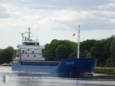
COSTAMAR
General Cargo
Current Trip
| Trip Time | 2 days |
|---|---|
| Trip Distance | 703.17 nm |
| AVG Speed | 10.3 Knopen |
| MAX Speed | 11.4 Knopen |
| Diepgang | 3.9 M |
| AVG Wind | 11.8 knots |
| MAX Wind | 19.7 knots |
| MIN Temp | -1.2°C / 29.84°F |
| MAX Temp | 4.9°C / 40.82°F |
| Positie ontvangen | 2 d geleden |
Current Position
| Lengtegraad | 19.22543° |
|---|---|
| Breedtegraat | 60.89480° |
| Status | Under way using engine |
| Snelheid | 11.1 Knopen |
| Koers | 11.8° |
| Gebied | Gulf of Bothnia |
| Station | T-AIS |
| Positie ontvangen | 2 d geleden |
Info
Information
The current position of COSTAMAR is in Gulf of Bothnia with coordinates 60.89480° / 19.22543° as reported on 2025-02-26 08:02 by AIS to our vessel tracker app. The vessel's current speed is 11.1 Knopen and is currently inside the port of VIRPIPERA.
The vessel COSTAMAR (IMO: 9552020, MMSI: 255805989) is a General Cargo that was built in 2010 ( 15 Jaar oud ). It's sailing under the flag of [PT] Portugal.
In this page you can find informations about the vessels current position, last detected port calls, and current voyage information. If the vessels is not in coverage by AIS you will find the latest position.
The current position of COSTAMAR is detected by our AIS receivers and we are not responsible for the reliability of the data. The last position was recorded while the vessel was in Coverage by the Ais receivers of our vessel tracking app.
The current draught of COSTAMAR as reported by AIS is 3.9 meters
Weather
| Temperature | -2.1°C / 28.22°F |
|---|---|
| Wind Speed | 10 knots |
| Direction | 208° SSW |
| Pressure | 1016.3 hPa |
| Humidity | 94 % |
| Cloud Coverage | 14 % |
Featured Company
Last Port Calls
| Port | Arrival | Departure | Time In Port |
|---|---|---|---|
| 2025-02-27 12:48 | |||
| 2025-02-23 19:33 | 2025-02-24 17:16 | 21 h | |
| 2025-02-21 16:20 | 2025-02-22 14:07 | 21 h | |
| 2025-02-18 09:18 | 2025-02-20 09:10 | 1 d | |
| 2025-02-15 11:52 | 2025-02-17 14:36 | 2 d | |
| 2025-02-12 21:37 | 2025-02-14 14:43 | 1 d | |
| 2025-02-10 01:50 | 2025-02-12 02:16 | 2 d | |
| 2025-02-02 20:03 | 2025-02-03 21:57 | 1 d | |
| 2025-01-31 06:50 | 2025-01-31 18:32 | 11 h | |
| 2025-01-28 10:37 | 2025-01-29 20:38 | 1 d |
Last Trips
| Origin | Departure | Destination | Arrival | Distance | |
|---|---|---|---|---|---|
| 2025-02-24 18:16 | 2025-02-27 14:48 | 703.17 nm | |||
| 2025-02-22 15:07 | 2025-02-23 20:33 | 250.26 nm | |||
| 2025-02-20 11:10 | 2025-02-21 17:20 | 239.30 nm | |||
| 2025-02-17 15:36 | 2025-02-18 11:18 | 205.78 nm | |||
| 2025-02-14 16:43 | 2025-02-15 12:52 | 204.21 nm | |||
| 2025-02-12 03:16 | 2025-02-12 23:37 | 214.83 nm | |||
| 2025-02-03 21:57 | 2025-02-10 02:50 | 892.44 nm | |||
| 2025-01-31 19:32 | 2025-02-02 20:03 | 199.25 nm | |||
| 2025-01-29 21:38 | 2025-01-31 07:50 | 312.93 nm | |||
| 2025-01-27 13:35 | 2025-01-28 11:37 | 170.65 nm |
Events
| Tijd | Evenement | Details | Positie / Bestemming | Info |
|---|---|---|---|---|
| 2025-02-27 12:48 | Stop beweging |
64.65546 / 24.41008
[FI] VIRPIPERA
|
Snelheid: Koers: 176° |
|
| 2025-02-27 12:48 | Aankomsthaven |
|
64.65546 / 24.41008
[FI] VIRPIPERA
|
Snelheid: 5.3 kn Koers: 73° |
| 2025-02-27 08:36 | Start beweging | 16.74 nm, North West of KALAJOKI |
64.41057 / 23.23421
FIRAA
|
Snelheid: 5 kn Koers: 37° |
| 2025-02-27 08:28 | Stop beweging | 16.76 nm, North West of KALAJOKI |
64.40818 / 23.22885
FIRAA
|
Snelheid: 0.2 kn Koers: 45° |
| 2025-02-26 08:10 | Status Changed | Default Under way using engine |
60.91900 / 19.23584
FIRAA
|
Snelheid: 11.1 kn Koers: 11.8° |
| 2025-02-26 08:02 | Status Changed | Under way using engine Default |
60.89480 / 19.22543
FIRAA
|
Snelheid: 11.1 kn Koers: 12° |
| 2025-02-26 08:02 | Buitenbereik |
60.89480 / 19.22543
Gulf of Bothnia
FIRAA
|
Snelheid: 11.1 kn Koers: 11.8° |
|
| 2025-02-26 07:57 | Status Changed | Default Under way using engine |
60.88221 / 19.21996
FIRAA
|
Snelheid: 11 kn Koers: 12.6° |
| 2025-02-26 07:47 | Status Changed | Under way using engine Default |
60.85161 / 19.20610
FIRAA
|
Snelheid: 11.1 kn Koers: 12° |
| 2025-02-26 07:34 | Status Changed | Default Under way using engine |
60.81069 / 19.18729
FIRAA
|
Snelheid: 11 kn Koers: 13.1° |