
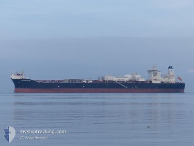
CURRENT SPIRIT
Tanker
Current Trip
| Time Travelled | 25 days |
|---|---|
| Remaining Time | --- |
| Distance Travelled | 1175.53 nm |
| Remaining Distance | 5.79 nm |
| AVG Speed | 8.6 Knopen |
| MAX Speed | 15.4 Knopen |
| AVG Wind | 21.4 knots |
| MAX Wind | 41 knots |
| MIN Temp | 1°C / 33.8°F |
| MAX Temp | 11°C / 51.8°F |
| Diepgang | 9.6 M |
| Positie ontvangen | 1 m geleden |
Current Position
| Lengtegraad | 10.62714° |
|---|---|
| Breedtegraat | 57.62082° |
| Status | At anchor |
| Snelheid | |
| Koers | 114° |
| Gebied | Kattegat |
| Station | T-AIS |
| Positie ontvangen | 1 m geleden |
Info
Information
The current position of CURRENT SPIRIT is in Kattegat with coordinates 57.62082° / 10.62714° as reported on 2025-03-21 19:13 by AIS to our vessel tracker app. The vessel's current speed is 0 Knopen and is heading at the port of SKAGEN. The estimated time of arrival as calculated by MyShipTracking vessel tracking app is 2025-03-18 17:00 LT
The vessel CURRENT SPIRIT (IMO: 9843924, MMSI: 311001594) is a Tanker It's sailing under the flag of [BS] Bahamas.
In this page you can find informations about the vessels current position, last detected port calls, and current voyage information. If the vessels is not in coverage by AIS you will find the latest position.
The current position of CURRENT SPIRIT is detected by our AIS receivers and we are not responsible for the reliability of the data. The last position was recorded while the vessel was in Coverage by the Ais receivers of our vessel tracking app.
The current draught of CURRENT SPIRIT as reported by AIS is 9.6 meters
Weather
| Temperature | 6.6°C / 43.88°F |
|---|---|
| Wind Speed | 14 knots |
| Direction | 103° ESE |
| Pressure | 1024.9 hPa |
| Humidity | 69.7 % |
| Cloud Coverage | 8 % |
Featured Company
Most Visited Ports (Last year)
| Port | Arrivals | |
|---|---|---|
| 1 |
Last Trips
| Origin | Departure | Destination | Arrival | Distance |
|---|
Events
| Tijd | Evenement | Details | Positie / Bestemming | Info |
|---|---|---|---|---|
| 2025-03-18 16:04 | Status Changed | At anchor Under way using engine |
57.62208 / 10.63416
DKSKA
|
Snelheid: 0.1 kn Koers: 223° |
| 2025-03-18 15:42 | Stop beweging | 5.7 nm, South of SKAGEN |
57.62062 / 10.63300
DKSKA
|
Snelheid: 0.3 kn Koers: 230° |
| 2025-03-18 13:31 | Wijzig zee gebeid | Danish part of the Kattegat Swedish part of the Kattegat |
57.59142 / 11.24891
Kattegat
DKSKA
|
Snelheid: 13.1 kn Koers: 272.9° |
| 2025-03-18 11:37 | Status Changed | Under way using engine Moored |
57.67834 / 11.77506
DKSKA
|
Snelheid: 4.5 kn Koers: 262° |
| 2025-03-18 11:31 | Start beweging | 0.83 nm, South of KROSSHOLMEN |
57.68057 / 11.78503
DKSKA
|
Snelheid: 3.1 kn Koers: 231° |
| 2025-03-18 10:12 | Draught Changed | 9.6 13.7 |
57.68342 / 11.78910
DKSKA
|
Snelheid: Koers: 203° |
| 2025-03-18 10:12 | ETA Changed | 2025/03/18 16:00 2025/03/16 20:00 |
57.68342 / 11.78910
DKSKA
|
Snelheid: Koers: 203° |
| 2025-03-18 10:10 | Destination Changed | DKSKA SE GOT |
57.68340 / 11.78911
DKSKA
|
Snelheid: Koers: 203° |
| 2025-03-16 22:23 | Status Changed | Moored Under way using engine |
57.68341 / 11.78912
SE GOT
|
Snelheid: Koers: 203° |
| 2025-03-16 21:45 | Stop beweging | 0.73 nm, South East of KROSSHOLMEN |
57.68333 / 11.78871
SE GOT
|
Snelheid: 0.3 kn Koers: 205° |