
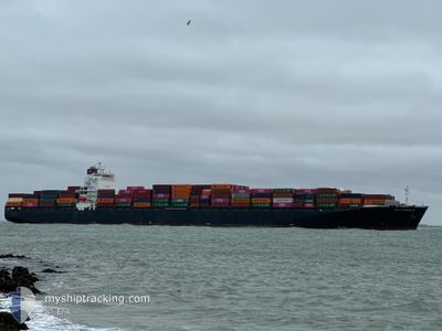
DELPHINUS C
Container Ship
Current Trip
| Time Travelled | 11 days |
|---|---|
| Remaining Time | --- |
| Distance Travelled | 4616.03 nm |
| Remaining Distance | --- |
| AVG Speed | 16.2 Knopen |
| MAX Speed | 20.5 Knopen |
| AVG Wind | 13 knots |
| MAX Wind | 33 knots |
| MIN Temp | -0.8°C / 30.56°F |
| MAX Temp | 24.1°C / 75.38°F |
| Diepgang | 12.9 M |
| Positie ontvangen | 8 d geleden |
Current Position
| Lengtegraad | -11.43552° |
|---|---|
| Breedtegraat | 38.12183° |
| Status | Under way using engine |
| Snelheid | 18.4 Knopen |
| Koers | 190.3° |
| Gebied | North Atlantic Ocean |
| Station | T-AIS |
| Positie ontvangen | 8 d geleden |
Info
Information
The current position of DELPHINUS C is in North Atlantic Ocean with coordinates 38.12183° / -11.43552° as reported on 2025-02-17 19:53 by AIS to our vessel tracker app. The vessel's current speed is 18.4 Knopen and is heading at the port of HALIFAX. The estimated time of arrival as calculated by MyShipTracking vessel tracking app is 2025-02-24 09:00 LT
The vessel DELPHINUS C (IMO: 9337652, MMSI: 636018222) is a Container Ship that was built in 2007 ( 18 Jaar oud ). It's sailing under the flag of [LR] Liberia.
In this page you can find informations about the vessels current position, last detected port calls, and current voyage information. If the vessels is not in coverage by AIS you will find the latest position.
The current position of DELPHINUS C is detected by our AIS receivers and we are not responsible for the reliability of the data. The last position was recorded while the vessel was in Coverage by the Ais receivers of our vessel tracking app.
The current draught of DELPHINUS C as reported by AIS is 12.9 meters
Weather
| Temperature | 22.3°C / 72.14°F |
|---|---|
| Wind Speed | 13 knots |
| Direction | 283° WNW |
| Pressure | 1012.1 hPa |
| Humidity | 71.7 % |
| Cloud Coverage | --- |
Featured Company
Last Port Calls
| Port | Arrival | Departure | Time In Port |
|---|---|---|---|
| 2025-02-14 12:17 | 2025-02-15 03:29 | 15 h | |
| 2025-02-11 21:05 | 2025-02-13 06:02 | 1 d | |
| 2025-02-05 12:31 | 2025-02-06 19:36 | 1 d | |
| 2025-01-25 19:23 | 2025-01-26 20:50 | 1 d | |
| 2025-01-23 11:48 | 2025-01-24 21:43 | 1 d | |
| 2025-01-14 09:23 | 2025-01-15 06:05 | 20 h | |
| 2025-01-12 13:39 | 2025-01-13 02:55 | 13 h | |
| 2025-01-06 03:46 | 2025-01-06 18:43 | 14 h | |
| 2024-12-29 09:41 | 2024-12-30 03:09 | 17 h | |
| 2024-12-25 14:39 | 2024-12-26 03:03 | 12 h |
Most Visited Ports (Last year)
| Port | Arrivals | |
|---|---|---|
| 10 | ||
| 7 | ||
| 7 | ||
| 5 | ||
| 4 | ||
| 4 |
Last Trips
| Origin | Departure | Destination | Arrival | Distance | |
|---|---|---|---|---|---|
| 2025-02-13 07:02 | 2025-02-14 13:17 | 406.83 nm | |||
| 2025-02-06 20:36 | 2025-02-11 22:05 | 575.47 nm | |||
| 2025-01-26 21:50 | 2025-02-05 13:31 | 390.21 nm | |||
| 2025-01-24 21:43 | 2025-01-25 20:23 | 128.05 nm | |||
| 2025-01-15 02:05 | 2025-01-23 11:48 | 2592.50 nm | |||
| 2025-01-12 22:55 | 2025-01-14 05:23 | 320.98 nm | |||
| 2025-01-06 14:43 | 2025-01-12 09:39 | 1920.46 nm | |||
| 2024-12-29 22:09 | 2025-01-05 23:46 | 828.90 nm | |||
| 2024-12-25 22:03 | 2024-12-29 04:41 | 355.00 nm | |||
| 2024-12-16 13:34 | 2024-12-25 09:39 | 3334.33 nm |
Events
| Tijd | Evenement | Details | Positie / Bestemming | Info |
|---|---|---|---|---|
| 2025-02-17 19:54 | Status Changed | Default Under way using engine |
38.11786 / -11.43631
CA HAL
|
Snelheid: 18.4 kn Koers: 190.3° |
| 2025-02-17 19:53 | Status Changed | Under way using engine Default |
38.12183 / -11.43552
CA HAL
|
Snelheid: 18.5 kn Koers: 190° |
| 2025-02-17 19:53 | Buitenbereik |
38.12183 / -11.43552
North Atlantic Ocean
CA HAL
|
Snelheid: 18.4 kn Koers: 190.3° |
|
| 2025-02-17 19:40 | Status Changed | Default Under way using engine |
38.18932 / -11.42032
CA HAL
|
Snelheid: 18.5 kn Koers: 190° |
| 2025-02-17 19:31 | Status Changed | Under way using engine Default |
38.23095 / -11.41081
CA HAL
|
Snelheid: 18.5 kn Koers: 190° |
| 2025-02-17 19:27 | Status Changed | Default Under way using engine |
38.25192 / -11.40644
CA HAL
|
Snelheid: 18.4 kn Koers: 189.7° |
| 2025-02-17 19:16 | Status Changed | Under way using engine Default |
38.30928 / -11.39390
CA HAL
|
Snelheid: 18.4 kn Koers: 190° |
| 2025-02-17 19:16 | Binnenbereik |
38.30928 / -11.39390
North Atlantic Ocean
CA HAL
|
Snelheid: 18.3 kn Koers: 189.5° |
|
| 2025-02-17 18:07 | Status Changed | Default Under way using engine |
38.66293 / -11.31851
CA HAL
|
Snelheid: 18.5 kn Koers: 189.4° |
| 2025-02-17 18:05 | Buitenbereik |
38.67160 / -11.31671
North Atlantic Ocean
CA HAL
|
Snelheid: 18.5 kn Koers: 189.4° |