

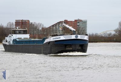
DIADEMAR
Wing in ground

Current Trip
| Time Travelled | 4 days |
|---|---|
| Remaining Time | --- |
| Distance Travelled | 80.82 nm |
| Remaining Distance | --- |
| AVG Speed | 7.1 Knopen |
| MAX Speed | 9.6 Knopen |
| AVG Wind | 6.8 knots |
| MAX Wind | 11 knots |
| MIN Temp | 7.1°C / 44.78°F |
| MAX Temp | 20°C / 68°F |
| Diepgang | 0 M |
| Positie ontvangen | 6 m geleden |
Current Position
| Lengtegraad | 5.52079° |
|---|---|
| Breedtegraat | 51.89620° |
| Status | Moored |
| Snelheid | |
| Koers | --- |
| Gebied | North Sea |
| Station | T-AIS |
| Positie ontvangen | 6 m geleden |
Information
The current position of DIADEMAR is in North Sea with coordinates 51.89620° / 5.52079° as reported on 2025-04-15 19:51 by AIS to our vessel tracker app. The vessel's current speed is 0 Knopen and is heading at the port of ITTEREN. The estimated time of arrival as calculated by MyShipTracking vessel tracking app is 2025-06-03 14:00 LT
The vessel DIADEMAR (MMSI: 244660085) is a Wing in ground It's sailing under the flag of [NL] Netherlands.
In this page you can find informations about the vessels current position, last detected port calls, and current voyage information. If the vessels is not in coverage by AIS you will find the latest position.
The current position of DIADEMAR is detected by our AIS receivers and we are not responsible for the reliability of the data. The last position was recorded while the vessel was in Coverage by the Ais receivers of our vessel tracking app.
Weather
| Temperature | 13°C / 55.4°F |
|---|---|
| Wind Speed | 6 knots |
| Direction | 219° SW |
| Pressure | 999.2 hPa |
| Humidity | 93 % |
| Cloud Coverage | 100 % |


Featured Company
Last Port Calls
| Port | Arrival | Departure | Time In Port |
|---|---|---|---|
| 2025-04-10 20:44 | 2025-04-11 17:43 | 20 h | |
| 2025-04-10 18:13 | 2025-04-10 18:31 | 18 m | |
| 2025-04-10 04:29 | 2025-04-10 07:13 | 2 h | |
| 2025-04-08 19:52 | 2025-04-08 20:04 | 11 m | |
| 2025-04-08 14:24 | 2025-04-08 14:42 | 17 m | |
| 2025-04-07 22:16 | 2025-04-08 09:04 | 10 h | |
| 2025-04-02 20:21 | 2025-04-03 08:10 | 11 h | |
| 2025-03-31 08:44 | 2025-03-31 11:46 | 3 h | |
| 2025-03-26 20:20 | 2025-03-27 09:29 | 13 h | |
| 2025-03-21 19:05 | 2025-03-24 13:16 | 2 d |
Most Visited Ports (Last year)
| Port | Arrivals | |
|---|---|---|
| 42 | ||
| 23 | ||
| 21 | ||
| 14 | ||
| 13 | ||
| 10 |
Last Trips
| Origin | Departure | Destination | Arrival | Distance | |
|---|---|---|---|---|---|
| 2025-04-10 18:31 | 2025-04-10 20:44 | 18.13 nm | |||
| 2025-04-10 07:13 | 2025-04-10 18:13 | 33.52 nm | |||
| 2025-04-08 20:04 | 2025-04-10 04:29 | 62.52 nm | |||
| 2025-04-08 14:42 | 2025-04-08 19:52 | 42.57 nm | |||
| 2025-04-08 09:04 | 2025-04-08 14:24 | 4.09 nm | |||
| 2025-04-03 08:10 | 2025-04-07 22:16 | 101.98 nm | |||
| 2025-03-31 11:46 | 2025-04-02 20:21 | 161.36 nm | |||
| 2025-03-27 09:29 | 2025-03-31 08:44 | 150.05 nm | |||
| 2025-03-24 13:16 | 2025-03-26 20:20 | 61.18 nm | |||
| 2025-03-20 07:44 | 2025-03-21 19:05 | 92.21 nm |
Events
| Tijd | Evenement | Details | Positie / Bestemming | Info |
|---|---|---|---|---|
| 2025-04-15 13:32 | Status Changed | Moored Under way using engine |
51.89603 / 5.52092
ITTERENXXX
|
Snelheid: 0.3 kn Koers: 511° |
| 2025-04-15 13:32 | Stop beweging | 0.55 nm, North of BENEDEN LEEUWEN |
51.89603 / 5.52089
ITTERENXXX
|
Snelheid: 0.3 kn Koers: 511° |
| 2025-04-15 12:38 | Binnenbereik |
51.85743 / 5.41846
North Sea
|
Snelheid: 6.2 kn Koers: 14.1° |
|
| 2025-04-14 13:21 | Buitenbereik |
51.81461 / 5.14185
North Sea
|
Snelheid: 7.6 kn Koers: 262.2° |
|
| 2025-04-14 13:21 | Binnenbereik |
51.81461 / 5.14185
North Sea
|
Snelheid: 7.6 kn Koers: 262.2° |
|
| 2025-04-14 12:15 | Buitenbereik |
51.80409 / 5.34914
North Sea
|
Snelheid: 7.6 kn Koers: 274.1° |
|
| 2025-04-14 10:16 | Start beweging | 0.33 nm, East of DEEST |
51.89463 / 5.68122
ITTERENXXX
|
Snelheid: 4.2 kn Koers: 319° |
| 2025-04-14 10:14 | Status Changed | Under way using engine Moored |
51.89363 / 5.68228
ITTERENXXX
|
Snelheid: 0.8 kn Koers: 511° |
| 2025-04-14 08:26 | Stop beweging | 0.39 nm, East of DEEST |
51.89265 / 5.68255
ITTERENXXX
|
Snelheid: Koers: 511° |
| 2025-04-14 08:25 | Status Changed | Moored Under way using engine |
51.89279 / 5.68251
ITTERENXXX
|
Snelheid: 1 kn Koers: 511° |