
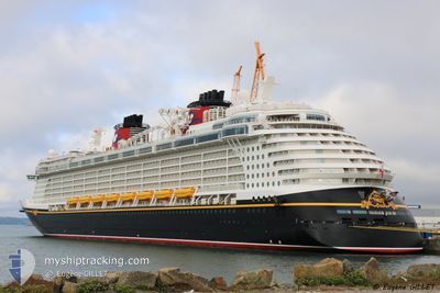
DISNEY FANTASY
Passengers Ship
Current Trip
BS NAS
| Time Travelled | 1 day |
|---|---|
| Remaining Time | --- |
| Distance Travelled | 262.21 nm |
| Remaining Distance | --- |
| AVG Speed | 13.3 Knopen |
| MAX Speed | 18.8 Knopen |
| AVG Wind | 13.7 knots |
| MAX Wind | 19 knots |
| MIN Temp | 23.9°C / 75.02°F |
| MAX Temp | 24.7°C / 76.46°F |
| Diepgang | 8.6 M |
| Positie ontvangen | 19 h, 43 m geleden |
Current Position
| Lengtegraad | -76.16350° |
|---|---|
| Breedtegraat | 24.61245° |
| Status | Moored |
| Snelheid | |
| Koers | 126° |
| Gebied | North Atlantic Ocean |
| Station | T-AIS |
| Positie ontvangen | 19 h, 43 m geleden |
Info
Information
The current position of DISNEY FANTASY is in North Atlantic Ocean with coordinates 24.61245° / -76.16350° as reported on 2025-02-14 16:40 by AIS to our vessel tracker app. The vessel's current speed is 0 Knopen
The vessel DISNEY FANTASY (IMO: 9445590, MMSI: 311058700) is a Passengers Ship that was built in 2012 ( 13 Jaar oud ). It's sailing under the flag of [BS] Bahamas.
In this page you can find informations about the vessels current position, last detected port calls, and current voyage information. If the vessels is not in coverage by AIS you will find the latest position.
The current position of DISNEY FANTASY is detected by our AIS receivers and we are not responsible for the reliability of the data. The last position was recorded while the vessel was in Coverage by the Ais receivers of our vessel tracking app.
The current draught of DISNEY FANTASY as reported by AIS is 8.6 meters
Weather
| Temperature | 23.4°C / 74.12°F |
|---|---|
| Wind Speed | 17 knots |
| Direction | 91° E |
| Pressure | 1023.2 hPa |
| Humidity | 77.6 % |
| Cloud Coverage | 1 % |
Featured Company
Last Port Calls
| Port | Arrival | Departure | Time In Port |
|---|---|---|---|
| 2025-02-13 08:40 | 2025-02-13 18:23 | 9 h | |
| 2025-02-12 05:11 | 2025-02-12 17:05 | 11 h | |
| 2025-02-09 07:01 | 2025-02-09 18:03 | 11 h | |
| 2025-02-07 03:53 | 2025-02-07 16:59 | 13 h | |
| 2025-02-05 06:49 | 2025-02-05 17:14 | 10 h | |
| 2025-02-03 08:35 | 2025-02-03 22:24 | 13 h | |
| 2025-02-02 04:10 | 2025-02-02 17:14 | 13 h | |
| 2025-01-31 06:46 | 2025-01-31 17:22 | 10 h | |
| 2025-01-30 08:40 | 2025-01-30 18:36 | 9 h | |
| 2025-01-29 05:13 | 2025-01-29 16:36 | 11 h |
Last Trips
| Origin | Departure | Destination | Arrival | Distance | |
|---|---|---|---|---|---|
| 2025-02-12 17:05 | 2025-02-13 08:40 | 276.37 nm | |||
| 2025-02-09 18:03 | 2025-02-12 05:11 | 572.67 nm | |||
| 2025-02-07 16:59 | 2025-02-09 07:01 | 337.68 nm | |||
| 2025-02-05 17:14 | 2025-02-07 03:53 | 400.43 nm | |||
| 2025-02-03 22:24 | 2025-02-05 06:49 | 259.35 nm | |||
| 2025-02-02 17:14 | 2025-02-03 08:35 | 276.07 nm | |||
| 2025-01-31 17:22 | 2025-02-02 04:10 | 400.43 nm | |||
| 2025-01-30 18:36 | 2025-01-31 06:46 | 168.18 nm | |||
| 2025-01-29 16:36 | 2025-01-30 08:40 | 275.19 nm | |||
| 2025-01-27 20:11 | 2025-01-29 05:13 | 374.51 nm |
Events
| Tijd | Evenement | Details | Positie / Bestemming | Info |
|---|---|---|---|---|
| 2025-02-14 22:19 | Start beweging | 3.48 nm, South East of PRINCESS CAYS |
24.58695 / -76.14232
BS NAS
|
Snelheid: 11.7 kn Koers: 122° |
| 2025-02-14 16:40 | Buitenbereik |
24.61245 / -76.16350
North Atlantic Ocean
|
Snelheid: Koers: 293.9° |
|
| 2025-02-14 15:46 | Binnenbereik |
24.61247 / -76.16350
North Atlantic Ocean
|
Snelheid: Koers: 302.9° |
|
| 2025-02-14 13:43 | Status Changed | Moored Default |
24.61247 / -76.16350
BS NAS
|
Snelheid: Koers: 126° |
| 2025-02-14 13:28 | Status Changed | Default Moored |
24.61247 / -76.16350
BS NAS
|
Snelheid: Koers: 126° |
| 2025-02-14 13:25 | Status Changed | Moored Default |
24.61247 / -76.16350
BS NAS
|
Snelheid: Koers: 126° |
| 2025-02-14 13:25 | Binnenbereik |
24.61247 / -76.16350
North Atlantic Ocean
|
Snelheid: Koers: 308.1° |
|
| 2025-02-14 13:25 | Buitenbereik |
24.61247 / -76.16350
North Atlantic Ocean
|
Snelheid: Koers: 308.1° |
|
| 2025-02-14 12:13 | Stop beweging | 1.58 nm, South East of PRINCESS CAYS |
24.61247 / -76.16350
BS NAS
|
Snelheid: Koers: 126° |
| 2025-02-14 00:36 | Buitenbereik |
25.37457 / -77.17813
North Atlantic Ocean
|
Snelheid: 16 kn Koers: 50.8° |