
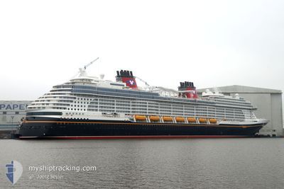
DISNEY TREASURE
Passenger
Current Trip
| Time Travelled | 16 h, 27 mins |
|---|---|
| Remaining Time | --- |
| Distance Travelled | 52.96 nm |
| Remaining Distance | --- |
| AVG Speed | 19.9 Knopen |
| MAX Speed | 22.1 Knopen |
| AVG Wind | 9.9 knots |
| MAX Wind | 11 knots |
| MIN Temp | 25.9°C / 78.62°F |
| MAX Temp | 26.3°C / 79.34°F |
| Diepgang | 8.6 M |
| Positie ontvangen | 13 h, 47 m geleden |
Current Position
| Lengtegraad | -65.67580° |
|---|---|
| Breedtegraat | 18.75110° |
| Status | Under way using engine |
| Snelheid | 21.9 Knopen |
| Koers | 306.1° |
| Gebied | North Atlantic Ocean |
| Station | T-AIS |
| Positie ontvangen | 13 h, 47 m geleden |
Info
Information
The current position of DISNEY TREASURE is in North Atlantic Ocean with coordinates 18.75110° / -65.67580° as reported on 2025-03-05 23:15 by AIS to our vessel tracker app. The vessel's current speed is 21.9 Knopen
The vessel DISNEY TREASURE (IMO: 9834753, MMSI: 311001221) is a Passenger It's sailing under the flag of [BS] Bahamas.
In this page you can find informations about the vessels current position, last detected port calls, and current voyage information. If the vessels is not in coverage by AIS you will find the latest position.
The current position of DISNEY TREASURE is detected by our AIS receivers and we are not responsible for the reliability of the data. The last position was recorded while the vessel was in Coverage by the Ais receivers of our vessel tracking app.
The current draught of DISNEY TREASURE as reported by AIS is 8.6 meters
Weather
| Temperature | 26°C / 78.8°F |
|---|---|
| Wind Speed | 11 knots |
| Direction | 69° ENE |
| Pressure | 1012.3 hPa |
| Humidity | 77.2 % |
| Cloud Coverage | 6 % |
Featured Company
Last Port Calls
| Port | Arrival | Departure | Time In Port |
|---|---|---|---|
| 2025-03-05 06:58 | 2025-03-05 16:35 | 9 h | |
| 2025-03-04 07:06 | 2025-03-04 18:08 | 11 h | |
| 2025-03-01 05:10 | 2025-03-01 17:08 | 11 h | |
| 2025-02-24 07:49 | 2025-02-24 17:06 | 9 h | |
| 2025-02-22 05:10 | 2025-02-22 17:12 | 12 h | |
| 2025-02-19 06:55 | 2025-02-19 16:39 | 9 h | |
| 2025-02-18 07:04 | 2025-02-18 18:16 | 11 h | |
| 2025-02-15 05:10 | 2025-02-15 17:32 | 12 h | |
| 2025-02-10 07:31 | 2025-02-10 17:26 | 9 h | |
| 2025-02-08 05:09 | 2025-02-08 17:11 | 12 h |
Last Trips
| Origin | Departure | Destination | Arrival | Distance | |
|---|---|---|---|---|---|
| 2025-03-04 18:08 | 2025-03-05 06:58 | 118.28 nm | |||
| 2025-03-01 17:08 | 2025-03-04 07:06 | 1080.37 nm | |||
| 2025-02-24 17:06 | 2025-03-01 05:10 | 1410.32 nm | |||
| 2025-02-22 17:12 | 2025-02-24 07:49 | 692.08 nm | |||
| 2025-02-19 16:39 | 2025-02-22 05:10 | 1065.55 nm | |||
| 2025-02-18 18:16 | 2025-02-19 06:55 | 94.64 nm | |||
| 2025-02-15 17:32 | 2025-02-18 07:04 | 1080.10 nm | |||
| 2025-02-10 17:26 | 2025-02-15 05:10 | 1243.51 nm | |||
| 2025-02-08 17:11 | 2025-02-10 07:31 | 691.30 nm | |||
| 2025-02-04 18:04 | 2025-02-05 06:31 | 266.03 nm |
Events
| Tijd | Evenement | Details | Positie / Bestemming | Info |
|---|---|---|---|---|
| 2025-03-05 23:15 | Buitenbereik |
18.75110 / -65.67580
North Atlantic Ocean
VISTT-BSGOC
|
Snelheid: 21.9 kn Koers: 306.1° |
|
| 2025-03-05 23:06 | Wijzig zee gebeid | Puerto Rican part of the North Atlantic Ocean Puerto Rican part of the Caribbean Sea |
18.72015 / -65.63125
North Atlantic Ocean
VISTT-BSGOC
|
Snelheid: 21.8 kn Koers: 305.3° |
| 2025-03-05 20:35 | Vertrekhaven |
|
18.31933 / -64.92614
VISTT-BSGOC
|
Snelheid: 7.3 kn Koers: 170° |
| 2025-03-05 20:27 | Start beweging |
18.33072 / -64.92790
[VI] ST THOMAS
|
Snelheid: 3.1 kn Koers: 232° |
|
| 2025-03-05 20:15 | Status Changed | Under way using engine Moored |
18.33193 / -64.92427
[VI] ST THOMAS
|
Snelheid: Koers: 237° |
| 2025-03-05 11:51 | ETA Changed | 2025/03/07 13:15 2025/03/05 10:45 |
18.33192 / -64.92425
[VI] ST THOMAS
|
Snelheid: Koers: 237° |
| 2025-03-05 11:32 | Destination Changed | VISTT-BSGOC VGRAD-VISTT |
18.33192 / -64.92425
[VI] ST THOMAS
|
Snelheid: 0.2 kn Koers: 237° |
| 2025-03-05 11:30 | Status Changed | Moored Under way using engine |
18.33194 / -64.92426
[VI] ST THOMAS
|
Snelheid: 0.1 kn Koers: 237° |
| 2025-03-05 11:25 | Stop beweging |
18.33192 / -64.92453
[VI] ST THOMAS
|
Snelheid: 0.3 kn Koers: 236° |
|
| 2025-03-05 10:58 | Aankomsthaven |
|
18.32163 / -64.92633
[VI] ST THOMAS
|
Snelheid: 5.8 kn Koers: 344.1° |