
DORIS
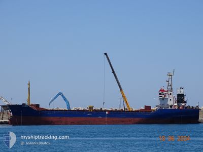
General Cargo
Current Trip
| Time Travelled | 4 days |
|---|---|
| Remaining Time | 17 h, 57 mins |
| Distance Travelled | 639.87 nm |
| Remaining Distance | 143.52 nm |
| AVG Speed | 8.6 Knopen |
| MAX Speed | 10.3 Knopen |
| AVG Wind | 10 knots |
| MAX Wind | 19.3 knots |
| MIN Temp | 7.3°C / 45.14°F |
| MAX Temp | 16°C / 60.8°F |
| Diepgang | 3.4 M |
| Positie ontvangen | 1 m geleden |
Current Position
| Lengtegraad | 24.40241° |
|---|---|
| Breedtegraat | 37.77844° |
| Status | Under way using engine |
| Snelheid | 8.3 Knopen |
| Koers | 51° |
| Gebied | Aegean Sea |
| Station | T-AIS |
| Positie ontvangen | 1 m geleden |
Info
Information
The current position of DORIS is in Aegean Sea with coordinates 37.77844° / 24.40241° as reported on 2025-03-06 14:08 by AIS to our vessel tracker app. The vessel's current speed is 8.3 Knopen and is heading at the port of NEMRUT. The estimated time of arrival as calculated by MyShipTracking vessel tracking app is 2025-03-07 08:06 LT
The vessel DORIS (IMO: 9365702, MMSI: 511101049) is a General Cargo that was built in 2006 ( 19 Jaar oud ). It's sailing under the flag of [PW] Palau.
In this page you can find informations about the vessels current position, last detected port calls, and current voyage information. If the vessels is not in coverage by AIS you will find the latest position.
The current position of DORIS is detected by our AIS receivers and we are not responsible for the reliability of the data. The last position was recorded while the vessel was in Coverage by the Ais receivers of our vessel tracking app.
The current draught of DORIS as reported by AIS is 3.4 meters
Weather
| Temperature | 14.8°C / 58.64°F |
|---|---|
| Wind Speed | 11 knots |
| Direction | 28° NNE |
| Pressure | 1025.1 hPa |
| Humidity | 61.1 % |
| Cloud Coverage | --- |
Featured Company
Last Port Calls
| Port | Arrival | Departure | Time In Port |
|---|---|---|---|
| 2025-02-25 08:13 | 2025-03-01 15:14 | 4 d | |
| 2025-02-20 05:37 | 2025-02-21 18:05 | 1 d | |
| 2025-02-15 15:31 | 2025-02-19 08:27 | 3 d | |
| 2025-01-21 14:36 | 2025-01-22 17:41 | 1 d | |
| 2025-01-16 00:23 | 2025-01-17 16:01 | 1 d | |
| 2025-01-07 19:36 |
Most Visited Ports (Last year)
| Port | Arrivals | |
|---|---|---|
| 5 | ||
| 2 | ||
| 2 | ||
| 2 | ||
| 2 | ||
| 1 |
Last Trips
| Origin | Departure | Destination | Arrival | Distance | |
|---|---|---|---|---|---|
| 2025-02-21 19:05 | 2025-02-25 09:13 | 716.95 nm | |||
| 2025-02-19 09:27 | 2025-02-20 06:37 | 147.93 nm | |||
| 2025-01-22 20:41 | 2025-02-15 16:31 | 1735.06 nm | |||
| 2025-01-17 19:01 | 2025-01-21 17:36 | 404.71 nm | |||
| 2025-01-07 20:36 | 2025-01-16 03:23 | 722.64 nm |
Events
| Tijd | Evenement | Details | Positie / Bestemming | Info |
|---|---|---|---|---|
| 2025-03-06 12:47 | Status Changed | Under way using engine Default |
37.66580 / 24.23298
ALIAGA TURKEY
|
Snelheid: 7.2 kn Koers: 50° |
| 2025-03-06 12:41 | Status Changed | Default Under way using engine |
37.65729 / 24.22042
ALIAGA TURKEY
|
Snelheid: 7.2 kn Koers: 49.6° |
| 2025-03-06 12:21 | Status Changed | Under way using engine Default |
37.62892 / 24.18192
ALIAGA TURKEY
|
Snelheid: 7.8 kn Koers: 49° |
| 2025-03-06 12:17 | Status Changed | Default Under way using engine |
37.62275 / 24.17360
ALIAGA TURKEY
|
Snelheid: 7.7 kn Koers: 53.4° |
| 2025-03-06 12:03 | Status Changed | Under way using engine Default |
37.60050 / 24.14911
ALIAGA TURKEY
|
Snelheid: 7.5 kn Koers: 34° |
| 2025-03-06 12:01 | Status Changed | Default Under way using engine |
37.59758 / 24.14669
ALIAGA TURKEY
|
Snelheid: 7.4 kn Koers: 32.3° |
| 2025-03-06 11:49 | Status Changed | Under way using engine Default |
37.57634 / 24.12971
ALIAGA TURKEY
|
Snelheid: 7.5 kn Koers: 30° |
| 2025-03-06 11:49 | Binnenbereik |
37.57667 / 24.12997
Aegean Sea
ALIAGA TURKEY
|
Snelheid: 7.5 kn Koers: 33.2° |
|
| 2025-03-06 10:49 | Status Changed | Default Under way using engine |
37.46547 / 24.04411
ALIAGA TURKEY
|
Snelheid: 7.1 kn Koers: 24° |
| 2025-03-06 10:42 | Buitenbereik |
37.45301 / 24.03591
Aegean Sea
ALIAGA TURKEY
|
Snelheid: 7.1 kn Koers: 24° |