

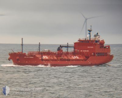
DREAM VERMAX
Tanker
Current Trip
| Time Travelled | 6 h, 54 mins |
|---|---|
| Remaining Time | 4 h, 27 mins |
| Distance Travelled | 63.86 nm |
| Remaining Distance | 46.64 nm |
| AVG Speed | 8.7 Knopen |
| MAX Speed | 11 Knopen |
| AVG Wind | 15.1 knots |
| MAX Wind | 18.3 knots |
| MIN Temp | 13.8°C / 56.84°F |
| MAX Temp | 14.9°C / 58.82°F |
| Diepgang | 5.7 M |
| Positie ontvangen | 1 m geleden |
Current Position
| Lengtegraad | 2.02082° |
|---|---|
| Breedtegraat | 51.41747° |
| Status | Under way using engine |
| Snelheid | 9.8 Knopen |
| Koers | 279.4° |
| Gebied | North Sea |
| Station | T-AIS |
| Positie ontvangen | 1 m geleden |
Information
The current position of DREAM VERMAX is in North Sea with coordinates 51.41747° / 2.02082° as reported on 2025-06-09 00:40 by AIS to our vessel tracker app. The vessel's current speed is 9.8 Knopen and is heading at the port of DUNKERQUE. The estimated time of arrival as calculated by MyShipTracking vessel tracking app is 2025-06-09 07:08 LT
The vessel DREAM VERMAX (IMO: 9719525, MMSI: 538006497) is a Tanker It's sailing under the flag of [MH] Marshall Is.
In this page you can find informations about the vessels current position, last detected port calls, and current voyage information. If the vessels is not in coverage by AIS you will find the latest position.
The current position of DREAM VERMAX is detected by our AIS receivers and we are not responsible for the reliability of the data. The last position was recorded while the vessel was in Coverage by the Ais receivers of our vessel tracking app.
The current draught of DREAM VERMAX as reported by AIS is 5.7 meters
Weather
| Temperature | 13.8°C / 56.84°F |
|---|---|
| Wind Speed | 13 knots |
| Direction | 261° W |
| Pressure | 1021 hPa |
| Humidity | 81.6 % |
| Cloud Coverage | 56 % |
Featured Company
Last Port Calls
| Port | Arrival | Departure | Time In Port |
|---|---|---|---|
| 2025-06-07 23:13 | 2025-06-08 19:47 | 20 h | |
| 2025-05-29 13:21 | 2025-05-30 04:53 | 15 h | |
| 2025-05-14 20:29 | 2025-05-17 16:31 | 2 d | |
| 2025-05-07 17:17 | 2025-05-09 11:15 | 1 d | |
| 2025-05-03 02:27 | 2025-05-03 22:27 | 19 h | |
| 2025-05-01 09:04 | 2025-05-02 15:25 | 1 d | |
| 2025-04-29 21:02 | 2025-04-30 21:19 | 1 d | |
| 2025-04-26 06:03 | 2025-04-26 23:18 | 17 h | |
| 2025-04-21 12:35 | 2025-04-22 11:48 | 23 h | |
| 2025-04-15 09:08 | 2025-04-17 01:40 | 1 d |
Last Trips
| Origin | Departure | Destination | Arrival | Distance | |
|---|---|---|---|---|---|
| 2025-05-30 04:53 | 2025-06-07 23:13 | 2267.47 nm | |||
| 2025-05-17 16:31 | 2025-05-29 13:21 | 1131.06 nm | |||
| 2025-05-09 11:15 | 2025-05-14 20:29 | 315.58 nm | |||
| 2025-05-03 22:27 | 2025-05-07 17:17 | 314.04 nm | |||
| 2025-05-02 15:25 | 2025-05-03 02:27 | 113.43 nm | |||
| 2025-04-30 21:19 | 2025-05-01 09:04 | 112.35 nm | |||
| 2025-04-26 23:18 | 2025-04-29 21:02 | 788.90 nm | |||
| 2025-04-22 11:48 | 2025-04-26 06:03 | 990.71 nm | |||
| 2025-04-17 01:40 | 2025-04-21 12:35 | 869.20 nm | |||
| 2025-04-11 11:29 | 2025-04-15 09:08 | 879.22 nm |
Events
| Tijd | Evenement | Details | Positie / Bestemming | Info |
|---|---|---|---|---|
| 2025-06-09 00:28 | Wijzig zee gebeid | United Kingdom part of the North Sea French part of the North Sea |
51.40527 / 2.07084
North Sea
FRDKK
|
Snelheid: 10.7 kn Koers: 304.5° |
| 2025-06-08 23:16 | Wijzig zee gebeid | French part of the North Sea Belgian part of the North Sea |
51.34871 / 2.33835
North Sea
FRDKK
|
Snelheid: 9.1 kn Koers: 254.2° |
| 2025-06-08 19:04 | Wijzig zee gebeid | Belgian part of the North Sea Dutch part of the North Sea |
51.40870 / 3.31989
North Sea
FRDKK
|
Snelheid: 10.1 kn Koers: 273.4° |
| 2025-06-08 17:47 | Vertrekhaven |
|
51.44680 / 3.67065
FRDKK
|
Snelheid: 8.5 kn Koers: 227° |
| 2025-06-08 17:31 | Status Changed | Under way using engine Moored |
51.46676 / 3.70835
[NL] VLISSINGEN
|
Snelheid: 3.4 kn Koers: 245° |
| 2025-06-08 17:29 | Start beweging |
51.46705 / 3.71069
[NL] VLISSINGEN
|
Snelheid: 3.1 kn Koers: 262° |
|
| 2025-06-08 16:06 | Draught Changed | 5.7 4.9 |
51.46545 / 3.71551
[NL] VLISSINGEN
|
Snelheid: 0.1 kn Koers: 329° |
| 2025-06-08 16:06 | Destination Changed | FRDKK NLVLI |
51.46545 / 3.71551
[NL] VLISSINGEN
|
Snelheid: 0.1 kn Koers: 329° |
| 2025-06-08 16:06 | ETA Changed | 2025/06/09 04:00 2025/06/07 19:00 |
51.46545 / 3.71551
[NL] VLISSINGEN
|
Snelheid: 0.1 kn Koers: 329° |
| 2025-06-08 12:52 | Status Changed | Moored Default |
51.46549 / 3.71549
[NL] VLISSINGEN
|
Snelheid: 0.1 kn Koers: 329° |