

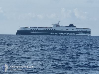
ECO MALTA
Cargo A

Current Trip
| Time Travelled | 8 h, 1 mins |
|---|---|
| Remaining Time | 1 day |
| Distance Travelled | 151.86 nm |
| Remaining Distance | 483.24 nm |
| AVG Speed | 18.9 Knopen |
| MAX Speed | 19.7 Knopen |
| AVG Wind | 8.8 knots |
| MAX Wind | 14 knots |
| MIN Temp | 18.2°C / 64.76°F |
| MAX Temp | 22.6°C / 72.68°F |
| Diepgang | 6.6 M |
| Positie ontvangen | Nu |
Current Position
| Lengtegraad | 14.42913° |
|---|---|
| Breedtegraat | 43.73009° |
| Status | Under way using engine |
| Snelheid | 19.4 Knopen |
| Koers | 141.8° |
| Gebied | Adriatic Sea |
| Station | T-AIS |
| Positie ontvangen | Nu |
Information
The current position of ECO MALTA is in Adriatic Sea with coordinates 43.73009° / 14.42913° as reported on 2025-06-06 05:25 by AIS to our vessel tracker app. The vessel's current speed is 19.4 Knopen and is heading at the port of PATRA. The estimated time of arrival as calculated by MyShipTracking vessel tracking app is 2025-06-07 08:56 LT
The vessel ECO MALTA (IMO: 9859583, MMSI: 247383800) is a Cargo A It's sailing under the flag of [IT] Italy.
In this page you can find informations about the vessels current position, last detected port calls, and current voyage information. If the vessels is not in coverage by AIS you will find the latest position.
The current position of ECO MALTA is detected by our AIS receivers and we are not responsible for the reliability of the data. The last position was recorded while the vessel was in Coverage by the Ais receivers of our vessel tracking app.
The current draught of ECO MALTA as reported by AIS is 6.6 meters
Weather
| Temperature | 21.7°C / 71.06°F |
|---|---|
| Wind Speed | 5 knots |
| Direction | 138° SE |
| Pressure | 1017 hPa |
| Humidity | 72 % |
| Cloud Coverage | 29 % |


Featured Company
Last Port Calls
| Port | Arrival | Departure | Time In Port |
|---|---|---|---|
| 2025-06-05 03:06 | 2025-06-05 23:25 | 20 h | |
| 2025-06-02 00:20 | 2025-06-02 10:16 | 9 h | |
| 2025-06-01 09:28 | 2025-06-01 20:32 | 11 h | |
| 2025-05-28 15:40 | 2025-05-29 18:20 | 1 d | |
| 2025-05-25 09:45 | 2025-05-26 02:46 | 17 h | |
| 2025-05-24 20:37 | 2025-05-25 06:28 | 9 h | |
| 2025-05-21 15:21 | 2025-05-22 06:20 | 14 h | |
| 2025-05-18 20:03 | 2025-05-19 04:20 | 8 h | |
| 2025-05-18 03:24 | 2025-05-18 16:58 | 13 h | |
| 2025-05-14 07:16 | 2025-05-15 06:18 | 23 h |
Last Trips
| Origin | Departure | Destination | Arrival | Distance | |
|---|---|---|---|---|---|
| 2025-06-02 10:16 | 2025-06-05 03:06 | 1185.80 nm | |||
| 2025-06-01 20:32 | 2025-06-02 00:20 | 47.43 nm | |||
| 2025-05-29 18:20 | 2025-06-01 09:28 | 1174.10 nm | |||
| 2025-05-26 02:46 | 2025-05-28 15:40 | 1183.02 nm | |||
| 2025-05-25 06:28 | 2025-05-25 09:45 | 47.47 nm | |||
| 2025-05-22 06:20 | 2025-05-24 20:37 | 1175.16 nm | |||
| 2025-05-19 04:20 | 2025-05-21 15:21 | 1185.78 nm | |||
| 2025-05-18 16:58 | 2025-05-18 20:03 | 47.54 nm | |||
| 2025-05-15 06:18 | 2025-05-18 03:24 | 1183.70 nm | |||
| 2025-05-13 00:09 | 2025-05-14 07:16 | 623.49 nm |
Events
| Tijd | Evenement | Details | Positie / Bestemming | Info |
|---|---|---|---|---|
| 2025-06-06 04:42 | Draught Changed | 6.6 5.6 |
43.91376 / 14.22953
ITTRS>GRGPA
|
Snelheid: 19.3 kn Koers: 143.2° |
| 2025-06-05 23:46 | Wijzig zee gebeid | Croatian part of the Adriatic Sea Italian part of the Adriatic Sea |
45.26044 / 13.05992
Adriatic Sea
ITTRS>GRGPA
|
Snelheid: 18.6 kn Koers: 167.3° |
| 2025-06-05 22:36 | Draught Changed | 5.6 5 |
45.55077 / 13.30395
ITTRS>GRGPA
|
Snelheid: 18.9 kn Koers: 236.8° |
| 2025-06-05 22:36 | ETA Changed | 2025/06/07 06:00 |
45.55077 / 13.30395
ITTRS>GRGPA
|
Snelheid: 18.9 kn Koers: 236.8° |
| 2025-06-05 22:30 | Draught Changed | 5 5.6 |
45.56806 / 13.34170
ITTRS>GRGPA
|
Snelheid: 19 kn Koers: 236.3° |
| 2025-06-05 22:18 | Draught Changed | 5.6 5 |
45.59520 / 13.42403
ITTRS>GRGPA
|
Snelheid: 19.3 kn Koers: 246.2° |
| 2025-06-05 22:18 | ETA Changed | 2025/06/07 06:00 |
45.59520 / 13.42403
ITTRS>GRGPA
|
Snelheid: 19.3 kn Koers: 246.2° |
| 2025-06-05 22:12 | Draught Changed | 5 5.6 |
45.60719 / 13.46704
ITTRS>GRGPA
|
Snelheid: 19.5 kn Koers: 248.4° |
| 2025-06-05 22:04 | Draught Changed | 5.6 5 |
45.62213 / 13.52164
ITTRS>GRGPA
|
Snelheid: 19.2 kn Koers: 248.5° |
| 2025-06-05 22:04 | ETA Changed | 2025/06/07 06:00 |
45.62213 / 13.52164
ITTRS>GRGPA
|
Snelheid: 19.2 kn Koers: 248.5° |