
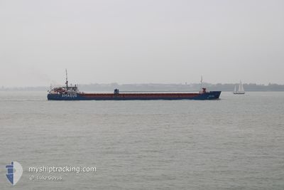
EEMS SPRING
General Cargo
Current Trip
| Trip Time | 3 days |
|---|---|
| Trip Distance | 760.90 nm |
| AVG Speed | 8.4 Knopen |
| MAX Speed | 10.5 Knopen |
| Diepgang | 3.2 M |
| AVG Wind | 12 knots |
| MAX Wind | 24.1 knots |
| MIN Temp | 4.5°C / 40.1°F |
| MAX Temp | 14.2°C / 57.56°F |
| Positie ontvangen | 23 h, 33 m geleden |
Current Position
| Lengtegraad | -8.82432° |
|---|---|
| Breedtegraat | 42.59300° |
| Status | Under way using engine |
| Snelheid | 4.5 Knopen |
| Koers | 71° |
| Gebied | North Atlantic Ocean |
| Station | T-AIS |
| Positie ontvangen | 23 h, 33 m geleden |
Info
Information
The current position of EEMS SPRING is in North Atlantic Ocean with coordinates 42.59300° / -8.82432° as reported on 2025-02-10 06:02 by AIS to our vessel tracker app. The vessel's current speed is 4.5 Knopen and is currently inside the port of VILLAGARCIA.
The vessel EEMS SPRING (IMO: 9503524, MMSI: 245465000) is a General Cargo that was built in 2009 ( 16 Jaar oud ). It's sailing under the flag of [NL] Netherlands.
In this page you can find informations about the vessels current position, last detected port calls, and current voyage information. If the vessels is not in coverage by AIS you will find the latest position.
The current position of EEMS SPRING is detected by our AIS receivers and we are not responsible for the reliability of the data. The last position was recorded while the vessel was in Coverage by the Ais receivers of our vessel tracking app.
The current draught of EEMS SPRING as reported by AIS is 3.2 meters
Weather
| Temperature | 11.7°C / 53.06°F |
|---|---|
| Wind Speed | 2 knots |
| Direction | 114° ESE |
| Pressure | 1015.3 hPa |
| Humidity | 92.1 % |
| Cloud Coverage | 100 % |
Featured Company
Last Port Calls
| Port | Arrival | Departure | Time In Port |
|---|---|---|---|
| 2025-02-10 06:18 | |||
| 2025-02-05 03:29 | 2025-02-06 17:43 | 1 d | |
| 2025-01-21 15:44 | 2025-01-30 15:02 | 8 d | |
| 2025-01-15 17:33 | 2025-01-16 23:11 | 1 d | |
| 2025-01-13 15:05 | |||
| 2025-01-09 19:11 | 2025-01-10 19:23 | 1 d | |
| 2025-01-06 08:26 | 2025-01-07 21:31 | 1 d | |
| 2024-12-30 07:01 | 2025-01-03 21:24 | 4 d | |
| 2024-12-25 08:45 | 2024-12-27 08:42 | 1 d | |
| 2024-12-20 20:15 | 2024-12-23 22:34 | 3 d |
Most Visited Ports (Last year)
| Port | Arrivals | |
|---|---|---|
| 6 | ||
| 6 | ||
| 5 | ||
| 5 | ||
| 5 | ||
| 3 |
Last Trips
| Origin | Departure | Destination | Arrival | Distance | |
|---|---|---|---|---|---|
| 2025-02-06 17:43 | 2025-02-10 07:18 | 760.90 nm | |||
| 2025-01-30 16:02 | 2025-02-05 03:29 | 750.06 nm | |||
| 2025-01-17 00:11 | 2025-01-21 16:44 | 924.76 nm | |||
| 2025-01-10 19:23 | 2025-01-15 18:33 | 285.99 nm | |||
| 2025-01-10 19:23 | 2025-01-13 16:05 | 284.35 nm | |||
| 2025-01-07 22:31 | 2025-01-09 19:11 | 300.20 nm | |||
| 2025-01-03 21:24 | 2025-01-06 09:26 | 530.04 nm | |||
| 2024-12-27 09:42 | 2024-12-30 07:01 | 593.77 nm | |||
| 2024-12-23 23:34 | 2024-12-25 09:45 | 230.12 nm | |||
| 2024-12-18 20:03 | 2024-12-20 21:15 | 344.52 nm |
Events
| Tijd | Evenement | Details | Positie / Bestemming | Info |
|---|---|---|---|---|
| 2025-02-10 06:18 | Aankomsthaven |
|
42.60121 / -8.78576
[ES] VILLAGARCIA
|
Snelheid: 8 kn Koers: 74° |
| 2025-02-10 06:07 | Status Changed | Default Under way using engine |
42.59579 / -8.81300
ES VIL
|
Snelheid: 4.5 kn Koers: 71° |
| 2025-02-10 06:02 | Buitenbereik |
42.59300 / -8.82433
North Atlantic Ocean
[ES] VILLAGARCIA
|
Snelheid: 4.5 kn Koers: 71° |
|
| 2025-02-10 05:41 | Status Changed | Under way using engine Default |
42.58640 / -8.85805
ES VIL
|
Snelheid: 4.3 kn Koers: 76° |
| 2025-02-10 05:39 | Status Changed | Default Under way using engine |
42.58579 / -8.86123
ES VIL
|
Snelheid: 4.4 kn Koers: 76° |
| 2025-02-10 03:19 | Gevonden in zee | Spanish part of the North Atlantic Ocean |
42.45567 / -9.07244
North Atlantic Ocean
ES VIL
|
Snelheid: 8.1 kn Koers: 112.4° |
| 2025-02-10 03:19 | Status Changed | Under way using engine Default |
42.45567 / -9.07244
ES VIL
|
Snelheid: 8.4 kn Koers: 119° |
| 2025-02-10 02:59 | Binnenbereik |
42.45567 / -9.07244
North Atlantic Ocean
ES VIL
|
Snelheid: 8.1 kn Koers: 112.4° |
|
| 2025-02-07 00:43 | Status Changed | Default Under way using engine |
52.78194 / -5.68469
ES VIL
|
Snelheid: 8.1 kn Koers: 187.1° |
| 2025-02-07 00:38 | Buitenbereik |
52.79469 / -5.68204
Irish Sea and St. George's Channel
ES VIL
|
Snelheid: 8.1 kn Koers: 187.1° |