

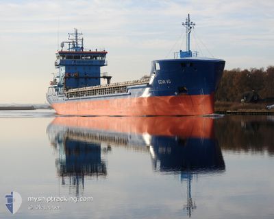
EEVA VG
Cargo

Current Trip
| Time Travelled | 1 day |
|---|---|
| Remaining Time | 11 h, 45 mins |
| Distance Travelled | 492.03 nm |
| Remaining Distance | 121.70 nm |
| AVG Speed | 10.5 Knopen |
| MAX Speed | 11.4 Knopen |
| AVG Wind | 15.5 knots |
| MAX Wind | 20 knots |
| MIN Temp | 2°C / 35.6°F |
| MAX Temp | 5.2°C / 41.36°F |
| Diepgang | 5.6 M |
| Positie ontvangen | Nu |
Current Position
| Lengtegraad | 19.73191° |
|---|---|
| Breedtegraat | 59.81104° |
| Status | Under way using engine |
| Snelheid | 10.5 Knopen |
| Koers | 317.3° |
| Gebied | Baltic Sea |
| Station | T-AIS |
| Positie ontvangen | Nu |
Information
The current position of EEVA VG is in Baltic Sea with coordinates 59.81104° / 19.73191° as reported on 2025-02-23 21:26 by AIS to our vessel tracker app. The vessel's current speed is 10.5 Knopen and is heading at the port of UUSIKAUPUNKI. The estimated time of arrival as calculated by MyShipTracking vessel tracking app is 2025-02-24 09:11 LT
The vessel EEVA VG (IMO: 9769104, MMSI: 230663000) is a Cargo It's sailing under the flag of [FI] Finland.
In this page you can find informations about the vessels current position, last detected port calls, and current voyage information. If the vessels is not in coverage by AIS you will find the latest position.
The current position of EEVA VG is detected by our AIS receivers and we are not responsible for the reliability of the data. The last position was recorded while the vessel was in Coverage by the Ais receivers of our vessel tracking app.
The current draught of EEVA VG as reported by AIS is 5.6 meters
Weather
| Temperature | 3.9°C / 39.02°F |
|---|---|
| Wind Speed | 15 knots |
| Direction | 246° WSW |
| Pressure | 1022.2 hPa |
| Humidity | 86.6 % |
| Cloud Coverage | 97 % |


Featured Company
Last Port Calls
| Port | Arrival | Departure | Time In Port |
|---|---|---|---|
| 2025-02-20 11:07 | 2025-02-21 22:19 | 1 d | |
| 2025-02-17 13:47 | 2025-02-19 02:48 | 1 d | |
| 2025-02-11 15:33 | 2025-02-12 16:41 | 1 d | |
| 2025-02-08 14:39 | 2025-02-08 14:42 | 2 m | |
| 2025-02-06 12:45 | 2025-02-07 17:08 | 1 d | |
| 2025-02-03 05:00 | 2025-02-04 14:28 | 1 d | |
| 2025-01-29 03:57 | 2025-01-30 17:21 | 1 d | |
| 2025-01-26 23:05 | 2025-01-28 12:26 | 1 d | |
| 2025-01-23 22:27 | 2025-01-24 18:08 | 19 h | |
| 2025-01-21 23:08 | 2025-01-22 00:49 | 1 h |
Last Trips
| Origin | Departure | Destination | Arrival | Distance | |
|---|---|---|---|---|---|
| 2025-02-19 03:48 | 2025-02-20 12:07 | 304.48 nm | |||
| 2025-02-12 18:41 | 2025-02-17 14:47 | 1059.16 nm | |||
| 2025-02-08 15:42 | 2025-02-11 17:33 | 772.81 nm | |||
| 2025-02-07 18:08 | 2025-02-08 15:39 | 144.73 nm | |||
| 2025-02-04 15:28 | 2025-02-06 13:45 | 427.49 nm | |||
| 2025-01-30 19:21 | 2025-02-03 06:00 | 802.47 nm | |||
| 2025-01-28 13:26 | 2025-01-29 05:57 | 136.42 nm | |||
| 2025-01-24 19:08 | 2025-01-27 00:05 | 585.74 nm | |||
| 2025-01-22 01:49 | 2025-01-23 23:27 | 470.63 nm | |||
| 2025-01-21 22:43 | 2025-01-22 00:08 | 6.15 nm |
Events
| Tijd | Evenement | Details | Positie / Bestemming | Info |
|---|---|---|---|---|
| 2025-02-23 21:13 | Wijzig zee gebeid | Finnish part of the Gulf of Bothnia Finnish part of the Baltic Sea |
59.78471 / 19.77906
Gulf of Bothnia
FIUKI
|
Snelheid: 10.4 kn Koers: 315.2° |
| 2025-02-23 19:28 | Status Changed | Under way using engine Default |
59.55786 / 20.16501
FIUKI
|
Snelheid: 10.5 kn Koers: 358° |
| 2025-02-23 19:17 | Status Changed | Default Under way using engine |
59.52721 / 20.16694
FIUKI
|
Snelheid: 9.6 kn Koers: 19.3° |
| 2025-02-23 19:10 | Wijzig zee gebeid | Finnish part of the Baltic Sea Swedish part of the Baltic Sea |
59.50512 / 20.16785
Baltic Sea
FIUKI
|
Snelheid: 9.6 kn Koers: 19.3° |
| 2025-02-23 19:08 | Status Changed | Under way using engine Default |
59.50231 / 20.16453
FIUKI
|
Snelheid: 10.2 kn Koers: 31° |
| 2025-02-23 18:18 | Status Changed | Default Under way using engine |
59.37740 / 20.01696
FIUKI
|
Snelheid: 10.6 kn Koers: 35.7° |
| 2025-02-23 18:12 | Status Changed | Under way using engine Default |
59.36239 / 19.99832
FIUKI
|
Snelheid: 10.5 kn Koers: 33° |
| 2025-02-23 18:05 | Binnenbereik |
59.36239 / 19.99832
Baltic Sea
FIUKI
|
Snelheid: 10.6 kn Koers: 35.7° |
|
| 2025-02-23 12:53 | Status Changed | Default Under way using engine |
58.57610 / 19.10211
FIUKI
|
Snelheid: 10.2 kn Koers: 32.3° |
| 2025-02-23 12:46 | Buitenbereik |
58.55861 / 19.08216
Baltic Sea
FIUKI
|
Snelheid: 10.2 kn Koers: 32.3° |