

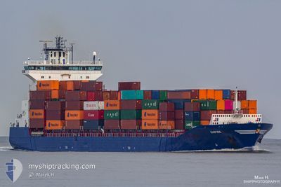
EMPIRE
Container Ship

Current Trip
| Time Travelled | 11 h, 24 mins |
|---|---|
| Remaining Time | 7 h, 30 mins |
| Distance Travelled | 182.22 nm |
| Remaining Distance | 122.58 nm |
| AVG Speed | 16.1 Knopen |
| MAX Speed | 16.7 Knopen |
| AVG Wind | 4.1 knots |
| MAX Wind | 8.8 knots |
| MIN Temp | 8.1°C / 46.58°F |
| MAX Temp | 16.3°C / 61.34°F |
| Diepgang | 8.3 M |
| Positie ontvangen | 1 m geleden |
Current Position
| Lengtegraad | 19.51109° |
|---|---|
| Breedtegraat | 59.94340° |
| Status | Under way using engine |
| Snelheid | 15.8 Knopen |
| Koers | 322.6° |
| Gebied | Gulf of Bothnia |
| Station | T-AIS |
| Positie ontvangen | 1 m geleden |
Information
The current position of EMPIRE is in Gulf of Bothnia with coordinates 59.94340° / 19.51109° as reported on 2025-05-29 02:08 by AIS to our vessel tracker app. The vessel's current speed is 15.8 Knopen and is heading at the port of RAUMA. The estimated time of arrival as calculated by MyShipTracking vessel tracking app is 2025-05-29 12:39 LT
The vessel EMPIRE (IMO: 9387425, MMSI: 245258000) is a Container Ship that was built in 2009 ( 16 Jaar oud ). It's sailing under the flag of [NL] Netherlands.
In this page you can find informations about the vessels current position, last detected port calls, and current voyage information. If the vessels is not in coverage by AIS you will find the latest position.
The current position of EMPIRE is detected by our AIS receivers and we are not responsible for the reliability of the data. The last position was recorded while the vessel was in Coverage by the Ais receivers of our vessel tracking app.
The current draught of EMPIRE as reported by AIS is 8.3 meters
Weather
| Temperature | 8.5°C / 47.3°F |
|---|---|
| Wind Speed | 1 knots |
| Direction | 324° NW |
| Pressure | 1008.9 hPa |
| Humidity | 93.8 % |
| Cloud Coverage | 100 % |

Featured Company
Last Port Calls
| Port | Arrival | Departure | Time In Port |
|---|---|---|---|
| 2025-05-28 06:29 | 2025-05-28 17:45 | 11 h | |
| 2025-05-27 11:34 | 2025-05-28 02:38 | 15 h | |
| 2025-05-25 11:43 | 2025-05-26 07:37 | 19 h | |
| 2025-05-22 21:14 | 2025-05-23 14:58 | 17 h | |
| 2025-05-19 05:30 | 2025-05-20 00:13 | 18 h | |
| 2025-05-18 07:00 | 2025-05-18 07:50 | 50 m | |
| 2025-05-15 14:12 | 2025-05-16 06:28 | 16 h | |
| 2025-05-14 08:43 | 2025-05-14 17:10 | 8 h | |
| 2025-05-13 07:58 | 2025-05-14 02:49 | 18 h | |
| 2025-05-11 03:26 | 2025-05-12 02:52 | 23 h |
Last Trips
| Origin | Departure | Destination | Arrival | Distance | |
|---|---|---|---|---|---|
| 2025-05-28 02:38 | 2025-05-28 06:29 | 45.34 nm | |||
| 2025-05-26 07:37 | 2025-05-27 11:34 | 433.70 nm | |||
| 2025-05-23 14:58 | 2025-05-25 11:43 | 441.78 nm | |||
| 2025-05-20 00:13 | 2025-05-22 21:14 | 114.41 nm | |||
| 2025-05-18 07:50 | 2025-05-19 05:30 | 130.63 nm | |||
| 2025-05-16 06:28 | 2025-05-18 07:00 | 652.81 nm | |||
| 2025-05-14 17:10 | 2025-05-15 14:12 | 304.67 nm | |||
| 2025-05-14 02:49 | 2025-05-14 08:43 | 45.48 nm | |||
| 2025-05-12 02:52 | 2025-05-13 07:58 | 434.10 nm | |||
| 2025-05-10 00:54 | 2025-05-11 03:26 | 348.65 nm |
Events
| Tijd | Evenement | Details | Positie / Bestemming | Info |
|---|---|---|---|---|
| 2025-05-29 01:23 | Wijzig zee gebeid | Finnish part of the Gulf of Bothnia Finnish part of the Baltic Sea |
59.79001 / 19.76202
Gulf of Bothnia
RAUMA
|
Snelheid: 16 kn Koers: 315.5° |
| 2025-05-28 23:03 | Status Changed | Under way using engine Default |
59.57629 / 20.84153
RAUMA
|
Snelheid: 16.3 kn Koers: 280° |
| 2025-05-28 22:58 | Status Changed | Default Under way using engine |
59.57206 / 20.89159
RAUMA
|
Snelheid: 16.3 kn Koers: 279.3° |
| 2025-05-28 22:51 | Status Changed | Under way using engine Default |
59.56730 / 20.94683
RAUMA
|
Snelheid: 16.3 kn Koers: 280° |
| 2025-05-28 22:16 | Status Changed | Default Under way using engine |
59.54076 / 21.25555
RAUMA
|
Snelheid: 16.4 kn Koers: 279.9° |
| 2025-05-28 21:14 | Status Changed | Under way using engine Default |
59.53287 / 21.80990
RAUMA
|
Snelheid: 16.3 kn Koers: 268° |
| 2025-05-28 21:01 | Status Changed | Default Under way using engine |
59.53440 / 21.92414
RAUMA
|
Snelheid: 16.2 kn Koers: 266.6° |
| 2025-05-28 18:50 | Wijzig zee gebeid | Finnish part of the Baltic Sea Finnish part of the Gulf of Finland |
59.60554 / 23.07689
Baltic Sea
RAUMA
|
Snelheid: 16.8 kn Koers: 254.9° |
| 2025-05-28 16:11 | Wijzig zee gebeid | Finnish part of the Gulf of Finland Estonian part of the Gulf of Finland |
59.76208 / 24.47652
Gulf of Finland
RAUMA
|
Snelheid: 15.1 kn Koers: 280.9° |
| 2025-05-28 14:45 | Vertrekhaven |
|
59.50137 / 24.96591
RAUMA
|
Snelheid: 10.1 kn Koers: 0° |