
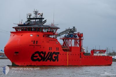
ESVAGT FARADAY
Other Type
Current Trip
HORNSA 2
| Time Travelled | 1 day |
|---|---|
| Remaining Time | --- |
| Distance Travelled | 94.59 nm |
| Remaining Distance | --- |
| AVG Speed | 9.2 Knopen |
| MAX Speed | 13.1 Knopen |
| AVG Wind | 19.6 knots |
| MAX Wind | 33.7 knots |
| MIN Temp | 1.8°C / 35.24°F |
| MAX Temp | 7°C / 44.6°F |
| Diepgang | 6.2 M |
| Positie ontvangen | 1 d geleden |
Current Position
| Lengtegraad | 0.15162° |
|---|---|
| Breedtegraat | 53.54297° |
| Status | Under way using engine |
| Snelheid | 12.9 Knopen |
| Koers | 112.8° |
| Gebied | North Sea |
| Station | T-AIS |
| Positie ontvangen | 1 d geleden |
Info
Information
The current position of ESVAGT FARADAY is in North Sea with coordinates 53.54297° / 0.15162° as reported on 2026-01-06 20:10 by AIS to our vessel tracker app. The vessel's current speed is 12.9 Knopen
The vessel ESVAGT FARADAY (IMO: 9703473, MMSI: 219613000) is a Other Type It's sailing under the flag of [DK] Denmark.
In this page you can find informations about the vessels current position, last detected port calls, and current voyage information. If the vessels is not in coverage by AIS you will find the latest position.
The current position of ESVAGT FARADAY is detected by our AIS receivers and we are not responsible for the reliability of the data. The last position was recorded while the vessel was in Coverage by the Ais receivers of our vessel tracking app.
The current draught of ESVAGT FARADAY as reported by AIS is 6.2 meters
Weather
| Temperature | 6.4°C / 43.52°F |
|---|---|
| Wind Speed | 8 knots |
| Direction | 303° WNW |
| Pressure | 1002.8 hPa |
| Humidity | 78.8 % |
| Cloud Coverage | 100 % |
Featured Company
Last Port Calls
Last Trips
| Origin | Departure | Destination | Arrival | Distance | |
|---|---|---|---|---|---|
| 2025-12-23 18:27 | 2026-01-06 04:10 | 477.72 nm | |||
| 2025-12-10 03:30 | 2025-12-23 03:53 | 532.88 nm | |||
| 2025-11-25 18:16 | 2025-12-09 03:51 | 516.45 nm | |||
| 2025-11-12 00:22 | 2025-11-25 04:08 | 647.56 nm | |||
| 2025-10-28 19:09 | 2025-11-11 04:15 | 579.45 nm |
Events
| Tijd | Evenement | Details | Positie / Bestemming | Info |
|---|---|---|---|---|
| 2026-01-08 05:19 | Stop beweging |
53.88167 / 1.64000
HORNSA 2
|
Snelheid: Koers: -1° |
|
| 2026-01-08 04:46 | Start beweging |
53.82834 / 1.64667
HORNSA 2
|
Snelheid: 8 kn Koers: 326° |
|
| 2026-01-07 23:56 | Stop beweging |
53.81738 / 1.66016
HORNSA 2
|
Snelheid: Koers: 297° |
|
| 2026-01-07 23:04 | Start beweging |
53.81496 / 1.71197
HORNSA 2
|
Snelheid: 3.6 kn Koers: 282° |
|
| 2026-01-07 02:12 | Stop beweging |
53.81167 / 1.49167
HORNSA 2
|
Snelheid: Koers: -1° |
|
| 2026-01-06 20:17 | Status Changed | Default Under way using engine |
53.54130 / .19022
HORNSA 2
|
Snelheid: 12.9 kn Koers: 112.8° |
| 2026-01-06 20:10 | Buitenbereik |
53.54297 / .15162
North Sea
HORNSA 2
|
Snelheid: 12.9 kn Koers: 112.8° |
|
| 2026-01-06 18:42 | Vertrekhaven |
|
53.63652 / -.18578
HORNSA 2
|
Snelheid: 4.1 kn Koers: 156° |
| 2026-01-06 18:41 | Start beweging |
53.63433 / -.18568
[GB] IMMINGHAM
|
Snelheid: 5.1 kn Koers: 200° |
|
| 2026-01-06 17:48 | Status Changed | Under way using engine Moored |
53.62945 / -.20077
[GB] IMMINGHAM
|
Snelheid: Koers: 124° |