
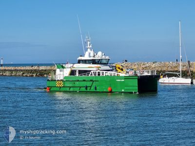
FARRA LARK
High speed craft
Current Trip
| Trip Time | 8 h, 47 mins |
|---|---|
| Trip Distance | 55.13 nm |
| AVG Speed | 13.5 Knopen |
| MAX Speed | 13.5 Knopen |
| Diepgang | 2.2 M |
| AVG Wind | 8.7 knots |
| MAX Wind | 12.2 knots |
| MIN Temp | 3.5°C / 38.3°F |
| MAX Temp | 6°C / 42.8°F |
| Positie ontvangen | 1 m geleden |
Current Position
| Lengtegraad | -3.17636° |
|---|---|
| Breedtegraat | 55.98630° |
| Status | Moored |
| Snelheid | |
| Koers | 59° |
| Gebied | North Sea |
| Station | T-AIS |
| Positie ontvangen | 1 m geleden |
Info
Information
The current position of FARRA LARK is in North Sea with coordinates 55.98630° / -3.17636° as reported on 2025-02-10 03:22 by AIS to our vessel tracker app. The vessel's current speed is 0 Knopen and is currently inside the port of LEITH.
The vessel FARRA LARK (IMO: 9926788, MMSI: 232043235) is a High speed craft It's sailing under the flag of [GB] United Kingdom.
In this page you can find informations about the vessels current position, last detected port calls, and current voyage information. If the vessels is not in coverage by AIS you will find the latest position.
The current position of FARRA LARK is detected by our AIS receivers and we are not responsible for the reliability of the data. The last position was recorded while the vessel was in Coverage by the Ais receivers of our vessel tracking app.
The current draught of FARRA LARK as reported by AIS is 2.2 meters
Weather
| Temperature | 3.6°C / 38.48°F |
|---|---|
| Wind Speed | 12 knots |
| Direction | 67° ENE |
| Pressure | 1039.2 hPa |
| Humidity | 68.8 % |
| Cloud Coverage | 66 % |
Featured Company
Last Port Calls
| Port | Arrival | Departure | Time In Port |
|---|---|---|---|
| 2025-02-09 05:25 | |||
| 2025-02-07 19:58 | 2025-02-08 20:38 | 1 d | |
| 2025-02-06 20:13 | 2025-02-06 21:24 | 1 h | |
| 2025-02-03 20:20 | 2025-02-06 04:12 | 2 d | |
| 2025-01-31 20:29 | 2025-02-01 04:45 | 8 h | |
| 2025-01-30 20:21 | 2025-01-31 04:12 | 7 h | |
| 2025-01-29 20:22 | 2025-01-29 22:31 | 2 h | |
| 2025-01-26 13:04 | 2025-01-28 05:49 | 1 d | |
| 2025-01-23 21:40 | 2025-01-26 04:14 | 2 d | |
| 2025-01-21 21:55 | 2025-01-23 04:20 | 1 d |
Last Trips
| Origin | Departure | Destination | Arrival | Distance | |
|---|---|---|---|---|---|
| 2025-02-08 20:38 | 2025-02-09 05:25 | 55.13 nm | |||
| 2025-02-06 21:24 | 2025-02-07 19:58 | 43.72 nm | |||
| 2025-02-06 04:12 | 2025-02-06 20:13 | 52.76 nm | |||
| 2025-02-01 04:45 | 2025-02-03 20:20 | 67.00 nm | |||
| 2025-01-31 04:12 | 2025-01-31 20:29 | 54.62 nm | |||
| 2025-01-29 22:31 | 2025-01-30 20:21 | 46.56 nm | |||
| 2025-01-28 05:49 | 2025-01-29 20:22 | 52.43 nm | |||
| 2025-01-26 04:14 | 2025-01-26 13:04 | 48.22 nm | |||
| 2025-01-23 04:20 | 2025-01-23 21:40 | 49.72 nm | |||
| 2025-01-21 04:16 | 2025-01-21 21:55 | 46.27 nm |
Events
| Tijd | Evenement | Details | Positie / Bestemming | Info |
|---|---|---|---|---|
| 2025-02-09 05:55 | Status Changed | Moored Under way using engine |
55.98629 / -3.17638
[GB] LEITH
|
Snelheid: Koers: 57° |
| 2025-02-09 05:50 | Stop beweging |
55.98626 / -3.17646
[GB] LEITH
|
Snelheid: 0.3 kn Koers: 58° |
|
| 2025-02-09 05:48 | Start beweging |
55.98626 / -3.17710
[GB] LEITH
|
Snelheid: 3.8 kn Koers: 80° |
|
| 2025-02-09 05:28 | Stop beweging |
55.98834 / -3.18043
[GB] LEITH
|
Snelheid: 0.3 kn Koers: 142° |
|
| 2025-02-09 05:25 | Aankomsthaven |
|
55.99085 / -3.18447
[GB] LEITH
|
Snelheid: 9.4 kn Koers: 142° |
| 2025-02-09 04:02 | Start beweging | 5.02 nm, South East of ANSTRUTHER |
56.17928 / -2.56709
GBLEI<>NNG
|
Snelheid: 5.2 kn Koers: 113° |
| 2025-02-09 03:00 | Stop beweging | 5.17 nm, South East of ANSTRUTHER |
56.17890 / -2.56225
GBLEI<>NNG
|
Snelheid: 0.3 kn Koers: 102° |
| 2025-02-09 02:52 | Binnenbereik |
56.18385 / -2.57114
North Sea
|
Snelheid: 2.6 kn Koers: 103° |
|
| 2025-02-09 01:34 | Buitenbereik |
56.17891 / -2.56299
North Sea
|
Snelheid: 0.3 kn Koers: 256° |
|
| 2025-02-09 01:34 | Binnenbereik |
56.17891 / -2.56299
North Sea
|
Snelheid: 0.3 kn Koers: 256° |