
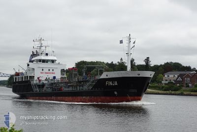
FINJA
Oil/Chemical Tanker
Current Trip
| Trip Time | 23 h, 2 mins |
|---|---|
| Trip Distance | 211.91 nm |
| AVG Speed | 9.2 Knopen |
| MAX Speed | 10.7 Knopen |
| Diepgang | 3.7 M |
| AVG Wind | 10.1 knots |
| MAX Wind | 21 knots |
| MIN Temp | -1.2°C / 29.84°F |
| MAX Temp | 1.1°C / 33.98°F |
| Positie ontvangen | 8 h, 32 m geleden |
Current Position
| Lengtegraad | 13.59267° |
|---|---|
| Breedtegraat | 54.65050° |
| Status | Under way using engine |
| Snelheid | 8.3 Knopen |
| Koers | 120.3° |
| Gebied | Baltic Sea |
| Station | T-AIS |
| Positie ontvangen | 8 h, 32 m geleden |
Info
Information
The current position of FINJA is in Baltic Sea with coordinates 54.65050° / 13.59267° as reported on 2025-02-15 22:51 by AIS to our vessel tracker app. The vessel's current speed is 8.3 Knopen and is currently inside the port of LUBMIN.
The vessel FINJA (IMO: 9212345, MMSI: 211333700) is a Oil/Chemical Tanker that was built in 2000 ( 25 Jaar oud ). It's sailing under the flag of [DE] Germany.
In this page you can find informations about the vessels current position, last detected port calls, and current voyage information. If the vessels is not in coverage by AIS you will find the latest position.
The current position of FINJA is detected by our AIS receivers and we are not responsible for the reliability of the data. The last position was recorded while the vessel was in Coverage by the Ais receivers of our vessel tracking app.
The current draught of FINJA as reported by AIS is 3.7 meters
Weather
| Temperature | -0.5°C / 31.1°F |
|---|---|
| Wind Speed | 16 knots |
| Direction | 42° NE |
| Pressure | 1025.3 hPa |
| Humidity | 59.2 % |
| Cloud Coverage | 100 % |
Featured Company
Last Port Calls
| Port | Arrival | Departure | Time In Port |
|---|---|---|---|
| 2025-02-16 02:56 | |||
| 2025-02-14 14:35 | 2025-02-15 03:54 | 13 h | |
| 2025-02-13 03:00 | 2025-02-13 17:58 | 14 h | |
| 2025-02-09 02:39 | 2025-02-10 00:06 | 21 h | |
| 2025-02-06 13:11 | 2025-02-06 17:39 | 4 h | |
| 2025-02-04 23:46 | 2025-02-05 06:07 | 6 h | |
| 2025-02-03 13:19 | 2025-02-04 12:06 | 22 h | |
| 2025-02-02 15:41 | 2025-02-03 00:13 | 8 h | |
| 2025-01-30 20:31 | 2025-01-31 08:33 | 12 h | |
| 2025-01-29 04:20 | 2025-01-29 13:47 | 9 h |
Most Visited Ports (Last year)
| Port | Arrivals | |
|---|---|---|
| 44 | ||
| 31 | ||
| 23 | ||
| 23 | ||
| 19 | ||
| 16 |
Last Trips
| Origin | Departure | Destination | Arrival | Distance | |
|---|---|---|---|---|---|
| 2025-02-15 04:54 | 2025-02-16 03:56 | 211.91 nm | |||
| 2025-02-13 18:58 | 2025-02-14 15:35 | 208.44 nm | |||
| 2025-02-10 01:06 | 2025-02-13 04:00 | 510.93 nm | |||
| 2025-02-06 18:39 | 2025-02-09 03:39 | 372.48 nm | |||
| 2025-02-05 07:07 | 2025-02-06 14:11 | 234.42 nm | |||
| 2025-02-04 13:06 | 2025-02-05 00:46 | 106.36 nm | |||
| 2025-02-03 01:13 | 2025-02-03 14:19 | 106.18 nm | |||
| 2025-01-31 09:33 | 2025-02-02 16:41 | 263.57 nm | |||
| 2025-01-29 14:47 | 2025-01-30 21:31 | 270.79 nm | |||
| 2025-01-28 20:33 | 2025-01-29 05:20 | 55.96 nm |
Events
| Tijd | Evenement | Details | Positie / Bestemming | Info |
|---|---|---|---|---|
| 2025-02-16 03:15 | Stop beweging |
54.14890 / 13.65352
[DE] LUBMIN
|
Snelheid: Koers: 317° |
|
| 2025-02-16 02:56 | Aankomsthaven |
|
54.15587 / 13.64325
[DE] LUBMIN
|
Snelheid: 6.8 kn Koers: 139° |
| 2025-02-15 22:53 | Status Changed | Default Under way using engine |
54.64854 / 13.59841
DELBM
|
Snelheid: 8.3 kn Koers: 120.3° |
| 2025-02-15 22:51 | Buitenbereik |
54.65050 / 13.59267
Baltic Sea
DELBM
|
Snelheid: 8.3 kn Koers: 120.3° |
|
| 2025-02-15 16:29 | Wijzig zee gebeid | German part of the Baltic Sea Danish part of the Baltic Sea |
54.41443 / 12.11746
Baltic Sea
DELBM
|
Snelheid: 9.5 kn Koers: 80° |
| 2025-02-15 13:50 | Gevonden in zee | Danish part of the Baltic Sea |
54.52078 / 11.40807
Baltic Sea
DELBM
|
Snelheid: 10.2 kn Koers: 116.2° |
| 2025-02-15 12:17 | Wijzig zee gebeid | German part of the Baltic Sea Danish part of the Baltic Sea |
54.63925 / 11.02672
Baltic Sea
DELBM
|
Snelheid: 9.9 kn Koers: 123.6° |
| 2025-02-15 11:22 | Wijzig zee gebeid | Danish part of the Baltic Sea Danish part of the Kattegat |
54.74006 / 10.86087
Baltic Sea
DELBM
|
Snelheid: 9.6 kn Koers: 175.3° |
| 2025-02-15 03:54 | Vertrekhaven |
|
55.66869 / 11.06680
DELBM
|
Snelheid: 7.3 kn Koers: 285° |
| 2025-02-15 03:42 | Start beweging |
55.67336 / 11.09354
[DK] KALUNDBORG
|
Snelheid: 4.7 kn Koers: 280° |