

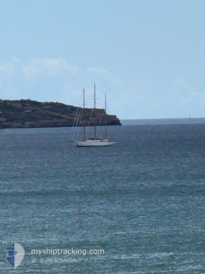
FLEURTJE
Sailing Vessel

Current Trip
Unknown
| Time Travelled | 14 h, 34 mins |
|---|---|
| Remaining Time | --- |
| Distance Travelled | 126.12 nm |
| Remaining Distance | --- |
| AVG Speed | 8.2 Knopen |
| MAX Speed | 9.3 Knopen |
| AVG Wind | 8.3 knots |
| MAX Wind | 12.4 knots |
| MIN Temp | 20.9°C / 69.62°F |
| MAX Temp | 28°C / 82.4°F |
| Diepgang | 0 M |
| Positie ontvangen | 1 m geleden |
Current Position
| Lengtegraad | 1.44978° |
|---|---|
| Breedtegraat | 39.14932° |
| Status | Under way using engine |
| Snelheid | 9 Knopen |
| Koers | 58.1° |
| Gebied | Balearic Sea |
| Station | T-AIS |
| Positie ontvangen | 1 m geleden |
Information
The current position of FLEURTJE is in Balearic Sea with coordinates 39.14932° / 1.44978° as reported on 2025-06-07 22:54 by AIS to our vessel tracker app. The vessel's current speed is 9 Knopen
The vessel FLEURTJE (IMO: 1001702, MMSI: 373602000) is a Sailing Vessel that was built in 1960 ( 65 Jaar oud ). It's sailing under the flag of [PA] Panama.
In this page you can find informations about the vessels current position, last detected port calls, and current voyage information. If the vessels is not in coverage by AIS you will find the latest position.
The current position of FLEURTJE is detected by our AIS receivers and we are not responsible for the reliability of the data. The last position was recorded while the vessel was in Coverage by the Ais receivers of our vessel tracking app.
Weather
| Temperature | 22.6°C / 72.68°F |
|---|---|
| Wind Speed | 5 knots |
| Direction | 154° SSE |
| Pressure | 1016.5 hPa |
| Humidity | 80.4 % |
| Cloud Coverage | 49 % |


Featured Company
Last Port Calls
| Port | Arrival | Departure | Time In Port |
|---|---|---|---|
| 2025-05-27 09:18 | 2025-06-07 10:21 | 11 d | |
| 2025-05-25 08:17 | 2025-05-25 11:15 | 2 h | |
| 2025-05-23 14:20 | 2025-05-24 19:39 | 1 d | |
| 2025-05-08 13:02 | 2025-05-23 13:38 | 15 d | |
| 2025-05-06 09:14 |
Most Visited Ports (Last year)
| Port | Arrivals | |
|---|---|---|
| 2 | ||
| 2 | ||
| 1 | ||
| 1 | ||
| 1 | ||
| 1 |
Last Trips
| Origin | Departure | Destination | Arrival | Distance | |
|---|---|---|---|---|---|
| 2025-05-25 11:15 | 2025-05-27 09:18 | 292.61 nm | |||
| 2025-05-24 19:39 | 2025-05-25 08:17 | 100.03 nm | |||
| 2025-05-23 13:38 | 2025-05-23 14:20 | 4.81 nm | |||
| 2025-05-06 09:14 | 2025-05-08 13:02 | 381.73 nm |
Events
| Tijd | Evenement | Details | Positie / Bestemming | Info |
|---|---|---|---|---|
| 2025-06-07 17:52 | Wijzig zee gebeid | Spanish part of the Balearic Sea Spanish part of the Mediterranean Sea - Western Basin |
38.71731 / .66273
Balearic Sea
|
Snelheid: 8.9 kn Koers: 55.3° |
| 2025-06-07 08:25 | Status Changed | Under way using engine Moored |
37.96419 / -.67709
|
Snelheid: 6.4 kn Koers: 78.4° |
| 2025-06-07 08:21 | Vertrekhaven |
|
37.96287 / -.68591
|
Snelheid: 4.5 kn Koers: 83.8° |
| 2025-06-07 08:13 | Start beweging |
37.97088 / -.68638
[ES] TORREVIEJA
|
Snelheid: 3.4 kn Koers: 204.9° |
|
| 2025-05-29 10:53 | Status Changed | Moored Under way using engine |
37.97149 / -.68412
[ES] TORREVIEJA
|
Snelheid: Koers: 511° |
| 2025-05-29 09:45 | Status Changed | Under way using engine Moored |
37.97142 / -.68410
[ES] TORREVIEJA
|
Snelheid: Koers: 511° |
| 2025-05-29 09:30 | Binnenbereik |
37.97149 / -.68412
Mediterranean Sea - Western Basin
[ES] TORREVIEJA
|
Snelheid: Koers: 511° |