
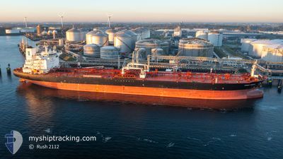
FRONT SIRIUS
Tanker
Current Trip
GBTTL
| Time Travelled | 4 days |
|---|---|
| Remaining Time | --- |
| Distance Travelled | 716.67 nm |
| Remaining Distance | --- |
| AVG Speed | 9.6 Knopen |
| MAX Speed | 12.9 Knopen |
| AVG Wind | 26.3 knots |
| MAX Wind | 42 knots |
| MIN Temp | 2.5°C / 36.5°F |
| MAX Temp | 7.7°C / 45.86°F |
| Diepgang | 14.2 M |
| Positie ontvangen | 2 d geleden |
Current Position
| Lengtegraad | 7.56970° |
|---|---|
| Breedtegraat | 57.32362° |
| Status | Under way using engine |
| Snelheid | 6.6 Knopen |
| Koers | 22.9° |
| Gebied | North Sea |
| Station | T-AIS |
| Positie ontvangen | 2 d geleden |
Info
Information
The current position of FRONT SIRIUS is in North Sea with coordinates 57.32362° / 7.56970° as reported on 2026-01-01 19:42 by AIS to our vessel tracker app. The vessel's current speed is 6.6 Knopen
The vessel FRONT SIRIUS (IMO: 9767340, MMSI: 538007337) is a Tanker It's sailing under the flag of [MH] Marshall Is.
In this page you can find informations about the vessels current position, last detected port calls, and current voyage information. If the vessels is not in coverage by AIS you will find the latest position.
The current position of FRONT SIRIUS is detected by our AIS receivers and we are not responsible for the reliability of the data. The last position was recorded while the vessel was in Coverage by the Ais receivers of our vessel tracking app.
The current draught of FRONT SIRIUS as reported by AIS is 14.2 meters
Weather
| Temperature | 3.2°C / 37.76°F |
|---|---|
| Wind Speed | 17 knots |
| Direction | 299° WNW |
| Pressure | 1008 hPa |
| Humidity | 63.3 % |
| Cloud Coverage | 17 % |
Featured Company
Most Visited Ports (Last year)
| Port | Arrivals | |
|---|---|---|
| 3 | ||
| 3 | ||
| 2 | ||
| 2 | ||
| 2 | ||
| 2 |
Events
| Tijd | Evenement | Details | Positie / Bestemming | Info |
|---|---|---|---|---|
| 2026-01-04 14:30 | Stop beweging |
54.00167 / .59667
GBTTL
|
Snelheid: Koers: -1° |
|
| 2026-01-04 07:59 | Start beweging |
53.85467 / .81277
GBTTL
|
Snelheid: 3.7 kn Koers: 334° |
|
| 2026-01-04 02:44 | Stop beweging |
53.84432 / .79995
GBTTL
|
Snelheid: 0.3 kn Koers: 340° |
|
| 2026-01-01 19:46 | Status Changed | Default Under way using engine |
57.32713 / 7.56711
GBTTL
|
Snelheid: 6.6 kn Koers: 22.9° |
| 2026-01-01 19:42 | Status Changed | Under way using engine Default |
57.32362 / 7.56970
GBTTL
|
Snelheid: 9.9 kn Koers: 70° |
| 2026-01-01 19:42 | Buitenbereik |
57.32362 / 7.56970
North Sea
GBTTL
|
Snelheid: 6.6 kn Koers: 22.9° |
|
| 2026-01-01 19:34 | Status Changed | Default Under way using engine |
57.31492 / 7.53227
GBTTL
|
Snelheid: 10.5 kn Koers: 74.5° |
| 2026-01-01 19:10 | Status Changed | Under way using engine Default |
57.29858 / 7.41112
GBTTL
|
Snelheid: 10.1 kn Koers: 68° |
| 2026-01-01 18:54 | Status Changed | Default Under way using engine |
57.28904 / 7.33180
GBTTL
|
Snelheid: 10.1 kn Koers: 72.2° |
| 2026-01-01 18:45 | Wijzig zee gebeid | Danish part of the North Sea Norwegian part of the North Sea |
57.28248 / 7.28470
North Sea
GBTTL
|
Snelheid: 10.4 kn Koers: 79° |