
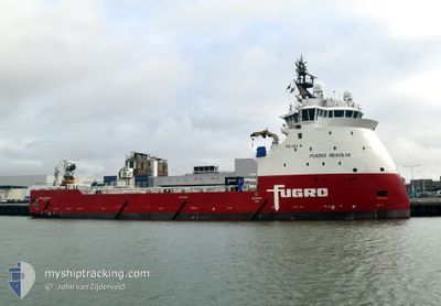
FUGRO RESOLVE
Cargo
Current Trip
GERMAN BIGHT
| Time Travelled | 3 h, 33 mins |
|---|---|
| Remaining Time | --- |
| Distance Travelled | 27.26 nm |
| Remaining Distance | --- |
| AVG Speed | 10.5 Knopen |
| MAX Speed | 11.8 Knopen |
| AVG Wind | 8.2 knots |
| MAX Wind | 9 knots |
| MIN Temp | 5°C / 41°F |
| MAX Temp | 6°C / 42.8°F |
| Diepgang | 5.7 M |
| Positie ontvangen | 57 m geleden |
Current Position
| Lengtegraad | 6.21498° |
|---|---|
| Breedtegraat | 53.67018° |
| Status | Under way using engine |
| Snelheid | 10.5 Knopen |
| Koers | 336.1° |
| Gebied | North Sea |
| Station | T-AIS |
| Positie ontvangen | 57 m geleden |
Info
Information
The current position of FUGRO RESOLVE is in North Sea with coordinates 53.67018° / 6.21498° as reported on 2025-02-05 18:57 by AIS to our vessel tracker app. The vessel's current speed is 10.5 Knopen
The vessel FUGRO RESOLVE (IMO: 9678769, MMSI: 311001406) is a Cargo It's sailing under the flag of [BS] Bahamas.
In this page you can find informations about the vessels current position, last detected port calls, and current voyage information. If the vessels is not in coverage by AIS you will find the latest position.
The current position of FUGRO RESOLVE is detected by our AIS receivers and we are not responsible for the reliability of the data. The last position was recorded while the vessel was in Coverage by the Ais receivers of our vessel tracking app.
The current draught of FUGRO RESOLVE as reported by AIS is 5.7 meters
Weather
| Temperature | 6°C / 42.8°F |
|---|---|
| Wind Speed | 9 knots |
| Direction | 288° WNW |
| Pressure | 1039.3 hPa |
| Humidity | 89.9 % |
| Cloud Coverage | 100 % |
Featured Company
Last Port Calls
| Port | Arrival | Departure | Time In Port |
|---|---|---|---|
| 2025-02-04 16:12 | 2025-02-05 16:22 | 1 d | |
| 2025-01-26 17:59 | 2025-02-01 06:54 | 5 d | |
| 2025-01-23 14:23 | 2025-01-24 21:08 | 1 d | |
| 2025-01-21 19:54 |
Most Visited Ports (Last year)
| Port | Arrivals | |
|---|---|---|
| 7 | ||
| 6 | ||
| 3 | ||
| 3 | ||
| 3 | ||
| 2 |
Last Trips
| Origin | Departure | Destination | Arrival | Distance | |
|---|---|---|---|---|---|
| 2025-02-01 07:54 | 2025-02-04 17:12 | 241.48 nm | |||
| 2025-01-24 22:08 | 2025-01-26 18:59 | 23.00 nm | |||
| 2025-01-21 20:54 | 2025-01-23 15:23 | 15.89 nm |
Events
| Tijd | Evenement | Details | Positie / Bestemming | Info |
|---|---|---|---|---|
| 2025-02-05 18:59 | Status Changed | Default Under way using engine |
53.67585 / 6.21099
GERMAN BIGHT
|
Snelheid: 10.5 kn Koers: 336.1° |
| 2025-02-05 18:32 | Status Changed | Under way using engine Default |
53.61688 / 6.31467
GERMAN BIGHT
|
Snelheid: 7.1 kn Koers: 272° |
| 2025-02-05 18:29 | Status Changed | Default Under way using engine |
53.61595 / 6.32754
GERMAN BIGHT
|
Snelheid: 7.4 kn Koers: 272° |
| 2025-02-05 17:44 | Wijzig zee gebeid | Dutch part of the North Sea German part of the North Sea |
53.61419 / 6.52968
North Sea
GERMAN BIGHT
|
Snelheid: 10.5 kn Koers: 268.7° |
| 2025-02-05 16:44 | Wijzig zee gebeid | German part of the North Sea Dutch part of the North Sea |
53.51503 / 6.77756
North Sea
GERMAN BIGHT
|
Snelheid: 11.2 kn Koers: 306.4° |
| 2025-02-05 16:22 | Vertrekhaven |
|
53.46303 / 6.83784
GERMAN BIGHT
|
Snelheid: 10.2 kn Koers: 350° |
| 2025-02-05 16:17 | Draught Changed | 5.7 5.5 |
53.44951 / 6.83535
[NL] EEMSHAVEN
|
Snelheid: 4.3 kn Koers: 17° |
| 2025-02-05 16:17 | Destination Changed | GERMAN BIGHT EEMSHAVEN |
53.44951 / 6.83535
[NL] EEMSHAVEN
|
Snelheid: 4.3 kn Koers: 17° |
| 2025-02-05 16:17 | ETA Changed | 2025/02/06 00:00 2025/02/04 16:00 |
53.44951 / 6.83535
[NL] EEMSHAVEN
|
Snelheid: 4.3 kn Koers: 17° |
| 2025-02-05 16:04 | Start beweging |
53.45053 / 6.82099
[NL] EEMSHAVEN
|
Snelheid: 3.1 kn Koers: 280° |