
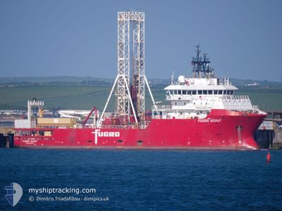
FUGRO SCOUT
Other Type
Current Trip
| Trip Time | 12 days |
|---|---|
| Trip Distance | 74.67 nm |
| AVG Speed | 10.4 Knopen |
| MAX Speed | 11.6 Knopen |
| Diepgang | 6.2 M |
| AVG Wind | 6.1 knots |
| MAX Wind | 24 knots |
| MIN Temp | -1.3°C / 29.66°F |
| MAX Temp | 5.7°C / 42.26°F |
| Positie ontvangen | 5 m geleden |
Current Position
| Lengtegraad | 13.14649° |
|---|---|
| Breedtegraat | 55.37082° |
| Status | Moored |
| Snelheid | |
| Koers | 311° |
| Gebied | Baltic Sea |
| Station | T-AIS |
| Positie ontvangen | 5 m geleden |
Info
Information
The current position of FUGRO SCOUT is in Baltic Sea with coordinates 55.37082° / 13.14649° as reported on 2025-03-01 16:22 by AIS to our vessel tracker app. The vessel's current speed is 0 Knopen and is currently inside the port of TRELLEBORG.
The vessel FUGRO SCOUT (IMO: 9600372, MMSI: 311001438) is a Other Type It's sailing under the flag of [BS] Bahamas.
In this page you can find informations about the vessels current position, last detected port calls, and current voyage information. If the vessels is not in coverage by AIS you will find the latest position.
The current position of FUGRO SCOUT is detected by our AIS receivers and we are not responsible for the reliability of the data. The last position was recorded while the vessel was in Coverage by the Ais receivers of our vessel tracking app.
The current draught of FUGRO SCOUT as reported by AIS is 6.2 meters
Weather
| Temperature | 4.4°C / 39.92°F |
|---|---|
| Wind Speed | 10 knots |
| Direction | 304° NW |
| Pressure | 1029 hPa |
| Humidity | 80.7 % |
| Cloud Coverage | 11 % |
Featured Company
Last Port Calls
| Port | Arrival | Departure | Time In Port |
|---|---|---|---|
| 2025-02-27 12:53 | |||
| 2025-02-13 16:01 | 2025-02-14 18:12 | 1 d | |
| 2025-01-30 22:54 | 2025-01-31 18:20 | 19 h | |
| 2025-01-15 15:58 | 2025-01-17 17:42 | 2 d | |
| 2025-01-11 12:30 | 2025-01-11 14:36 | 2 h | |
| 2025-01-03 19:43 |
Most Visited Ports (Last year)
| Port | Arrivals | |
|---|---|---|
| 9 | ||
| 6 | ||
| 3 | ||
| 2 | ||
| 1 | ||
| 1 |
Last Trips
| Origin | Departure | Destination | Arrival | Distance | |
|---|---|---|---|---|---|
| 2025-02-14 19:12 | 2025-02-27 13:53 | 74.67 nm | |||
| 2025-01-31 19:20 | 2025-02-13 17:01 | 108.40 nm | |||
| 2025-01-17 18:42 | 2025-01-30 23:54 | 74.46 nm | |||
| 2025-01-11 15:36 | 2025-01-15 16:58 | 73.28 nm | |||
| 2025-01-03 20:43 | 2025-01-11 13:30 | 115.35 nm |
Events
| Tijd | Evenement | Details | Positie / Bestemming | Info |
|---|---|---|---|---|
| 2025-03-01 00:03 | ETA Changed | 2026/02/27 20:00 2025/02/27 20:00 |
55.37083 / 13.14647
[SE] TRELLEBORG
|
Snelheid: Koers: 312° |
| 2025-02-27 13:25 | Status Changed | Moored Under way using engine |
55.37083 / 13.14648
[SE] TRELLEBORG
|
Snelheid: Koers: 312° |
| 2025-02-27 13:06 | Stop beweging |
55.37078 / 13.14699
[SE] TRELLEBORG
|
Snelheid: 0.3 kn Koers: 314° |
|
| 2025-02-27 12:53 | Aankomsthaven |
|
55.36039 / 13.14955
[SE] TRELLEBORG
|
Snelheid: 8.7 kn Koers: 16.7° |
| 2025-02-27 10:34 | Wijzig zee gebeid | Swedish part of the Baltic Sea German part of the Baltic Sea |
55.01824 / 13.57769
Baltic Sea
TRELLEBORG
|
Snelheid: 11.1 kn Koers: 319.9° |
| 2025-02-27 09:28 | Start beweging |
54.87749 / 13.76624
TRELLEBORG
|
Snelheid: 3.1 kn Koers: 316° |
|
| 2025-02-27 08:15 | Draught Changed | 6.2 6.1 |
54.88071 / 13.76713
TRELLEBORG
|
Snelheid: 1.1 kn Koers: 356° |
| 2025-02-27 08:09 | Destination Changed | TRELLEBORG OFFSHORE |
54.88033 / 13.76689
TRELLEBORG
|
Snelheid: 0.1 kn Koers: 102° |
| 2025-02-27 08:09 | ETA Changed | 2025/02/27 20:00 2025/02/14 22:00 |
54.88033 / 13.76689
TRELLEBORG
|
Snelheid: 0.1 kn Koers: 102° |
| 2025-02-27 08:08 | Status Changed | Under way using engine Restricted manoeuverability |
54.88035 / 13.76682
OFFSHORE
|
Snelheid: 0.1 kn Koers: 109° |