

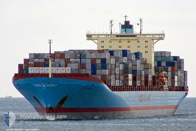
GEORG MAERSK
Container Ship

Current Trip
| Trip Time | 20 h, 20 mins |
|---|---|
| Trip Distance | 132.18 nm |
| AVG Speed | 9.4 Knopen |
| MAX Speed | 15.9 Knopen |
| Diepgang | 10.5 M |
| AVG Wind | 16.2 knots |
| MAX Wind | 22 knots |
| MIN Temp | 15.3°C / 59.54°F |
| MAX Temp | 19.5°C / 67.1°F |
| Positie ontvangen | 15 d geleden |
Current Position
| Lengtegraad | 139.71870° |
|---|---|
| Breedtegraat | 35.07403° |
| Status | Under way using engine |
| Snelheid | 13 Knopen |
| Koers | 196° |
| Gebied | North Pacific Ocean |
| Station | T-AIS |
| Positie ontvangen | 15 d geleden |
Information
The current position of GEORG MAERSK is in North Pacific Ocean with coordinates 35.07403° / 139.71870° as reported on 2025-02-03 19:51 by AIS to our vessel tracker app. The vessel's current speed is 13 Knopen and is currently inside the port of YANTIAN.
The vessel GEORG MAERSK (IMO: 9320257, MMSI: 220416000) is a Container Ship that was built in 2006 ( 19 Jaar oud ). It's sailing under the flag of [DK] Denmark.
In this page you can find informations about the vessels current position, last detected port calls, and current voyage information. If the vessels is not in coverage by AIS you will find the latest position.
The current position of GEORG MAERSK is detected by our AIS receivers and we are not responsible for the reliability of the data. The last position was recorded while the vessel was in Coverage by the Ais receivers of our vessel tracking app.
The current draught of GEORG MAERSK as reported by AIS is 10.5 meters
Weather
| Temperature | 16.3°C / 61.34°F |
|---|---|
| Wind Speed | 9 knots |
| Direction | 99° E |
| Pressure | 1022.6 hPa |
| Humidity | 79.1 % |
| Cloud Coverage | 90 % |


Featured Company
Last Port Calls
| Port | Arrival | Departure | Time In Port |
|---|---|---|---|
| 2025-02-19 00:49 | |||
| 2025-02-17 15:55 | 2025-02-18 04:29 | 12 h | |
| 2025-02-03 09:12 | 2025-02-03 18:12 | 8 h | |
| 2025-01-15 13:21 | 2025-01-21 19:38 | 6 d | |
| 2024-12-27 05:01 | 2024-12-28 11:08 | 1 d | |
| 2024-12-26 06:07 | 2024-12-26 18:49 | 12 h | |
| 2024-12-21 01:28 | 2024-12-21 23:05 | 21 h | |
| 2024-12-17 03:16 | 2024-12-18 02:08 | 22 h | |
| 2024-12-02 14:42 |
Most Visited Ports (Last year)
| Port | Arrivals | |
|---|---|---|
| 8 | ||
| 6 | ||
| 6 | ||
| 6 | ||
| 1 | ||
| 1 |
Last Trips
| Origin | Departure | Destination | Arrival | Distance | |
|---|---|---|---|---|---|
| 2025-02-18 12:29 | 2025-02-19 08:49 | 132.18 nm | |||
| 2025-02-04 03:12 | 2025-02-17 23:55 | 3477.22 nm | |||
| 2025-01-21 11:38 | 2025-02-03 18:12 | 4982.94 nm | |||
| 2024-12-28 19:08 | 2025-01-15 05:21 | 6856.62 nm | |||
| 2024-12-27 02:49 | 2024-12-27 13:01 | 71.58 nm | |||
| 2024-12-22 07:05 | 2024-12-26 14:07 | 503.12 nm | |||
| 2024-12-18 11:08 | 2024-12-21 09:28 | 1269.62 nm | |||
| 2024-12-02 06:42 | 2024-12-17 12:16 | 5030.44 nm |
Events
| Tijd | Evenement | Details | Positie / Bestemming | Info |
|---|---|---|---|---|
| 2025-02-19 00:50 | Stop beweging |
22.56832 / 114.28767
[CN] YANTIAN
|
Snelheid: 0.1 kn Koers: 318° |
|
| 2025-02-19 00:49 | Aankomsthaven |
|
22.56832 / 114.28767
[CN] YANTIAN
|
Snelheid: 1.2 kn Koers: 317° |
| 2025-02-18 21:37 | Start beweging | 13.42 nm, East of HONG KONG |
22.21155 / 114.40567
JP YOK > CN XAM
|
Snelheid: 3.2 kn Koers: 165° |
| 2025-02-18 17:09 | Stop beweging | 20.67 nm, South of XIANTOULING |
22.25512 / 114.55165
JP YOK > CN XAM
|
Snelheid: 0.1 kn Koers: 90° |
| 2025-02-18 04:37 | Start beweging | 2.2 nm, South of NANSHA |
22.63820 / 113.68925
JP YOK > CN XAM
|
Snelheid: 3.1 kn Koers: 152° |
| 2025-02-18 04:29 | Vertrekhaven |
|
22.63803 / 113.68965
JP YOK > CN XAM
|
Snelheid: 0.6 kn Koers: 346° |
| 2025-02-17 15:56 | Stop beweging |
22.63835 / 113.68368
[CN] NANSHA
|
Snelheid: Koers: 348° |
|
| 2025-02-17 15:55 | Aankomsthaven |
|
22.63835 / 113.68368
[CN] NANSHA
|
Snelheid: 0.7 kn Koers: 343° |
| 2025-02-13 21:20 | Start beweging | 4.98 nm, South of CAI MEP |
10.46368 / 106.99565
JP YOK > CN XAM
|
Snelheid: 10.7 kn Koers: 180° |