
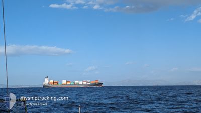
GH FOEHN
Container Ship
Current Trip
| Time Travelled | 6 h, 40 mins |
|---|---|
| Remaining Time | 5 h, 0 mins |
| Distance Travelled | 61.30 nm |
| Remaining Distance | 20.42 nm |
| AVG Speed | 8.6 Knopen |
| MAX Speed | 12.1 Knopen |
| AVG Wind | 9 knots |
| MAX Wind | 12.7 knots |
| MIN Temp | 3.4°C / 38.12°F |
| MAX Temp | 9.4°C / 48.92°F |
| Diepgang | 10.3 M |
| Positie ontvangen | 3 m geleden |
Current Position
| Lengtegraad | 12.65149° |
|---|---|
| Breedtegraat | 45.26551° |
| Status | Under way using engine |
| Snelheid | 1 Knopen |
| Koers | 53° |
| Gebied | Adriatic Sea |
| Station | T-AIS |
| Positie ontvangen | 3 m geleden |
Info
Information
The current position of GH FOEHN is in Adriatic Sea with coordinates 45.26551° / 12.65149° as reported on 2025-02-06 06:10 by AIS to our vessel tracker app. The vessel's current speed is 1 Knopen and is heading at the port of VENEZIA. The estimated time of arrival as calculated by MyShipTracking vessel tracking app is 2025-02-06 12:13 LT
The vessel GH FOEHN (IMO: 9377559, MMSI: 538009390) is a Container Ship that was built in 2008 ( 17 Jaar oud ). It's sailing under the flag of [MH] Marshall Is.
In this page you can find informations about the vessels current position, last detected port calls, and current voyage information. If the vessels is not in coverage by AIS you will find the latest position.
The current position of GH FOEHN is detected by our AIS receivers and we are not responsible for the reliability of the data. The last position was recorded while the vessel was in Coverage by the Ais receivers of our vessel tracking app.
The current draught of GH FOEHN as reported by AIS is 10.3 meters
Weather
| Temperature | 9.3°C / 48.74°F |
|---|---|
| Wind Speed | 13 knots |
| Direction | 56° NE |
| Pressure | 1032.1 hPa |
| Humidity | 58.7 % |
| Cloud Coverage | 5 % |
Featured Company
Last Port Calls
| Port | Arrival | Departure | Time In Port |
|---|---|---|---|
| 2025-02-04 13:09 | 2025-02-06 00:33 | 1 d | |
| 2025-01-27 12:27 | 2025-01-29 09:21 | 1 d | |
| 2025-01-26 15:26 | 2025-01-27 03:03 | 11 h | |
| 2025-01-22 09:01 | 2025-01-23 23:11 | 1 d | |
| 2025-01-17 07:20 | 2025-01-18 20:52 | 1 d | |
| 2025-01-15 18:09 | 2025-01-16 19:33 | 1 d | |
| 2025-01-14 08:35 | 2025-01-15 04:10 | 19 h | |
| 2025-01-08 23:37 | 2025-01-10 18:43 | 1 d | |
| 2025-01-06 12:00 | 2025-01-07 16:09 | 1 d | |
| 2024-12-31 19:16 | 2025-01-04 16:54 | 3 d |
Last Trips
| Origin | Departure | Destination | Arrival | Distance | |
|---|---|---|---|---|---|
| 2025-01-29 09:21 | 2025-02-04 13:09 | 1310.71 nm | |||
| 2025-01-27 03:03 | 2025-01-27 12:27 | 139.06 nm | |||
| 2025-01-23 23:11 | 2025-01-26 15:26 | 532.52 nm | |||
| 2025-01-18 20:52 | 2025-01-22 09:01 | 907.75 nm | |||
| 2025-01-16 19:33 | 2025-01-17 07:20 | 132.70 nm | |||
| 2025-01-15 04:10 | 2025-01-15 18:09 | 153.26 nm | |||
| 2025-01-10 18:43 | 2025-01-14 08:35 | 1306.09 nm | |||
| 2025-01-07 16:09 | 2025-01-08 23:37 | 153.88 nm | |||
| 2025-01-04 16:54 | 2025-01-06 12:00 | 534.57 nm | |||
| 2024-12-24 06:29 | 2024-12-31 19:16 | 892.13 nm |
Events
| Tijd | Evenement | Details | Positie / Bestemming | Info |
|---|---|---|---|---|
| 2025-02-06 02:13 | Draught Changed | 10.3 10 |
45.44944 / 13.11382
ITVCE
|
Snelheid: 11.9 kn Koers: 231.6° |
| 2025-02-06 02:13 | ETA Changed | 2025/02/06 07:00 |
45.44944 / 13.11382
ITVCE
|
Snelheid: 11.9 kn Koers: 231.6° |
| 2025-02-06 01:22 | Status Changed | Under way using engine Default |
45.54757 / 13.29354
ITVCE
|
Snelheid: 12 kn Koers: 240° |
| 2025-02-06 01:09 | Status Changed | Default Under way using engine |
45.56845 / 13.35130
ITVCE
|
Snelheid: 11.8 kn Koers: 244° |
| 2025-02-06 00:57 | Status Changed | Under way using engine Default |
45.58392 / 13.40206
ITVCE
|
Snelheid: 12 kn Koers: 251° |
| 2025-02-06 00:49 | Status Changed | Default Under way using engine |
45.59345 / 13.43664
ITVCE
|
Snelheid: 11.8 kn Koers: 247° |
| 2025-02-06 00:23 | Wijzig zee gebeid | Italian part of the Adriatic Sea Slovenian part of the Adriatic Sea |
45.62523 / 13.55287
Adriatic Sea
|
Snelheid: 11.7 kn Koers: 250° |
| 2025-02-05 23:33 | Vertrekhaven |
|
45.55730 / 13.71007
ITVCE
|
Snelheid: 6.7 kn Koers: 289° |
| 2025-02-05 23:28 | Start beweging |
45.55434 / 13.72172
[SI] KOPER
|
Snelheid: 3.1 kn Koers: 288° |
|
| 2025-02-05 22:59 | Status Changed | Under way using engine Moored |
45.55312 / 13.73508
[SI] KOPER
|
Snelheid: Koers: 86° |