

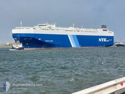
GLORIOUS LEADER
Vehicles Carrier

Current Trip
| Trip Time | 7 days |
|---|---|
| Trip Distance | 1063.43 nm |
| AVG Speed | 11.7 Knopen |
| MAX Speed | 17.3 Knopen |
| Diepgang | 9.2 M |
| AVG Wind | 8.7 knots |
| MAX Wind | 15.6 knots |
| MIN Temp | 7.9°C / 46.22°F |
| MAX Temp | 22.3°C / 72.14°F |
| Positie ontvangen | 7 d geleden |
Current Position
| Lengtegraad | -48.67466° |
|---|---|
| Breedtegraat | -28.84867° |
| Status | Under way using engine |
| Snelheid | 13.1 Knopen |
| Koers | 213° |
| Gebied | South Atlantic Ocean |
| Station | T-AIS |
| Positie ontvangen | 7 d geleden |
Information
The current position of GLORIOUS LEADER is in South Atlantic Ocean with coordinates -28.84867° / -48.67466° as reported on 2025-06-03 11:47 by AIS to our vessel tracker app. The vessel's current speed is 13.1 Knopen and is currently inside the port of ZARATE.
The vessel GLORIOUS LEADER (IMO: 9357298, MMSI: 309108000) is a Vehicles Carrier that was built in 2007 ( 18 Jaar oud ). It's sailing under the flag of [BS] Bahamas.
In this page you can find informations about the vessels current position, last detected port calls, and current voyage information. If the vessels is not in coverage by AIS you will find the latest position.
The current position of GLORIOUS LEADER is detected by our AIS receivers and we are not responsible for the reliability of the data. The last position was recorded while the vessel was in Coverage by the Ais receivers of our vessel tracking app.
The current draught of GLORIOUS LEADER as reported by AIS is 9.2 meters
Weather
| Temperature | 7.2°C / 44.96°F |
|---|---|
| Wind Speed | 3 knots |
| Direction | 47° NE |
| Pressure | 1025.8 hPa |
| Humidity | 91.3 % |
| Cloud Coverage | 1 % |


Featured Company
Last Port Calls
| Port | Arrival | Departure | Time In Port |
|---|---|---|---|
| 2025-06-09 14:40 | |||
| 2025-06-01 02:44 | 2025-06-02 09:58 | 1 d | |
| 2025-05-23 11:33 | 2025-05-23 19:31 | 7 h | |
| 2025-05-20 12:41 | 2025-05-21 01:29 | 12 h | |
| 2025-05-12 17:15 | 2025-05-13 05:47 | 12 h | |
| 2025-05-03 21:46 | 2025-05-05 14:28 | 1 d | |
| 2025-05-01 03:14 | 2025-05-02 14:44 | 1 d | |
| 2025-04-28 05:16 | 2025-04-28 17:37 | 12 h | |
| 2025-04-27 05:55 | 2025-04-27 17:21 | 11 h | |
| 2025-04-24 23:12 | 2025-04-25 17:47 | 18 h |
Last Trips
| Origin | Departure | Destination | Arrival | Distance | |
|---|---|---|---|---|---|
| 2025-06-02 09:58 | 2025-06-09 14:40 | 1063.43 nm | |||
| 2025-05-23 19:31 | 2025-06-01 02:44 | 554.68 nm | |||
| 2025-05-21 01:29 | 2025-05-23 11:33 | 797.98 nm | |||
| 2025-05-13 05:47 | 2025-05-20 12:41 | 2709.76 nm | |||
| 2025-05-05 14:28 | 2025-05-12 17:15 | 1919.54 nm | |||
| 2025-05-02 14:44 | 2025-05-03 21:46 | 267.51 nm | |||
| 2025-04-28 17:37 | 2025-05-01 03:14 | 391.61 nm | |||
| 2025-04-27 17:21 | 2025-04-28 05:16 | 117.52 nm | |||
| 2025-04-25 17:47 | 2025-04-27 05:55 | 389.49 nm | |||
| 2025-04-22 14:00 | 2025-04-24 23:12 | 706.31 nm |
Events
| Tijd | Evenement | Details | Positie / Bestemming | Info |
|---|---|---|---|---|
| 2025-06-09 17:44 | Stop beweging |
-34.06907 / -59.03091
[AR] ZARATE
|
Snelheid: 0.1 kn Koers: 147° |
|
| 2025-06-09 17:40 | Aankomsthaven |
|
-34.06898 / -59.03070
[AR] ZARATE
|
Snelheid: 1.1 kn Koers: 124° |
| 2025-06-08 23:39 | Start beweging | 11.19 nm, South East of PUNTA CARRETAS |
-35.07633 / -56.01915
AR ZAE
|
Snelheid: 3.3 kn Koers: 222° |
| 2025-06-08 11:20 | Stop beweging | 11.07 nm, South East of PUNTA CARRETAS |
-35.07255 / -56.01763
AR ZAE
|
Snelheid: 0.2 kn Koers: 283° |
| 2025-06-08 08:30 | Start beweging |
-35.21384 / -55.54317
AR ZAE
|
Snelheid: 3.7 kn Koers: 249° |
|
| 2025-06-05 09:33 | Stop beweging |
-35.20974 / -55.54233
AR ZAE
|
Snelheid: 0.2 kn Koers: 150° |
|
| 2025-06-03 11:53 | Status Changed | Default Under way using engine |
-28.86714 / -48.68814
AR ZAE
|
Snelheid: 13.1 kn Koers: 213° |
| 2025-06-03 11:47 | Buitenbereik |
-28.84867 / -48.67466
South Atlantic Ocean
AR ZAE
|
Snelheid: 13.1 kn Koers: 213° |
|
| 2025-06-03 11:37 | Status Changed | Under way using engine Default |
-28.81621 / -48.65093
AR ZAE
|
Snelheid: 12.8 kn Koers: 213° |
| 2025-06-03 11:29 | Status Changed | Default Under way using engine |
-28.79243 / -48.63318
AR ZAE
|
Snelheid: 13.2 kn Koers: 214.1° |