
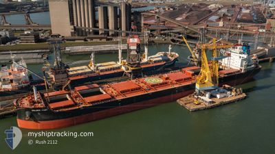
GOLDEN FAST
Cargo
Current Trip
| Time Travelled | 22 h, 27 mins |
|---|---|
| Remaining Time | --- |
| Distance Travelled | 245.17 nm |
| Remaining Distance | --- |
| AVG Speed | 10.1 Knopen |
| MAX Speed | 15.6 Knopen |
| AVG Wind | 14.5 knots |
| MAX Wind | 24 knots |
| MIN Temp | 2.9°C / 37.22°F |
| MAX Temp | 9.8°C / 49.64°F |
| Diepgang | 7.7 M |
| Positie ontvangen | 1 h, 39 m geleden |
Current Position
| Lengtegraad | -1.06191° |
|---|---|
| Breedtegraat | 50.32572° |
| Status | Under way using engine |
| Snelheid | 15.2 Knopen |
| Koers | 253.1° |
| Gebied | English Channel |
| Station | T-AIS |
| Positie ontvangen | 1 h, 39 m geleden |
Info
Information
The current position of GOLDEN FAST is in English Channel with coordinates 50.32572° / -1.06191° as reported on 2025-02-05 05:56 by AIS to our vessel tracker app. The vessel's current speed is 15.2 Knopen and is heading at the port of PORTO TROMBETAS. The estimated time of arrival as calculated by MyShipTracking vessel tracking app is 2025-02-18 15:00 LT
The vessel GOLDEN FAST (IMO: 9860116, MMSI: 538009293) is a Cargo It's sailing under the flag of [MH] Marshall Is.
In this page you can find informations about the vessels current position, last detected port calls, and current voyage information. If the vessels is not in coverage by AIS you will find the latest position.
The current position of GOLDEN FAST is detected by our AIS receivers and we are not responsible for the reliability of the data. The last position was recorded while the vessel was in Coverage by the Ais receivers of our vessel tracking app.
The current draught of GOLDEN FAST as reported by AIS is 7.7 meters
Weather
| Temperature | 9.3°C / 48.74°F |
|---|---|
| Wind Speed | 10 knots |
| Direction | 284° WNW |
| Pressure | 1036.3 hPa |
| Humidity | 77.1 % |
| Cloud Coverage | 12 % |
Featured Company
Last Port Calls
| Port | Arrival | Departure | Time In Port |
|---|---|---|---|
| 2025-02-04 09:53 | 2025-02-04 10:08 | 14 m | |
| 2025-02-01 05:41 | 2025-02-01 06:00 | 19 m | |
| 2025-01-31 04:10 | 2025-02-01 03:23 | 23 h | |
| 2025-01-13 16:15 | 2025-01-14 03:07 | 10 h | |
| 2025-01-09 13:41 | 2025-01-10 03:43 | 14 h | |
| 2024-12-26 08:28 | 2024-12-29 19:14 | 3 d |
Most Visited Ports (Last year)
| Port | Arrivals | |
|---|---|---|
| 3 | ||
| 2 | ||
| 2 | ||
| 2 | ||
| 2 | ||
| 1 |
Last Trips
| Origin | Departure | Destination | Arrival | Distance | |
|---|---|---|---|---|---|
| 2025-02-01 06:00 | 2025-02-04 09:53 | 9.03 nm | |||
| 2025-02-01 03:23 | 2025-02-01 05:41 | 10.29 nm | |||
| 2025-01-14 03:07 | 2025-01-31 04:10 | 3163.06 nm | |||
| 2025-01-10 03:43 | 2025-01-13 16:15 | 5.03 nm | |||
| 2024-12-29 19:14 | 2025-01-09 13:41 | 405.26 nm | |||
| 2024-11-30 06:47 | 2024-12-26 08:28 | 3981.54 nm |
Events
| Tijd | Evenement | Details | Positie / Bestemming | Info |
|---|---|---|---|---|
| 2025-02-05 06:03 | Status Changed | Default Under way using engine |
50.31654 / -1.11040
TROMBETAS
|
Snelheid: 15.2 kn Koers: 253.1° |
| 2025-02-05 05:56 | Buitenbereik |
50.32572 / -1.06191
English Channel
TROMBETAS
|
Snelheid: 15.2 kn Koers: 253.1° |
|
| 2025-02-05 00:02 | Status Changed | Under way using engine Default |
50.69274 / .69735
TROMBETAS
|
Snelheid: 12.1 kn Koers: 229° |
| 2025-02-05 00:01 | Status Changed | Default Under way using engine |
50.69463 / .70082
TROMBETAS
|
Snelheid: 12.1 kn Koers: 229.2° |
| 2025-02-05 00:01 | Status Changed | Under way using engine Default |
50.69532 / .70208
TROMBETAS
|
Snelheid: 12.2 kn Koers: 229° |
| 2025-02-04 23:57 | Status Changed | Default Under way using engine |
50.70355 / .71674
TROMBETAS
|
Snelheid: 12.3 kn Koers: 229.6° |
| 2025-02-04 21:10 | Gevonden in zee | United Kingdom part of the English Channel |
51.08161 / 1.45535
English Channel
TROMBETAS
|
Snelheid: 12 kn Koers: 232.3° |
| 2025-02-04 18:06 | Wijzig zee gebeid | United Kingdom part of the North Sea French part of the North Sea |
51.41130 / 2.06731
North Sea
TROMBETAS
|
Snelheid: 12.9 kn Koers: 297.7° |
| 2025-02-04 17:44 | Destination Changed | TROMBETAS TROMBETOS |
51.36867 / 2.17464
TROMBETAS
|
Snelheid: 12.9 kn Koers: 302° |
| 2025-02-04 17:44 | ETA Changed | 2025/02/18 18:00 2025/02/16 18:00 |
51.36867 / 2.17464
TROMBETAS
|
Snelheid: 12.9 kn Koers: 302° |