

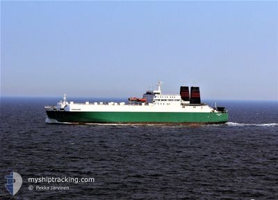
GREENLAND
Ro-Ro Cargo

Current Trip
| Time Travelled | 17 days |
|---|---|
| Remaining Time | 9 h, 57 mins |
| Distance Travelled | 919.35 nm |
| Remaining Distance | 69.10 nm |
| AVG Speed | 8 Knopen |
| MAX Speed | 10.6 Knopen |
| AVG Wind | 11.2 knots |
| MAX Wind | 30 knots |
| MIN Temp | 27.9°C / 82.22°F |
| MAX Temp | 34.6°C / 94.28°F |
| Diepgang | 6.6 M |
| Positie ontvangen | 1 m geleden |
Current Position
| Lengtegraad | 49.00273° |
|---|---|
| Breedtegraat | 29.45741° |
| Status | Under way using engine |
| Snelheid | 8.2 Knopen |
| Koers | 305.1° |
| Gebied | Persian Gulf |
| Station | T-AIS |
| Positie ontvangen | 1 m geleden |
Information
The current position of GREENLAND is in Persian Gulf with coordinates 29.45741° / 49.00273° as reported on 2025-06-05 23:51 by AIS to our vessel tracker app. The vessel's current speed is 8.2 Knopen and is heading at the port of UMM QASR. The estimated time of arrival as calculated by MyShipTracking vessel tracking app is 2025-06-06 12:50 LT
The vessel GREENLAND (IMO: 8222111, MMSI: 341139000) is a Ro-Ro Cargo that was built in 1984 ( 41 Jaar oud ). It's sailing under the flag of [KN] St Kitts Nevis.
In this page you can find informations about the vessels current position, last detected port calls, and current voyage information. If the vessels is not in coverage by AIS you will find the latest position.
The current position of GREENLAND is detected by our AIS receivers and we are not responsible for the reliability of the data. The last position was recorded while the vessel was in Coverage by the Ais receivers of our vessel tracking app.
The current draught of GREENLAND as reported by AIS is 6.6 meters
Weather
| Temperature | 29.2°C / 84.56°F |
|---|---|
| Wind Speed | 13 knots |
| Direction | 289° WNW |
| Pressure | 1004.3 hPa |
| Humidity | 58.4 % |
| Cloud Coverage | --- |


Featured Company
Most Visited Ports (Last year)
| Port | Arrivals | |
|---|---|---|
| 9 | ||
| 4 | ||
| 2 | ||
| 1 |
Events
| Tijd | Evenement | Details | Positie / Bestemming | Info |
|---|---|---|---|---|
| 2025-06-05 21:34 | Wijzig zee gebeid | Kuwaiti part of the Persian Gulf Iranian part of the Persian Gulf |
29.31287 / 49.24389
Persian Gulf
UMM QASR
|
Snelheid: 5.4 kn Koers: 302.8° |
| 2025-06-05 21:24 | Status Changed | Under way using engine Default |
29.30395 / 49.25915
UMM QASR
|
Snelheid: 5.8 kn Koers: 304° |
| 2025-06-05 21:21 | Binnenbereik |
29.30395 / 49.25915
Persian Gulf
UMM QASR
|
Snelheid: 5.8 kn Koers: 304.1° |
|
| 2025-06-05 19:02 | Status Changed | Default Under way using engine |
29.18959 / 49.46767
UMM QASR
|
Snelheid: 4.9 kn Koers: 302° |
| 2025-06-05 18:56 | Status Changed | Under way using engine Default |
29.18437 / 49.47639
UMM QASR
|
Snelheid: 5.8 kn Koers: 305° |
| 2025-06-05 18:56 | Buitenbereik |
29.18437 / 49.47639
Persian Gulf
UMM QASR
|
Snelheid: 4.9 kn Koers: 304.6° |
|
| 2025-06-05 18:42 | Binnenbereik |
29.18437 / 49.47639
Persian Gulf
UMM QASR
|
Snelheid: 4.9 kn Koers: 304.6° |
|
| 2025-06-05 16:57 | Status Changed | Default Under way using engine |
29.06270 / 49.65348
UMM QASR
|
Snelheid: 6.2 kn Koers: 314.1° |
| 2025-06-05 16:51 | Buitenbereik |
29.05512 / 49.66264
Persian Gulf
UMM QASR
|
Snelheid: 6.2 kn Koers: 314.1° |
|
| 2025-06-05 16:40 | Status Changed | Under way using engine Default |
29.04227 / 49.67818
UMM QASR
|
Snelheid: 6.2 kn Koers: 314° |