
HAV BRIM
General Cargo
Current Trip
| Time Travelled | 1 day |
|---|---|
| Remaining Time | 2 days |
| Distance Travelled | 285.29 nm |
| Remaining Distance | 455.85 nm |
| AVG Speed | 9.1 Knopen |
| MAX Speed | 14.6 Knopen |
| AVG Wind | 10.3 knots |
| MAX Wind | 30 knots |
| MIN Temp | 3.1°C / 37.58°F |
| MAX Temp | 8.2°C / 46.76°F |
| Diepgang | 6.2 M |
| Positie ontvangen | 1 h, 7 m geleden |
Current Position
| Lengtegraad | 2.79534° |
|---|---|
| Breedtegraat | 51.94009° |
| Status | Under way using engine |
| Snelheid | 5.3 Knopen |
| Koers | 43° |
| Gebied | North Sea |
| Station | T-AIS |
| Positie ontvangen | 1 h, 7 m geleden |
Info
Information
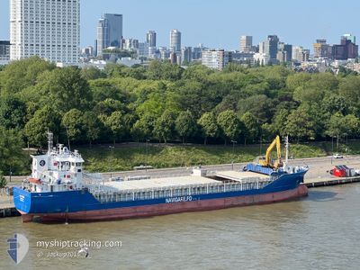
The current position of HAV BRIM is in North Sea with coordinates 51.94009° / 2.79534° as reported on 2025-02-07 11:54 by AIS to our vessel tracker app. The vessel's current speed is 5.3 Knopen and is heading at the port of KARMOY. The estimated time of arrival as calculated by MyShipTracking vessel tracking app is 2025-02-10 10:45 LT
The vessel HAV BRIM (IMO: 9361756, MMSI: 231234000) is a General Cargo that was built in 2008 ( 17 Jaar oud ). It's sailing under the flag of [FO] Faroe Is.
In this page you can find informations about the vessels current position, last detected port calls, and current voyage information. If the vessels is not in coverage by AIS you will find the latest position.
The current position of HAV BRIM is detected by our AIS receivers and we are not responsible for the reliability of the data. The last position was recorded while the vessel was in Coverage by the Ais receivers of our vessel tracking app.
The current draught of HAV BRIM as reported by AIS is 6.2 meters
Weather
| Temperature | 4.7°C / 40.46°F |
|---|---|
| Wind Speed | 30 knots |
| Direction | 90° E |
| Pressure | 1026.9 hPa |
| Humidity | 72.4 % |
| Cloud Coverage | 100 % |
Featured Company
Last Port Calls
| Port | Arrival | Departure | Time In Port |
|---|---|---|---|
| 2025-02-02 02:10 | 2025-02-05 16:15 | 3 d | |
| 2025-01-23 09:00 | 2025-01-24 00:29 | 15 h | |
| 2025-01-21 09:07 | 2025-01-21 13:59 | 4 h | |
| 2025-01-21 05:06 | 2025-01-21 07:59 | 2 h | |
| 2025-01-18 16:40 | 2025-01-19 09:21 | 16 h | |
| 2025-01-15 08:20 | 2025-01-15 16:05 | 7 h | |
| 2025-01-11 23:22 | 2025-01-14 13:46 | 2 d | |
| 2025-01-07 14:01 | 2025-01-10 01:30 | 2 d | |
| 2025-01-03 10:35 | 2025-01-04 12:30 | 1 d | |
| 2024-12-31 08:21 | 2024-12-31 15:51 | 7 h |
Last Trips
| Origin | Departure | Destination | Arrival | Distance | |
|---|---|---|---|---|---|
| 2025-01-24 00:29 | 2025-02-02 03:10 | 1330.62 nm | |||
| 2025-01-21 14:59 | 2025-01-23 09:00 | 424.42 nm | |||
| 2025-01-21 08:59 | 2025-01-21 10:07 | 8.55 nm | |||
| 2025-01-19 09:21 | 2025-01-21 06:06 | 434.50 nm | |||
| 2025-01-15 17:05 | 2025-01-18 16:40 | 498.25 nm | |||
| 2025-01-14 14:46 | 2025-01-15 09:20 | 163.25 nm | |||
| 2025-01-10 02:30 | 2025-01-12 00:22 | 425.10 nm | |||
| 2025-01-04 12:30 | 2025-01-07 15:01 | 745.87 nm | |||
| 2024-12-31 16:51 | 2025-01-03 10:35 | 455.69 nm | |||
| 2024-12-21 06:16 | 2024-12-31 09:21 | 1140.06 nm |
Events
| Tijd | Evenement | Details | Positie / Bestemming | Info |
|---|---|---|---|---|
| 2025-02-07 12:02 | Status Changed | Default Under way using engine |
51.94822 / 2.80711
KARMOY
|
Snelheid: 5.3 kn Koers: 43° |
| 2025-02-07 11:54 | Status Changed | Under way using engine Default |
51.94009 / 2.79534
KARMOY
|
Snelheid: 5.6 kn Koers: 40° |
| 2025-02-07 11:54 | Buitenbereik |
51.94009 / 2.79534
North Sea
KARMOY
|
Snelheid: 5.3 kn Koers: 43° |
|
| 2025-02-07 11:14 | Status Changed | Default Under way using engine |
51.89708 / 2.73548
KARMOY
|
Snelheid: 5.1 kn Koers: 43.1° |
| 2025-02-07 10:58 | Gevonden in zee | Dutch part of the North Sea |
51.87705 / 2.70731
North Sea
KARMOY
|
Snelheid: 5.4 kn Koers: 43.4° |
| 2025-02-07 10:58 | Status Changed | Under way using engine Default |
51.87705 / 2.70731
KARMOY
|
Snelheid: 5 kn Koers: 41° |
| 2025-02-07 10:13 | Status Changed | Default Under way using engine |
51.82381 / 2.63231
KARMOY
|
Snelheid: 5.7 kn Koers: 39.7° |
| 2025-02-07 10:01 | ETA Changed | 2025/02/09 16:00 2025/02/09 05:00 |
51.80560 / 2.60719
KARMOY
|
Snelheid: 5.9 kn Koers: 40.5° |
| 2025-02-07 09:26 | Status Changed | Under way using engine Default |
51.76310 / 2.55164
KARMOY
|
Snelheid: 6.6 kn Koers: 41° |
| 2025-02-07 09:26 | Binnenbereik |
51.77739 / 2.57027
North Sea
KARMOY
|
Snelheid: 6.2 kn Koers: 39.2° |