
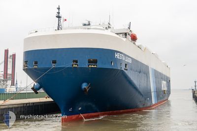
HESTIA LEADER
Vehicles Carrier
Current Trip
| Time Travelled | 12 days |
|---|---|
| Remaining Time | --- |
| Distance Travelled | 3736.42 nm |
| Remaining Distance | --- |
| AVG Speed | 16 Knopen |
| MAX Speed | 20.2 Knopen |
| AVG Wind | 11.2 knots |
| MAX Wind | 26 knots |
| MIN Temp | 18.3°C / 64.94°F |
| MAX Temp | 31.8°C / 89.24°F |
| Diepgang | 7.7 M |
| Positie ontvangen | 9 h, 48 m geleden |
Current Position
| Lengtegraad | -113.31197° |
|---|---|
| Breedtegraat | 20.26145° |
| Status | Under way using engine |
| Snelheid | 17.8 Knopen |
| Koers | 279° |
| Gebied | North Pacific Ocean |
| Station | T-AIS |
| Positie ontvangen | 9 h, 48 m geleden |
Info
Information
The current position of HESTIA LEADER is in North Pacific Ocean with coordinates 20.26145° / -113.31197° as reported on 2025-02-11 17:19 by AIS to our vessel tracker app. The vessel's current speed is 17.8 Knopen and is heading at the port of YOKOHAMA. The estimated time of arrival as calculated by MyShipTracking vessel tracking app is 2025-03-03 04:00 LT
The vessel HESTIA LEADER (IMO: 9355226, MMSI: 432669000) is a Vehicles Carrier that was built in 2008 ( 17 Jaar oud ). It's sailing under the flag of [JP] Japan.
In this page you can find informations about the vessels current position, last detected port calls, and current voyage information. If the vessels is not in coverage by AIS you will find the latest position.
The current position of HESTIA LEADER is detected by our AIS receivers and we are not responsible for the reliability of the data. The last position was recorded while the vessel was in Coverage by the Ais receivers of our vessel tracking app.
The current draught of HESTIA LEADER as reported by AIS is 7.7 meters
Weather
| Temperature | 18.4°C / 65.12°F |
|---|---|
| Wind Speed | 18 knots |
| Direction | 6° N |
| Pressure | 1016.8 hPa |
| Humidity | 75.3 % |
| Cloud Coverage | 27 % |
Featured Company
Last Port Calls
| Port | Arrival | Departure | Time In Port |
|---|---|---|---|
| 2025-01-29 08:17 | 2025-01-30 02:42 | 18 h | |
| 2025-01-28 15:08 | 2025-01-28 19:55 | 4 h | |
| 2025-01-23 08:27 | 2025-01-23 12:10 | 3 h | |
| 2025-01-22 09:00 | 2025-01-22 15:49 | 6 h | |
| 2025-01-20 05:20 | 2025-01-21 11:54 | 1 d | |
| 2025-01-18 22:31 | 2025-01-19 06:49 | 8 h | |
| 2025-01-15 06:03 | 2025-01-15 19:15 | 13 h | |
| 2025-01-12 01:25 | 2025-01-12 05:53 | 4 h | |
| 2025-01-06 19:01 | 2025-01-07 15:27 | 20 h | |
| 2025-01-04 06:58 | 2025-01-04 17:02 | 10 h |
Last Trips
| Origin | Departure | Destination | Arrival | Distance | |
|---|---|---|---|---|---|
| 2025-01-28 19:55 | 2025-01-29 08:17 | 129.89 nm | |||
| 2025-01-23 12:10 | 2025-01-28 15:08 | 1817.03 nm | |||
| 2025-01-22 15:49 | 2025-01-23 08:27 | 98.41 nm | |||
| 2025-01-21 11:54 | 2025-01-22 09:00 | 157.42 nm | |||
| 2025-01-19 06:49 | 2025-01-20 05:20 | 270.41 nm | |||
| 2025-01-15 19:15 | 2025-01-18 22:31 | 272.03 nm | |||
| 2025-01-12 05:53 | 2025-01-15 06:03 | 390.87 nm | |||
| 2025-01-07 15:27 | 2025-01-12 01:25 | 229.16 nm | |||
| 2025-01-04 17:02 | 2025-01-06 19:01 | 480.61 nm | |||
| 2024-12-31 00:59 | 2025-01-04 06:58 | 607.61 nm |
Events
| Tijd | Evenement | Details | Positie / Bestemming | Info |
|---|---|---|---|---|
| 2025-02-11 17:25 | Status Changed | Default Under way using engine |
20.26690 / -113.34721
JP YOK
|
Snelheid: 17.8 kn Koers: 279° |
| 2025-02-11 17:19 | Buitenbereik |
20.26145 / -113.31197
North Pacific Ocean
JP YOK
|
Snelheid: 17.8 kn Koers: 279° |
|
| 2025-02-11 17:11 | Status Changed | Under way using engine Default |
20.25497 / -113.27095
JP YOK
|
Snelheid: 18.1 kn Koers: 279° |
| 2025-02-11 16:54 | Binnenbereik |
20.25527 / -113.27296
North Pacific Ocean
JP YOK
|
Snelheid: 17.9 kn Koers: 279° |
|
| 2025-02-11 10:14 | Status Changed | Default Under way using engine |
19.91408 / -111.06592
JP YOK
|
Snelheid: 18.1 kn Koers: 280° |
| 2025-02-11 10:10 | Buitenbereik |
19.90992 / -111.04283
North Pacific Ocean
JP YOK
|
Snelheid: 18.1 kn Koers: 280° |
|
| 2025-02-11 10:07 | Status Changed | Under way using engine Default |
19.90738 / -111.02868
JP YOK
|
Snelheid: 18 kn Koers: 281° |
| 2025-02-11 09:27 | Status Changed | Default Under way using engine |
19.87082 / -110.82179
JP YOK
|
Snelheid: 17.9 kn Koers: 284° |
| 2025-02-11 09:26 | Status Changed | Under way using engine Default |
19.87003 / -110.81818
JP YOK
|
Snelheid: 18 kn Koers: 292° |
| 2025-02-11 08:26 | Buitenbereik |
19.75052 / -110.52477
North Pacific Ocean
JP YOK
|
Snelheid: 17.8 kn Koers: 294° |