

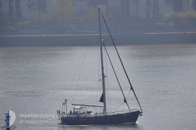
HESTIA
Pleasure Craft

Current Trip
Unknown
| Time Travelled | 1 day |
|---|---|
| Remaining Time | --- |
| Distance Travelled | 37.22 nm |
| Remaining Distance | --- |
| AVG Speed | 5.2 Knopen |
| MAX Speed | 7.1 Knopen |
| AVG Wind | 13.3 knots |
| MAX Wind | 16 knots |
| MIN Temp | 15.7°C / 60.26°F |
| MAX Temp | 17.7°C / 63.86°F |
| Diepgang | --- |
| Positie ontvangen | 11 m geleden |
Current Position
| Lengtegraad | -8.66393° |
|---|---|
| Breedtegraat | 40.64829° |
| Status | Default |
| Snelheid | |
| Koers | --- |
| Gebied | North Atlantic Ocean |
| Station | T-AIS |
| Positie ontvangen | 11 m geleden |
Information
The current position of HESTIA is in North Atlantic Ocean with coordinates 40.64829° / -8.66393° as reported on 2025-05-23 02:56 by AIS to our vessel tracker app. The vessel's current speed is 0 Knopen
The vessel HESTIA (MMSI: 244070103) is a Pleasure Craft It's sailing under the flag of [NL] Netherlands.
In this page you can find informations about the vessels current position, last detected port calls, and current voyage information. If the vessels is not in coverage by AIS you will find the latest position.
The current position of HESTIA is detected by our AIS receivers and we are not responsible for the reliability of the data. The last position was recorded while the vessel was in Coverage by the Ais receivers of our vessel tracking app.
Weather
| Temperature | 16.2°C / 61.16°F |
|---|---|
| Wind Speed | 9 knots |
| Direction | 359° N |
| Pressure | 1017.1 hPa |
| Humidity | 85.5 % |
| Cloud Coverage | 97 % |


Featured Company
Last Port Calls
| Port | Arrival | Departure | Time In Port |
|---|---|---|---|
| 2025-05-15 17:00 | 2025-05-21 09:03 | 5 d | |
| 2025-05-14 12:20 | |||
| 2025-05-10 14:10 | 2025-05-12 07:23 | 1 d | |
| 2025-05-04 18:17 | 2025-05-07 12:50 | 2 d | |
| 2025-05-02 16:01 | 2025-05-03 09:18 | 17 h | |
| 2025-04-28 08:17 | 2025-04-29 07:43 | 23 h | |
| 2025-04-18 16:40 | 2025-04-19 08:14 | 15 h | |
| 2025-04-14 17:55 | 2025-04-15 08:32 | 14 h | |
| 2025-04-12 12:29 | 2025-04-13 15:03 | 1 d | |
| 2025-04-10 14:22 | 2025-04-11 09:55 | 19 h |
Last Trips
| Origin | Departure | Destination | Arrival | Distance | |
|---|---|---|---|---|---|
| 2025-05-14 12:20 | 2025-05-15 17:00 | 126.51 nm | |||
| 2025-05-07 12:50 | 2025-05-10 14:10 | 345.02 nm | |||
| 2025-05-03 09:18 | 2025-05-04 18:17 | 65.46 nm | |||
| 2025-04-29 07:43 | 2025-05-02 16:01 | 87.12 nm | |||
| 2025-04-19 08:14 | 2025-04-28 08:17 | 143.48 nm | |||
| 2025-04-15 08:32 | 2025-04-18 16:40 | 113.14 nm | |||
| 2025-04-13 15:03 | 2025-04-14 17:55 | 73.02 nm | |||
| 2025-04-11 09:55 | 2025-04-12 12:29 | 73.34 nm | |||
| 2025-04-09 10:32 | 2025-04-10 14:22 | 58.79 nm | |||
| 2025-04-08 06:42 | 2025-04-08 11:15 | 24.56 nm |
Events
| Tijd | Evenement | Details | Positie / Bestemming | Info |
|---|---|---|---|---|
| 2025-05-21 15:01 | Stop beweging | 2.7 nm, East of AVEIRO |
40.64834 / -8.66396
|
Snelheid: 0.2 kn Koers: 511° |
| 2025-05-21 11:32 | Binnenbereik |
40.79787 / -8.75800
North Atlantic Ocean
|
Snelheid: 5.9 kn Koers: 188.1° |
|
| 2025-05-21 10:06 | Buitenbereik |
40.93470 / -8.72332
North Atlantic Ocean
|
Snelheid: 6 kn Koers: 186.9° |
|
| 2025-05-21 08:03 | Vertrekhaven |
|
41.14246 / -8.67984
|
Snelheid: 7.1 kn Koers: 235.9° |
| 2025-05-21 07:51 | Start beweging |
41.14426 / -8.65436
[PT] PORTO
|
Snelheid: 5.6 kn Koers: 279.5° |
|
| 2025-05-17 20:34 | Binnenbereik |
41.14290 / -8.65124
North Atlantic Ocean
[PT] PORTO
|
Snelheid: 0.2 kn Koers: 511° |
|
| 2025-05-15 16:03 | Buitenbereik |
41.14293 / -8.65127
North Atlantic Ocean
[PT] PORTO
|
Snelheid: Koers: 511° |
|
| 2025-05-15 16:00 | Stop beweging |
41.14292 / -8.65129
[PT] PORTO
|
Snelheid: 0.1 kn Koers: 511° |
|
| 2025-05-15 16:00 | Aankomsthaven |
|
41.14292 / -8.65129
[PT] PORTO
|
Snelheid: 1.5 kn Koers: 511° |
| 2025-05-15 12:34 | Gevonden in zee | Portuguese part of the North Atlantic Ocean |
41.35035 / -8.91745
North Atlantic Ocean
|
Snelheid: 4.8 kn Koers: 137.3° |