

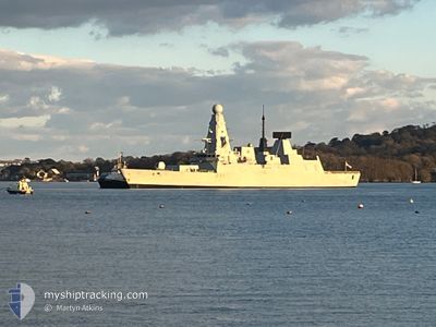
HMS DAUNTLESS
Military ops

Current Trip
R
| Time Travelled | 12 days |
|---|---|
| Remaining Time | --- |
| Distance Travelled | 646.72 nm |
| Remaining Distance | --- |
| AVG Speed | 9.5 Knopen |
| MAX Speed | 21.4 Knopen |
| AVG Wind | 16.7 knots |
| MAX Wind | 22.5 knots |
| MIN Temp | 7.7°C / 45.86°F |
| MAX Temp | 12°C / 53.6°F |
| Diepgang | 0 M |
| Positie ontvangen | 6 d geleden |
Current Position
| Lengtegraad | -1.11852° |
|---|---|
| Breedtegraat | 50.81165° |
| Status | Under way using engine |
| Snelheid | |
| Koers | 312° |
| Gebied | English Channel |
| Station | T-AIS |
| Positie ontvangen | 6 d geleden |
Information
The current position of HMS DAUNTLESS is in English Channel with coordinates 50.81165° / -1.11852° as reported on 2025-04-03 16:52 by AIS to our vessel tracker app. The vessel's current speed is 0 Knopen
The vessel HMS DAUNTLESS (MMSI: 234586000) is a Military ops It's sailing under the flag of [GB] United Kingdom.
In this page you can find informations about the vessels current position, last detected port calls, and current voyage information. If the vessels is not in coverage by AIS you will find the latest position.
The current position of HMS DAUNTLESS is detected by our AIS receivers and we are not responsible for the reliability of the data. The last position was recorded while the vessel was in Coverage by the Ais receivers of our vessel tracking app.
Weather
| Temperature | 11.9°C / 53.42°F |
|---|---|
| Wind Speed | 14 knots |
| Direction | 96° E |
| Pressure | 1016.9 hPa |
| Humidity | 80.7 % |
| Cloud Coverage | 80 % |


Featured Company
Last Port Calls
| Port | Arrival | Departure | Time In Port |
|---|---|---|---|
| 2025-03-27 16:49 | 2025-03-28 15:45 | 22 h | |
| 2025-03-21 17:10 | 2025-03-23 11:07 | 1 d | |
| 2025-03-18 08:16 | 2025-03-19 18:42 | 1 d | |
| 2025-03-15 18:10 | 2025-03-16 18:44 | 1 d | |
| 2025-03-08 07:51 | 2025-03-14 16:38 | 6 d | |
| 2025-03-07 19:07 | 2025-03-08 07:15 | 12 h | |
| 2025-03-04 15:00 | 2025-03-05 14:43 | 23 h | |
| 2025-03-01 13:05 |
Most Visited Ports (Last year)
| Port | Arrivals | |
|---|---|---|
| 7 | ||
| 5 | ||
| 4 | ||
| 4 | ||
| 1 |
Last Trips
| Origin | Departure | Destination | Arrival | Distance | |
|---|---|---|---|---|---|
| 2025-03-23 11:07 | 2025-03-27 16:49 | 258.46 nm | |||
| 2025-03-19 18:42 | 2025-03-21 17:10 | 165.91 nm | |||
| 2025-03-16 18:44 | 2025-03-18 08:16 | 37.64 nm | |||
| 2025-03-14 16:38 | 2025-03-15 18:10 | 152.39 nm | |||
| 2025-03-05 14:43 | 2025-03-08 07:51 | 182.45 nm | |||
| 2025-03-05 14:43 | 2025-03-07 19:07 | 176.93 nm | |||
| 2025-03-01 13:05 | 2025-03-04 15:00 | 205.46 nm |
Events
| Tijd | Evenement | Details | Positie / Bestemming | Info |
|---|---|---|---|---|
| 2025-04-03 16:52 | Buitenbereik |
50.81165 / -1.11852
English Channel
|
Snelheid: Koers: 313.2° |
|
| 2025-04-03 16:41 | Stop beweging | 0.59 nm, West of PORTSMOUTH |
50.81118 / -1.11882
R
|
Snelheid: Koers: 310° |
| 2025-04-03 14:19 | Binnenbereik |
50.52915 / -1.07348
English Channel
|
Snelheid: 20 kn Koers: 82.4° |
|
| 2025-04-03 07:31 | Buitenbereik |
50.25497 / -4.14810
English Channel
|
Snelheid: 12.3 kn Koers: 151.3° |
|
| 2025-04-03 06:02 | Wijzig zee gebeid | United Kingdom part of the English Channel United Kingdom part of the Celtic Sea |
50.24435 / -4.17078
English Channel
|
Snelheid: 11.6 kn Koers: 3.8° |
| 2025-04-03 06:01 | Binnenbereik |
50.24435 / -4.17078
English Channel
|
Snelheid: 11.6 kn Koers: 3.8° |
|
| 2025-04-03 00:55 | Buitenbereik |
49.97082 / -6.00862
Celtic Sea
|
Snelheid: 16.1 kn Koers: 194.8° |
|
| 2025-04-02 23:16 | Wijzig zee gebeid | United Kingdom part of the Celtic Sea United Kingdom part of the Irish Sea and St. George's Channel |
50.45037 / -6.00093
Celtic Sea
|
Snelheid: 16.5 kn Koers: 177.8° |
| 2025-04-02 23:16 | Binnenbereik |
50.45037 / -6.00093
Celtic Sea
|
Snelheid: 16.5 kn Koers: 177.8° |
|
| 2025-04-01 15:12 | Buitenbereik |
52.45528 / -4.71743
Irish Sea and St. George's Channel
|
Snelheid: 12.6 kn Koers: 323.9° |