
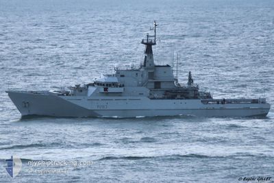
HMS MERSEY
Military ops
Current Trip
| Trip Time | 9 days |
|---|---|
| Trip Distance | 493.29 nm |
| AVG Speed | 10.4 Knopen |
| MAX Speed | 10.4 Knopen |
| Diepgang | 3.8 M |
| AVG Wind | 14.4 knots |
| MAX Wind | 25.3 knots |
| MIN Temp | 3.9°C / 39.02°F |
| MAX Temp | 10.7°C / 51.26°F |
| Positie ontvangen | 19 h, 38 m geleden |
Current Position
| Lengtegraad | -4.82059° |
|---|---|
| Breedtegraat | 56.05471° |
| Status | Moored |
| Snelheid | |
| Koers | 169° |
| Gebied | Inner Seas off the West Coast of Scotland |
| Station | T-AIS |
| Positie ontvangen | 19 h, 38 m geleden |
Info
Information
The current position of HMS MERSEY is in Inner Seas off the West Coast of Scotland with coordinates 56.05471° / -4.82059° as reported on 2025-02-21 16:49 by AIS to our vessel tracker app. The vessel's current speed is 0 Knopen and is currently inside the port of FASLANE.
The vessel HMS MERSEY (IMO: 9261346, MMSI: 234637000) is a Military ops It's sailing under the flag of [GB] United Kingdom.
In this page you can find informations about the vessels current position, last detected port calls, and current voyage information. If the vessels is not in coverage by AIS you will find the latest position.
The current position of HMS MERSEY is detected by our AIS receivers and we are not responsible for the reliability of the data. The last position was recorded while the vessel was in Coverage by the Ais receivers of our vessel tracking app.
The current draught of HMS MERSEY as reported by AIS is 3.8 meters
Weather
| Temperature | 8.4°C / 47.12°F |
|---|---|
| Wind Speed | 13 knots |
| Direction | 210° SSW |
| Pressure | 989.5 hPa |
| Humidity | 95.6 % |
| Cloud Coverage | 100 % |
Featured Company
Last Port Calls
| Port | Arrival | Departure | Time In Port |
|---|---|---|---|
| 2025-02-21 16:13 | |||
| 2025-02-14 14:17 | 2025-02-15 11:15 | 20 h | |
| 2025-02-13 17:20 | 2025-02-14 09:28 | 16 h | |
| 2025-02-12 21:31 | 2025-02-13 13:10 | 15 h | |
| 2025-02-12 09:24 |
Most Visited Ports (Last year)
| Port | Arrivals | |
|---|---|---|
| 11 | ||
| 3 | ||
| 1 |
Last Trips
| Origin | Departure | Destination | Arrival | Distance | |
|---|---|---|---|---|---|
| 2025-02-12 09:24 | 2025-02-21 16:13 | 493.29 nm | |||
| 2025-02-12 09:24 | 2025-02-14 14:17 | 101.64 nm | |||
| 2025-02-12 09:24 | 2025-02-13 17:20 | 65.87 nm | |||
| 2025-02-12 09:24 | 2025-02-12 21:31 | 44.71 nm |
Events
| Tijd | Evenement | Details | Positie / Bestemming | Info |
|---|---|---|---|---|
| 2025-02-21 16:49 | Buitenbereik |
56.05471 / -4.82059
Inner Seas off the West Coast of Scotland
[GB] FASLANE
|
Snelheid: Koers: 123.2° |
|
| 2025-02-21 16:32 | Status Changed | Moored Under way using engine |
56.05472 / -4.82059
[GB] FASLANE
|
Snelheid: Koers: 169° |
| 2025-02-21 16:17 | Stop beweging |
56.05452 / -4.82130
[GB] FASLANE
|
Snelheid: 0.3 kn Koers: 154° |
|
| 2025-02-21 16:13 | Aankomsthaven |
|
56.05518 / -4.82284
[GB] FASLANE
|
Snelheid: 2.5 kn Koers: 107° |
| 2025-02-21 15:07 | Start beweging | 1.63 nm, North West of GREENOCK |
55.97337 / -4.76446
|
Snelheid: 10.3 kn Koers: 256.3° |
| 2025-02-21 15:04 | Status Changed | Under way using engine At anchor |
55.97390 / -4.75798
|
Snelheid: 0.9 kn Koers: 251° |
| 2025-02-21 09:48 | Stop beweging | 1.65 nm, North West of GREENOCK |
55.97483 / -4.76055
|
Snelheid: 0.2 kn Koers: 159° |
| 2025-02-21 09:33 | Status Changed | At anchor Under way using engine |
55.97344 / -4.75930
|
Snelheid: 1.1 kn Koers: 185° |
| 2025-02-21 09:03 | Start beweging | 1.64 nm, North West of GREENOCK |
55.97449 / -4.76162
|
Snelheid: 3.4 kn Koers: 221° |
| 2025-02-21 09:03 | Status Changed | Under way using engine At anchor |
55.97458 / -4.76101
|
Snelheid: 1.5 kn Koers: 237° |