

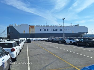
HOEGH TRAPPER
Cargo

Current Trip
ZA DUR>RE LPT
| Time Travelled | 1 day |
|---|---|
| Remaining Time | --- |
| Distance Travelled | 593.31 nm |
| Remaining Distance | --- |
| AVG Speed | 15.7 Knopen |
| MAX Speed | 17.3 Knopen |
| AVG Wind | 13.7 knots |
| MAX Wind | 18 knots |
| MIN Temp | 21°C / 69.8°F |
| MAX Temp | 24.5°C / 76.1°F |
| Diepgang | 9.6 M |
| Positie ontvangen | 1 d geleden |
Current Position
| Lengtegraad | 31.98180° |
|---|---|
| Breedtegraat | -29.66023° |
| Status | Under way using engine |
| Snelheid | 14.4 Knopen |
| Koers | 75.8° |
| Gebied | Indian Ocean |
| Station | T-AIS |
| Positie ontvangen | 1 d geleden |
Information
The current position of HOEGH TRAPPER is in Indian Ocean with coordinates -29.66023° / 31.98180° as reported on 2025-06-08 17:12 by AIS to our vessel tracker app. The vessel's current speed is 14.4 Knopen
The vessel HOEGH TRAPPER (IMO: 9706918, MMSI: 258872000) is a Cargo It's sailing under the flag of [NO] Norway.
In this page you can find informations about the vessels current position, last detected port calls, and current voyage information. If the vessels is not in coverage by AIS you will find the latest position.
The current position of HOEGH TRAPPER is detected by our AIS receivers and we are not responsible for the reliability of the data. The last position was recorded while the vessel was in Coverage by the Ais receivers of our vessel tracking app.
The current draught of HOEGH TRAPPER as reported by AIS is 9.6 meters
Weather
| Temperature | 24.3°C / 75.74°F |
|---|---|
| Wind Speed | 13 knots |
| Direction | 34° NE |
| Pressure | 1017.1 hPa |
| Humidity | 79.3 % |
| Cloud Coverage | --- |


Featured Company
Last Port Calls
| Port | Arrival | Departure | Time In Port |
|---|---|---|---|
| 2025-06-07 02:49 | 2025-06-08 15:56 | 1 d | |
| 2025-06-05 02:09 | 2025-06-05 19:17 | 17 h | |
| 2025-05-19 02:35 | 2025-05-20 04:12 | 1 d | |
| 2025-05-16 07:35 | 2025-05-16 14:31 | 6 h | |
| 2025-05-14 00:47 | 2025-05-14 16:20 | 15 h | |
| 2025-05-13 00:50 | 2025-05-13 15:13 | 14 h | |
| 2025-05-09 23:35 | 2025-05-11 22:10 | 1 d | |
| 2025-05-07 03:57 | 2025-05-08 16:54 | 1 d | |
| 2025-05-04 16:56 | 2025-05-05 21:53 | 1 d | |
| 2025-05-04 15:07 | 2025-05-04 15:48 | 41 m |
Last Trips
| Origin | Departure | Destination | Arrival | Distance | |
|---|---|---|---|---|---|
| 2025-06-05 19:17 | 2025-06-07 02:49 | 402.57 nm | |||
| 2025-05-20 04:12 | 2025-06-05 02:09 | 5543.40 nm | |||
| 2025-05-16 14:31 | 2025-05-19 02:35 | 902.69 nm | |||
| 2025-05-14 16:20 | 2025-05-16 07:35 | 589.73 nm | |||
| 2025-05-13 15:13 | 2025-05-14 00:47 | 112.80 nm | |||
| 2025-05-11 22:10 | 2025-05-13 00:50 | 281.67 nm | |||
| 2025-05-08 16:54 | 2025-05-09 23:35 | 353.43 nm | |||
| 2025-05-05 21:53 | 2025-05-07 03:57 | 285.11 nm | |||
| 2025-05-04 15:48 | 2025-05-04 16:56 | 7.30 nm | |||
| 2025-05-03 19:49 | 2025-05-04 15:07 | 277.11 nm |
Events
| Tijd | Evenement | Details | Positie / Bestemming | Info |
|---|---|---|---|---|
| 2025-06-08 17:17 | Status Changed | Default Under way using engine |
-29.65616 / 32.00354
ZA DUR>RE LPT
|
Snelheid: 14.4 kn Koers: 75.8° |
| 2025-06-08 17:12 | Status Changed | Under way using engine Default |
-29.66023 / 31.98180
ZA DUR>RE LPT
|
Snelheid: 13.9 kn Koers: 78° |
| 2025-06-08 17:12 | Buitenbereik |
-29.66023 / 31.98180
Indian Ocean
ZA DUR>RE LPT
|
Snelheid: 14.4 kn Koers: 75.8° |
|
| 2025-06-08 16:56 | Status Changed | Default Under way using engine |
-29.67351 / 31.91351
ZA DUR>RE LPT
|
Snelheid: 14.2 kn Koers: 75.9° |
| 2025-06-08 14:00 | ETA Changed | 2025/06/12 11:00 2025/06/12 10:00 |
-29.85832 / 31.06674
ZA DUR>RE LPT
|
Snelheid: 12.2 kn Koers: 37.4° |
| 2025-06-08 13:56 | Vertrekhaven |
|
-29.86725 / 31.05907
ZA DUR>RE LPT
|
Snelheid: 7.3 kn Koers: 38° |
| 2025-06-08 13:43 | Start beweging |
-29.87445 / 31.03836
[ZA] DURBAN
|
Snelheid: 3.1 kn Koers: 143° |
|
| 2025-06-08 13:37 | Draught Changed | 9.6 9.9 |
-29.87251 / 31.03707
[ZA] DURBAN
|
Snelheid: 1.2 kn Koers: 64° |
| 2025-06-08 13:37 | Destination Changed | ZA DUR>RE LPT ZA PLZ>ZA DUR |
-29.87251 / 31.03707
[ZA] DURBAN
|
Snelheid: 1.2 kn Koers: 64° |
| 2025-06-08 13:37 | ETA Changed | 2025/06/12 10:00 2025/06/07 00:00 |
-29.87251 / 31.03707
[ZA] DURBAN
|
Snelheid: 1.2 kn Koers: 64° |