
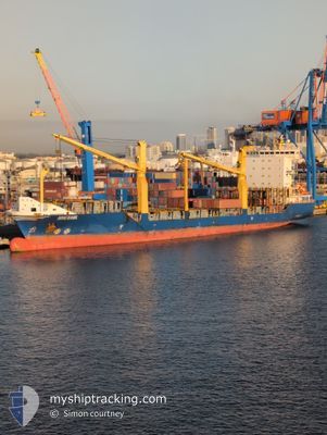
HOHEBANK
Container Ship
Current Trip
| Time Travelled | 1 day |
|---|---|
| Remaining Time | 16 h, 35 mins |
| Distance Travelled | 293.47 nm |
| Remaining Distance | 258.43 nm |
| AVG Speed | 12.1 Knopen |
| MAX Speed | 12.9 Knopen |
| AVG Wind | 18.8 knots |
| MAX Wind | 22 knots |
| MIN Temp | 21°C / 69.8°F |
| MAX Temp | 26.6°C / 79.88°F |
| Diepgang | 7.1 M |
| Positie ontvangen | 23 h, 10 m geleden |
Current Position
| Lengtegraad | -69.92049° |
|---|---|
| Breedtegraat | 18.14754° |
| Status | Under way using engine |
| Snelheid | 12.5 Knopen |
| Koers | 164.1° |
| Gebied | Caribbean Sea |
| Station | T-AIS |
| Positie ontvangen | 23 h, 10 m geleden |
Info
Information
The current position of HOHEBANK is in Caribbean Sea with coordinates 18.14754° / -69.92049° as reported on 2025-02-13 11:39 by AIS to our vessel tracker app. The vessel's current speed is 12.5 Knopen and is heading at the port of LA GUAIRA. The estimated time of arrival as calculated by MyShipTracking vessel tracking app is 2025-02-14 23:24 LT
The vessel HOHEBANK (IMO: 9435818, MMSI: 305134000) is a Container Ship that was built in 2007 ( 18 Jaar oud ). It's sailing under the flag of [AG] Antigua Barbuda.
In this page you can find informations about the vessels current position, last detected port calls, and current voyage information. If the vessels is not in coverage by AIS you will find the latest position.
The current position of HOHEBANK is detected by our AIS receivers and we are not responsible for the reliability of the data. The last position was recorded while the vessel was in Coverage by the Ais receivers of our vessel tracking app.
The current draught of HOHEBANK as reported by AIS is 7.1 meters
Weather
| Temperature | 26.6°C / 79.88°F |
|---|---|
| Wind Speed | 19 knots |
| Direction | 78° ENE |
| Pressure | 1016.3 hPa |
| Humidity | 72.1 % |
| Cloud Coverage | 13 % |
Featured Company
Last Port Calls
| Port | Arrival | Departure | Time In Port |
|---|---|---|---|
| 2025-02-12 09:20 | 2025-02-13 06:05 | 20 h | |
| 2025-02-08 18:26 | 2025-02-09 03:34 | 9 h | |
| 2025-02-06 17:23 | 2025-02-08 03:10 | 1 d | |
| 2025-02-03 10:00 | 2025-02-04 03:16 | 17 h | |
| 2025-02-01 14:47 | 2025-02-01 19:27 | 4 h | |
| 2025-01-31 14:06 | 2025-02-01 02:49 | 12 h | |
| 2025-01-30 21:31 | 2025-01-31 08:21 | 10 h | |
| 2025-01-28 23:24 | 2025-01-29 07:15 | 7 h | |
| 2025-01-23 21:30 | 2025-01-26 00:45 | 2 d | |
| 2025-01-20 13:22 | 2025-01-20 23:48 | 10 h |
Most Visited Ports (Last year)
| Port | Arrivals | |
|---|---|---|
| 42 | ||
| 40 | ||
| 21 | ||
| 12 | ||
| 11 | ||
| 11 |
Last Trips
| Origin | Departure | Destination | Arrival | Distance | |
|---|---|---|---|---|---|
| 2025-02-09 03:34 | 2025-02-12 09:20 | 937.08 nm | |||
| 2025-02-08 03:10 | 2025-02-08 18:26 | 8.88 nm | |||
| 2025-02-04 03:16 | 2025-02-06 17:23 | 936.41 nm | |||
| 2025-02-01 19:27 | 2025-02-03 10:00 | 396.46 nm | |||
| 2025-02-01 02:49 | 2025-02-01 14:47 | 117.01 nm | |||
| 2025-01-31 08:21 | 2025-01-31 14:06 | 66.80 nm | |||
| 2025-01-29 07:15 | 2025-01-30 21:31 | 501.38 nm | |||
| 2025-01-26 00:45 | 2025-01-28 23:24 | 931.73 nm | |||
| 2025-01-20 23:48 | 2025-01-23 21:30 | 939.34 nm | |||
| 2025-01-18 21:14 | 2025-01-20 13:22 | 488.77 nm |
Events
| Tijd | Evenement | Details | Positie / Bestemming | Info |
|---|---|---|---|---|
| 2025-02-13 11:51 | Status Changed | Default Under way using engine |
18.10556 / -69.90736
VELAG
|
Snelheid: 12.5 kn Koers: 164.1° |
| 2025-02-13 11:39 | Buitenbereik |
18.14754 / -69.92049
Caribbean Sea
VELAG
|
Snelheid: 12.5 kn Koers: 164.1° |
|
| 2025-02-13 11:37 | Status Changed | Under way using engine Default |
18.15313 / -69.92221
VELAG
|
Snelheid: 12.6 kn Koers: 162° |
| 2025-02-13 11:33 | Status Changed | Default Under way using engine |
18.16665 / -69.92677
VELAG
|
Snelheid: 12.7 kn Koers: 162.9° |
| 2025-02-13 10:44 | Draught Changed | 7.1 8.2 |
18.32288 / -69.98325
VELAG
|
Snelheid: 11.7 kn Koers: 162.3° |
| 2025-02-13 10:44 | Destination Changed | VELAG DOHAI |
18.32288 / -69.98325
VELAG
|
Snelheid: 11.7 kn Koers: 162.3° |
| 2025-02-13 10:44 | ETA Changed | 2025/02/14 23:30 2025/02/11 23:59 |
18.32288 / -69.98325
VELAG
|
Snelheid: 11.7 kn Koers: 162.3° |
| 2025-02-13 10:34 | Binnenbereik |
18.35234 / -69.99600
Caribbean Sea
|
Snelheid: 11.3 kn Koers: 155.6° |
|
| 2025-02-13 10:33 | Status Changed | Under way using engine Default |
18.35716 / -69.99781
DOHAI
|
Snelheid: 9.8 kn Koers: 159° |
| 2025-02-13 10:14 | Start beweging | 1.03 nm, South of RIO HAINA |
18.40188 / -70.01460
DOHAI
|
Snelheid: 8.5 kn Koers: 161° |