
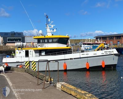
HST MILLIE
High speed craft
Current Trip
| Trip Time | 10 h, 29 mins |
|---|---|
| Trip Distance | 73.31 nm |
| AVG Speed | 17.8 Knopen |
| MAX Speed | 24 Knopen |
| Diepgang | 0 M |
| AVG Wind | 13.8 knots |
| MAX Wind | 21 knots |
| MIN Temp | 7.6°C / 45.68°F |
| MAX Temp | 8.6°C / 47.48°F |
| Positie ontvangen | 8 h, 4 m geleden |
Current Position
| Lengtegraad | -2.08928° |
|---|---|
| Breedtegraat | 55.88465° |
| Status | Under way using engine |
| Snelheid | 22.1 Knopen |
| Koers | 176.9° |
| Gebied | North Sea |
| Station | T-AIS |
| Positie ontvangen | 8 h, 4 m geleden |
Info
Information
The current position of HST MILLIE is in North Sea with coordinates 55.88465° / -2.08928° as reported on 2025-02-22 17:09 by AIS to our vessel tracker app. The vessel's current speed is 22.1 Knopen and is currently inside the port of EYEMOUTH.
The vessel HST MILLIE (IMO: 1018028, MMSI: 232048990) is a High speed craft It's sailing under the flag of [GB] United Kingdom.
In this page you can find informations about the vessels current position, last detected port calls, and current voyage information. If the vessels is not in coverage by AIS you will find the latest position.
The current position of HST MILLIE is detected by our AIS receivers and we are not responsible for the reliability of the data. The last position was recorded while the vessel was in Coverage by the Ais receivers of our vessel tracking app.
Weather
| Temperature | 8.3°C / 46.94°F |
|---|---|
| Wind Speed | 13 knots |
| Direction | 243° WSW |
| Pressure | 1008.5 hPa |
| Humidity | 75.5 % |
| Cloud Coverage | 22 % |
Featured Company
Last Port Calls
| Port | Arrival | Departure | Time In Port |
|---|---|---|---|
| 2025-02-22 17:14 | |||
| 2025-02-22 06:45 | |||
| 2025-02-15 17:25 | 2025-02-17 06:44 | 1 d | |
| 2025-02-13 16:51 | 2025-02-15 06:34 | 1 d | |
| 2025-02-07 16:42 | 2025-02-13 11:53 | 5 d | |
| 2025-02-03 06:40 | |||
| 2025-02-01 17:23 | 2025-02-02 06:52 | 13 h | |
| 2025-01-28 19:25 | 2025-01-29 07:01 | 11 h | |
| 2025-01-23 17:06 | 2025-01-28 11:11 | 4 d | |
| 2025-01-21 19:33 | 2025-01-23 07:27 | 1 d |
Most Visited Ports (Last year)
| Port | Arrivals | |
|---|---|---|
| 169 |
Last Trips
| Origin | Departure | Destination | Arrival | Distance | |
|---|---|---|---|---|---|
| 2025-02-22 06:45 | 2025-02-22 17:14 | 73.31 nm | |||
| 2025-02-15 06:34 | 2025-02-15 17:25 | 83.75 nm | |||
| 2025-02-13 11:53 | 2025-02-13 16:51 | 69.56 nm | |||
| 2025-02-03 06:40 | 2025-02-07 16:42 | 206.54 nm | |||
| 2025-01-29 07:01 | 2025-02-01 17:23 | 269.22 nm | |||
| 2025-01-28 11:11 | 2025-01-28 19:25 | 60.92 nm | |||
| 2025-01-23 07:27 | 2025-01-23 17:06 | 52.82 nm | |||
| 2025-01-20 06:53 | 2025-01-21 19:33 | 133.78 nm | |||
| 2025-01-19 07:10 | 2025-01-19 16:37 | 65.98 nm | |||
| 2025-01-18 06:49 | 2025-01-18 17:20 | 68.07 nm |
Events
| Tijd | Evenement | Details | Positie / Bestemming | Info |
|---|---|---|---|---|
| 2025-02-22 17:15 | Status Changed | Default Under way using engine |
55.87411 / -2.08636
[GB] EYEMOUTH
|
Snelheid: 22.1 kn Koers: 176.9° |
| 2025-02-22 17:15 | Stop beweging |
55.87411 / -2.08636
[GB] EYEMOUTH
|
Snelheid: 0.2 kn Koers: 341° |
|
| 2025-02-22 17:14 | Aankomsthaven |
|
55.87411 / -2.08636
[GB] EYEMOUTH
|
Snelheid: 22.1 kn Koers: 176.9° |
| 2025-02-22 17:09 | Buitenbereik |
55.88465 / -2.08928
North Sea
[GB] EYEMOUTH
|
Snelheid: 22.1 kn Koers: 176.9° |
|
| 2025-02-22 17:01 | ETA Changed | 2025/02/22 17:30 2025/02/13 17:30 |
55.93509 / -2.10829
GBEYE-NNGOWF-GBEYE
|
Snelheid: 21.6 kn Koers: 163.2° |
| 2025-02-22 16:46 | Status Changed | Under way using engine Default |
56.01950 / -2.13768
GBEYE-NNGOWF-GBEYE
|
Snelheid: 21.5 kn Koers: 172° |
| 2025-02-22 16:41 | Binnenbereik |
56.01880 / -2.13751
North Sea
|
Snelheid: 21.5 kn Koers: 171.1° |
|
| 2025-02-22 16:03 | Start beweging | 15.47 nm, East of ANSTRUTHER |
56.26529 / -2.24236
GBEYE-NNGOWF-GBEYE
|
Snelheid: 15.5 kn Koers: 148° |
| 2025-02-22 15:56 | Stop beweging | 15.4 nm, East of ANSTRUTHER |
56.26737 / -2.24514
GBEYE-NNGOWF-GBEYE
|
Snelheid: Koers: 206° |
| 2025-02-22 09:49 | Start beweging | 14.98 nm, East of ANSTRUTHER |
56.26265 / -2.25645
GBEYE-NNGOWF-GBEYE
|
Snelheid: 3.6 kn Koers: 132° |