
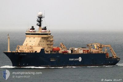
ILE DE BATZ
Cable Layer
Current Trip
KWT
| Time Travelled | 25 days |
|---|---|
| Remaining Time | --- |
| Distance Travelled | 361.88 nm |
| Remaining Distance | --- |
| AVG Speed | 9.6 Knopen |
| MAX Speed | 13 Knopen |
| AVG Wind | 8.5 knots |
| MAX Wind | 25.5 knots |
| MIN Temp | 10.6°C / 51.08°F |
| MAX Temp | 27.4°C / 81.32°F |
| Diepgang | 8.3 M |
| Positie ontvangen | 1 m geleden |
Current Position
| Lengtegraad | 49.05222° |
|---|---|
| Breedtegraat | 29.13526° |
| Status | Restricted manoeuverability |
| Snelheid | |
| Koers | 149° |
| Gebied | Persian Gulf |
| Station | T-AIS |
| Positie ontvangen | 1 m geleden |
Info
Information
The current position of ILE DE BATZ is in Persian Gulf with coordinates 29.13526° / 49.05222° as reported on 2025-03-22 19:57 by AIS to our vessel tracker app. The vessel's current speed is 0 Knopen
The vessel ILE DE BATZ (IMO: 9247041, MMSI: 226332000) is a Cable Layer that was built in 2001 ( 24 Jaar oud ). It's sailing under the flag of [FR] France.
In this page you can find informations about the vessels current position, last detected port calls, and current voyage information. If the vessels is not in coverage by AIS you will find the latest position.
The current position of ILE DE BATZ is detected by our AIS receivers and we are not responsible for the reliability of the data. The last position was recorded while the vessel was in Coverage by the Ais receivers of our vessel tracking app.
The current draught of ILE DE BATZ as reported by AIS is 8.3 meters
Weather
| Temperature | 19.3°C / 66.74°F |
|---|---|
| Wind Speed | 15 knots |
| Direction | 310° NW |
| Pressure | 1017.2 hPa |
| Humidity | 66.5 % |
| Cloud Coverage | 1 % |
Featured Company
Events
| Tijd | Evenement | Details | Positie / Bestemming | Info |
|---|---|---|---|---|
| 2025-03-13 08:30 | Stop beweging | 9.2 nm, North of FINTAS |
29.32434 / 48.12720
KWT
|
Snelheid: 0.3 kn Koers: 142° |
| 2025-03-13 07:55 | Start beweging | 9.57 nm, East of KUWAIT |
29.33204 / 48.11022
KWT
|
Snelheid: 3.2 kn Koers: 116° |
| 2025-03-13 04:13 | Stop beweging | 9.64 nm, North of FINTAS |
29.33101 / 48.11346
KWT
|
Snelheid: 0.3 kn Koers: 201° |
| 2025-03-13 03:58 | Start beweging | 9.4 nm, North of FINTAS |
29.32756 / 48.12404
KWT
|
Snelheid: 3.1 kn Koers: 324° |