

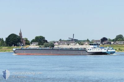
IMOLA
Tanker

Current Trip
| Time Travelled | 1 day |
|---|---|
| Remaining Time | 3 h, 6 mins |
| Distance Travelled | 279.92 nm |
| Remaining Distance | 35.51 nm |
| AVG Speed | 10.5 Knopen |
| MAX Speed | 12.4 Knopen |
| AVG Wind | 5.2 knots |
| MAX Wind | 9.9 knots |
| MIN Temp | 9.2°C / 48.56°F |
| MAX Temp | 25.1°C / 77.18°F |
| Diepgang | 2.1 M |
| Positie ontvangen | 1 m geleden |
Current Position
| Lengtegraad | 6.77530° |
|---|---|
| Breedtegraat | 51.18570° |
| Status | Under way using engine |
| Snelheid | 10.6 Knopen |
| Koers | 257.2° |
| Gebied | North Sea |
| Station | T-AIS |
| Positie ontvangen | 1 m geleden |
Information
The current position of IMOLA is in North Sea with coordinates 51.18570° / 6.77530° as reported on 2025-05-21 03:06 by AIS to our vessel tracker app. The vessel's current speed is 10.6 Knopen and is heading at the port of BOTTROP. The estimated time of arrival as calculated by MyShipTracking vessel tracking app is 2025-05-21 08:14 LT
The vessel IMOLA (MMSI: 244890292) is a Tanker It's sailing under the flag of [NL] Netherlands.
In this page you can find informations about the vessels current position, last detected port calls, and current voyage information. If the vessels is not in coverage by AIS you will find the latest position.
The current position of IMOLA is detected by our AIS receivers and we are not responsible for the reliability of the data. The last position was recorded while the vessel was in Coverage by the Ais receivers of our vessel tracking app.
The current draught of IMOLA as reported by AIS is 2.1 meters
Weather
| Temperature | 10.9°C / 51.62°F |
|---|---|
| Wind Speed | 3 knots |
| Direction | 314° NW |
| Pressure | 1015.8 hPa |
| Humidity | 68.7 % |
| Cloud Coverage | 96 % |


Featured Company
Last Port Calls
| Port | Arrival | Departure | Time In Port |
|---|---|---|---|
| 2025-05-19 15:20 | 2025-05-19 15:24 | 3 m | |
| 2025-05-18 17:41 | 2025-05-19 14:38 | 20 h | |
| 2025-05-17 11:15 | 2025-05-17 12:31 | 1 h | |
| 2025-05-15 19:53 | 2025-05-16 01:30 | 5 h | |
| 2025-05-10 06:22 | 2025-05-10 20:25 | 14 h | |
| 2025-05-09 09:46 | 2025-05-09 10:23 | 36 m | |
| 2025-05-07 20:53 | 2025-05-08 20:19 | 23 h | |
| 2025-05-06 15:22 | 2025-05-07 00:18 | 8 h | |
| 2025-05-05 21:01 | 2025-05-05 21:35 | 34 m | |
| 2025-05-04 20:48 | 2025-05-05 09:36 | 12 h |
Most Visited Ports (Last year)
| Port | Arrivals | |
|---|---|---|
| 49 | ||
| 23 | ||
| 20 | ||
| 10 | ||
| 10 | ||
| 9 |
Last Trips
| Origin | Departure | Destination | Arrival | Distance | |
|---|---|---|---|---|---|
| 2025-05-19 14:38 | 2025-05-19 15:20 | 2.66 nm | |||
| 2025-05-17 12:31 | 2025-05-18 17:41 | 132.58 nm | |||
| 2025-05-16 01:30 | 2025-05-17 11:15 | 174.47 nm | |||
| 2025-05-10 20:25 | 2025-05-15 19:53 | 6.52 nm | |||
| 2025-05-09 10:23 | 2025-05-10 06:22 | 168.24 nm | |||
| 2025-05-08 20:19 | 2025-05-09 09:46 | 5.47 nm | |||
| 2025-05-07 00:18 | 2025-05-07 20:53 | 89.20 nm | |||
| 2025-05-05 21:35 | 2025-05-06 15:22 | 88.79 nm | |||
| 2025-05-05 09:36 | 2025-05-05 21:01 | 78.10 nm | |||
| 2025-05-04 20:03 | 2025-05-04 20:48 | 3.81 nm |
Events
| Tijd | Evenement | Details | Positie / Bestemming | Info |
|---|---|---|---|---|
| 2025-05-20 21:34 | Binnenbereik |
50.50273 / 7.31275
North Sea
BOTTROP RHEINHERNEK
|
Snelheid: 11.1 kn Koers: 322.5° |
|
| 2025-05-20 16:36 | Buitenbereik |
49.97174 / 7.92854
North Sea
BOTTROP RHEINHERNEK
|
Snelheid: 8.4 kn Koers: 272.7° |
|
| 2025-05-20 15:58 | Destination Changed | BOTTROP RHEINHERNEK BIRSFELDEN |
50.01156 / 8.06502
BOTTROP RHEINHERNEK
|
Snelheid: 9 kn Koers: 267.7° |
| 2025-05-20 15:58 | ETA Changed | 2025/05/23 05:56 2025/05/19 01:17 |
50.01156 / 8.06502
BOTTROP RHEINHERNEK
|
Snelheid: 9 kn Koers: 267.7° |
| 2025-05-20 12:49 | Binnenbereik |
49.74114 / 8.45458
North Sea
|
Snelheid: 9.6 kn Koers: 25.2° |
|
| 2025-05-20 11:24 | Buitenbereik |
49.54862 / 8.41841
North Sea
|
Snelheid: 9.6 kn Koers: 334.6° |
|
| 2025-05-20 07:23 | Status Changed | Under way using engine Default |
48.97559 / 8.25048
BIRSFELDEN
|
Snelheid: 11.2 kn Koers: 47° |
| 2025-05-20 07:21 | Status Changed | Default Under way using engine |
48.97169 / 8.24292
BIRSFELDEN
|
Snelheid: 10.9 kn Koers: 72.2° |
| 2025-05-20 07:11 | Binnenbereik |
48.96069 / 8.20515
North Sea
|
Snelheid: 10.9 kn Koers: 72.2° |
|
| 2025-05-20 06:09 | Buitenbereik |
48.83104 / 8.11313
North Sea
|
Snelheid: Koers: 511° |