

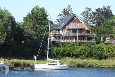
IS SO
Sailing

Current Trip
| Trip Time | 4 h, 11 mins |
|---|---|
| Trip Distance | 19.24 nm |
| AVG Speed | 4.4 Knopen |
| MAX Speed | 6.7 Knopen |
| Diepgang | 0 M |
| AVG Wind | 8.8 knots |
| MAX Wind | 11 knots |
| MIN Temp | 17.3°C / 63.14°F |
| MAX Temp | 19.6°C / 67.28°F |
| Positie ontvangen | 2 d geleden |
Current Position
| Lengtegraad | 6.93133° |
|---|---|
| Breedtegraat | 53.33055° |
| Status | Default |
| Snelheid | |
| Koers | --- |
| Gebied | North Sea |
| Station | T-AIS |
| Positie ontvangen | 2 d geleden |
Information
The current position of IS SO is in North Sea with coordinates 53.33055° / 6.93133° as reported on 2025-04-12 16:16 by AIS to our vessel tracker app. The vessel's current speed is 0 Knopen and is currently inside the port of DELFZIJL.
The vessel IS SO (MMSI: 211322090) is a Sailing It's sailing under the flag of [DE] Germany.
In this page you can find informations about the vessels current position, last detected port calls, and current voyage information. If the vessels is not in coverage by AIS you will find the latest position.
The current position of IS SO is detected by our AIS receivers and we are not responsible for the reliability of the data. The last position was recorded while the vessel was in Coverage by the Ais receivers of our vessel tracking app.
Weather
| Temperature | 19°C / 66.2°F |
|---|---|
| Wind Speed | 10 knots |
| Direction | 124° SE |
| Pressure | 1008.2 hPa |
| Humidity | 51.5 % |
| Cloud Coverage | 11 % |


Featured Company
Events
| Tijd | Evenement | Details | Positie / Bestemming | Info |
|---|---|---|---|---|
| 2025-04-12 16:16 | Buitenbereik |
53.33055 / 6.93133
North Sea
[NL] DELFZIJL
|
Snelheid: Koers: 115.4° |
|
| 2025-04-12 15:32 | Stop beweging |
53.33051 / 6.93132
[NL] DELFZIJL
|
Snelheid: Koers: 511° |
|
| 2025-04-12 15:32 | Aankomsthaven |
|
53.33051 / 6.93132
[NL] DELFZIJL
|
Snelheid: 2.3 kn Koers: 511° |
| 2025-04-12 14:38 | Wijzig zee gebeid | Dutch part of the North Sea German part of the North Sea |
53.31793 / 7.02440
North Sea
|
Snelheid: 6.7 kn Koers: 265.2° |
| 2025-04-12 14:06 | Binnenbereik |
53.33267 / 7.12092
North Sea
|
Snelheid: 6.7 kn Koers: 270.3° |
|
| 2025-04-12 12:07 | Buitenbereik |
53.29792 / 7.36116
North Sea
|
Snelheid: 4.1 kn Koers: 289.7° |
|
| 2025-04-12 11:21 | Start beweging | 0.13 nm, East of JEMGUM |
53.26434 / 7.39670
|
Snelheid: 3.5 kn Koers: 6.6° |
| 2025-04-12 11:21 | Vertrekhaven |
|
53.26434 / 7.39670
|
Snelheid: 2.8 kn Koers: 511° |
| 2025-04-12 10:32 | Binnenbereik |
53.26455 / 7.39254
North Sea
[DE] JEMGUM
|
Snelheid: Koers: 236° |
|
| 2025-04-10 10:23 | Buitenbereik |
53.26454 / 7.39248
North Sea
[DE] JEMGUM
|
Snelheid: Koers: 253.3° |