

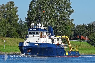
IVERO
Research/Survey Vessel

Current Trip
0.5NM WIDE BERTH
| Time Travelled | 3 days |
|---|---|
| Remaining Time | --- |
| Distance Travelled | 313.71 nm |
| Remaining Distance | --- |
| AVG Speed | 4.1 Knopen |
| MAX Speed | 7.7 Knopen |
| AVG Wind | 11.6 knots |
| MAX Wind | 21 knots |
| MIN Temp | 6.4°C / 43.52°F |
| MAX Temp | 15.4°C / 59.72°F |
| Diepgang | 3.1 M |
| Positie ontvangen | 2 m geleden |
Current Position
| Lengtegraad | -3.63300° |
|---|---|
| Breedtegraat | 58.75329° |
| Status | Restricted manoeuverability |
| Snelheid | 6.9 Knopen |
| Koers | 217.6° |
| Gebied | North Atlantic Ocean |
| Station | T-AIS |
| Positie ontvangen | 2 m geleden |
Information
The current position of IVERO is in North Atlantic Ocean with coordinates 58.75329° / -3.63300° as reported on 2025-05-25 00:09 by AIS to our vessel tracker app. The vessel's current speed is 6.9 Knopen
The vessel IVERO (IMO: 8108377, MMSI: 232013165) is a Research/Survey Vessel that was built in 1982 ( 43 Jaar oud ). It's sailing under the flag of [GB] United Kingdom.
In this page you can find informations about the vessels current position, last detected port calls, and current voyage information. If the vessels is not in coverage by AIS you will find the latest position.
The current position of IVERO is detected by our AIS receivers and we are not responsible for the reliability of the data. The last position was recorded while the vessel was in Coverage by the Ais receivers of our vessel tracking app.
The current draught of IVERO as reported by AIS is 3.1 meters
Weather
| Temperature | 11.5°C / 52.7°F |
|---|---|
| Wind Speed | 11 knots |
| Direction | 129° SE |
| Pressure | 991.4 hPa |
| Humidity | 95.4 % |
| Cloud Coverage | 51 % |


Featured Company
Last Port Calls
| Port | Arrival | Departure | Time In Port |
|---|---|---|---|
| 2025-05-15 12:38 | 2025-05-21 04:32 | 5 d | |
| 2025-05-13 15:07 | 2025-05-14 16:30 | 1 d | |
| 2025-05-12 21:52 | 2025-05-12 22:12 | 19 m | |
| 2025-05-11 02:49 | 2025-05-12 14:14 | 1 d | |
| 2025-05-09 21:35 | 2025-05-10 11:09 | 13 h | |
| 2025-05-08 20:06 | 2025-05-09 07:10 | 11 h | |
| 2025-05-06 21:53 | 2025-05-08 06:09 | 1 d | |
| 2025-05-05 21:40 | 2025-05-06 12:13 | 14 h | |
| 2025-05-02 12:03 | 2025-05-05 11:30 | 2 d | |
| 2025-04-18 14:45 | 2025-05-01 23:35 | 13 d |
Last Trips
| Origin | Departure | Destination | Arrival | Distance | |
|---|---|---|---|---|---|
| 2025-05-14 16:30 | 2025-05-15 12:38 | 107.08 nm | |||
| 2025-05-12 22:12 | 2025-05-13 15:07 | 100.71 nm | |||
| 2025-05-12 14:14 | 2025-05-12 21:52 | 25.75 nm | |||
| 2025-05-10 11:09 | 2025-05-11 02:49 | 97.62 nm | |||
| 2025-05-09 07:10 | 2025-05-09 21:35 | 42.32 nm | |||
| 2025-05-08 06:09 | 2025-05-08 20:06 | 42.53 nm | |||
| 2025-05-06 12:13 | 2025-05-06 21:53 | 29.75 nm | |||
| 2025-05-05 11:30 | 2025-05-05 21:40 | 34.46 nm | |||
| 2025-05-01 23:35 | 2025-05-02 12:03 | 40.54 nm | |||
| 2025-04-18 14:32 | 2025-04-18 14:45 | 1.38 nm |
Events
| Tijd | Evenement | Details | Positie / Bestemming | Info |
|---|---|---|---|---|
| 2025-05-24 19:40 | Start beweging | 7.24 nm, West of SCRABSTER |
58.58067 / -3.76551
0.5NM WIDE BERTH
|
Snelheid: 4.7 kn Koers: 355° |
| 2025-05-24 19:37 | Stop beweging | 7.27 nm, West of SCRABSTER |
58.57882 / -3.76580
0.5NM WIDE BERTH
|
Snelheid: 0.2 kn Koers: 352° |
| 2025-05-24 13:04 | Wijzig zee gebeid | United Kingdom part of the North Atlantic Ocean United Kingdom part of the North Sea |
58.95463 / -3.36080
North Atlantic Ocean
|
Snelheid: 4.2 kn Koers: 251.8° |
| 2025-05-24 13:00 | Wijzig zee gebeid | United Kingdom part of the North Sea United Kingdom part of the North Atlantic Ocean |
58.95548 / -3.35233
North Sea
|
Snelheid: 2.7 kn Koers: 160.6° |
| 2025-05-24 06:22 | Start beweging | 7.24 nm, West of SCRABSTER |
58.58094 / -3.76554
0.5NM WIDE BERTH
|
Snelheid: 4 kn Koers: 356° |
| 2025-05-24 06:19 | Stop beweging | 7.29 nm, West of SCRABSTER |
58.57896 / -3.76630
0.5NM WIDE BERTH
|
Snelheid: 0.3 kn Koers: 18° |
| 2025-05-23 23:34 | Wijzig zee gebeid | United Kingdom part of the North Atlantic Ocean United Kingdom part of the North Sea |
58.95478 / -3.36037
North Atlantic Ocean
|
Snelheid: 5.4 kn Koers: 253.7° |
| 2025-05-23 23:31 | Wijzig zee gebeid | United Kingdom part of the North Sea United Kingdom part of the North Atlantic Ocean |
58.95640 / -3.35331
North Sea
|
Snelheid: 3.7 kn Koers: 278.2° |
| 2025-05-23 22:58 | Wijzig zee gebeid | United Kingdom part of the North Atlantic Ocean United Kingdom part of the North Sea |
58.95428 / -3.36394
North Atlantic Ocean
|
Snelheid: 4.6 kn Koers: 251.9° |
| 2025-05-23 22:52 | Wijzig zee gebeid | United Kingdom part of the North Sea United Kingdom part of the North Atlantic Ocean |
58.95559 / -3.35246
North Sea
|
Snelheid: 2.8 kn Koers: 131.2° |