
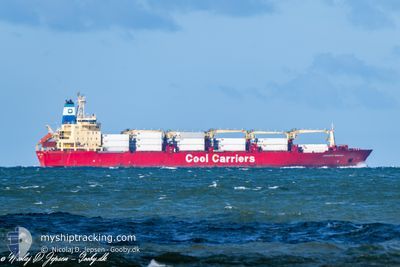
JORGEN REEFER
Reefer
Current Trip
| Time Travelled | 2 days |
|---|---|
| Remaining Time | 3 days |
| Distance Travelled | 1129.06 nm |
| Remaining Distance | 1516.03 nm |
| AVG Speed | 17 Knopen |
| MAX Speed | 18.5 Knopen |
| AVG Wind | 9.9 knots |
| MAX Wind | 20 knots |
| MIN Temp | 17°C / 62.6°F |
| MAX Temp | 23.7°C / 74.66°F |
| Diepgang | 8.5 M |
| Positie ontvangen | 2 d geleden |
Current Position
| Lengtegraad | -71.73787° |
|---|---|
| Breedtegraat | -32.66036° |
| Status | Under way using engine |
| Snelheid | 17.4 Knopen |
| Koers | 344° |
| Gebied | South Pacific Ocean |
| Station | T-AIS |
| Positie ontvangen | 2 d geleden |
Info
Information
The current position of JORGEN REEFER is in South Pacific Ocean with coordinates -32.66036° / -71.73787° as reported on 2025-03-10 17:17 by AIS to our vessel tracker app. The vessel's current speed is 17.4 Knopen and is heading at the port of BALBOA. The estimated time of arrival as calculated by MyShipTracking vessel tracking app is 2025-03-16 23:14 LT
The vessel JORGEN REEFER (IMO: 9007489, MMSI: 309193000) is a Reefer that was built in 1991 ( 34 Jaar oud ). It's sailing under the flag of [BS] Bahamas.
In this page you can find informations about the vessels current position, last detected port calls, and current voyage information. If the vessels is not in coverage by AIS you will find the latest position.
The current position of JORGEN REEFER is detected by our AIS receivers and we are not responsible for the reliability of the data. The last position was recorded while the vessel was in Coverage by the Ais receivers of our vessel tracking app.
The current draught of JORGEN REEFER as reported by AIS is 8.5 meters
Weather
| Temperature | 23.6°C / 74.48°F |
|---|---|
| Wind Speed | 7 knots |
| Direction | 145° SE |
| Pressure | 1012.3 hPa |
| Humidity | 68.7 % |
| Cloud Coverage | 24 % |
Featured Company
Last Port Calls
| Port | Arrival | Departure | Time In Port |
|---|---|---|---|
| 2025-03-04 20:39 | 2025-03-10 15:46 | 5 d | |
| 2025-01-29 11:11 | 2025-02-02 06:34 | 3 d | |
| 2025-01-25 18:54 | 2025-01-27 15:44 | 1 d | |
| 2025-01-24 13:17 | 2025-01-25 17:07 | 1 d | |
| 2025-01-03 14:48 | 2025-01-06 22:57 | 3 d | |
| 2025-01-02 00:02 |
Most Visited Ports (Last year)
| Port | Arrivals | |
|---|---|---|
| 4 | ||
| 3 | ||
| 1 | ||
| 1 | ||
| 1 | ||
| 1 |
Last Trips
| Origin | Departure | Destination | Arrival | Distance | |
|---|---|---|---|---|---|
| 2025-02-02 03:34 | 2025-03-04 17:39 | 8927.31 nm | |||
| 2025-01-27 12:44 | 2025-01-29 08:11 | 376.11 nm | |||
| 2025-01-25 14:07 | 2025-01-25 15:54 | 3.15 nm | |||
| 2025-01-06 23:57 | 2025-01-24 10:17 | 6742.59 nm | |||
| 2025-01-02 00:02 | 2025-01-03 15:48 | 524.54 nm |
Events
| Tijd | Evenement | Details | Positie / Bestemming | Info |
|---|---|---|---|---|
| 2025-03-10 17:22 | Status Changed | Default Under way using engine |
-32.63942 / -71.74552
PA BLB
|
Snelheid: 17.4 kn Koers: 344° |
| 2025-03-10 17:17 | Buitenbereik |
-32.66036 / -71.73787
South Pacific Ocean
|
Snelheid: 17.4 kn Koers: 344° |
|
| 2025-03-10 16:44 | ETA Changed | 2025/03/17 02:00 |
-32.81255 / -71.67324
PA BLB
|
Snelheid: 17.2 kn Koers: 340.8° |
| 2025-03-10 16:07 | ETA Changed | 2025/03/17 02:00 |
-32.97306 / -71.60886
PA BLB
|
Snelheid: 15.5 kn Koers: 351.5° |
| 2025-03-10 15:46 | Vertrekhaven |
|
-33.03088 / -71.61646
PA BLB
|
Snelheid: 3.7 kn Koers: 36° |
| 2025-03-10 15:43 | Start beweging |
-33.03366 / -71.61876
[CL] VALPARAISO
|
Snelheid: 3.1 kn Koers: 36° |
|
| 2025-03-10 15:20 | Status Changed | Under way using engine Moored |
-33.03610 / -71.62647
[CL] VALPARAISO
|
Snelheid: 0.1 kn Koers: 196° |
| 2025-03-10 14:47 | ETA Changed | 2025/03/17 02:00 |
-33.03611 / -71.62647
[CL] VALPARAISO
|
Snelheid: 0.2 kn Koers: 197° |
| 2025-03-10 14:29 | ETA Changed | 2025/03/17 02:00 |
-33.03610 / -71.62648
[CL] VALPARAISO
|
Snelheid: 0.1 kn Koers: 197° |
| 2025-03-10 13:35 | ETA Changed | 2025/03/16 15:00 |
-33.03609 / -71.62646
[CL] VALPARAISO
|
Snelheid: 0.1 kn Koers: 196° |