
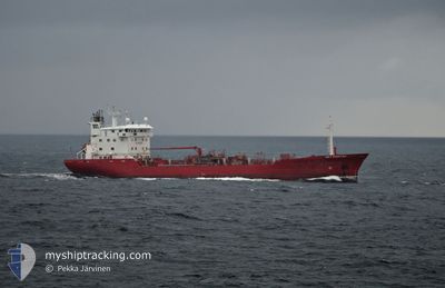
KEY FIGHTER
Oil/Chemical Tanker
Current Trip
NO KAS
| Time Travelled | 1 day |
|---|---|
| Remaining Time | --- |
| Distance Travelled | 235.90 nm |
| Remaining Distance | --- |
| AVG Speed | 12.4 Knopen |
| MAX Speed | 14.3 Knopen |
| AVG Wind | 12.6 knots |
| MAX Wind | 26 knots |
| MIN Temp | -4.9°C / 23.18°F |
| MAX Temp | 5.3°C / 41.54°F |
| Diepgang | 6.5 M |
| Positie ontvangen | 2 m geleden |
Current Position
| Lengtegraad | 4.04064° |
|---|---|
| Breedtegraat | 60.33853° |
| Status | Under way using engine |
| Snelheid | 13.4 Knopen |
| Koers | 175.3° |
| Gebied | North Sea |
| Station | T-AIS |
| Positie ontvangen | 2 m geleden |
Info
Information
The current position of KEY FIGHTER is in North Sea with coordinates 60.33853° / 4.04064° as reported on 2025-02-09 10:31 by AIS to our vessel tracker app. The vessel's current speed is 13.4 Knopen
The vessel KEY FIGHTER (IMO: 8712166, MMSI: 215211000) is a Oil/Chemical Tanker that was built in 1989 ( 36 Jaar oud ). It's sailing under the flag of [MT] Malta.
In this page you can find informations about the vessels current position, last detected port calls, and current voyage information. If the vessels is not in coverage by AIS you will find the latest position.
The current position of KEY FIGHTER is detected by our AIS receivers and we are not responsible for the reliability of the data. The last position was recorded while the vessel was in Coverage by the Ais receivers of our vessel tracking app.
The current draught of KEY FIGHTER as reported by AIS is 6.5 meters
Weather
| Temperature | 3.8°C / 38.84°F |
|---|---|
| Wind Speed | 3 knots |
| Direction | 159° SSE |
| Pressure | 1041.7 hPa |
| Humidity | 63.2 % |
| Cloud Coverage | 26 % |
Featured Company
Last Port Calls
| Port | Arrival | Departure | Time In Port |
|---|---|---|---|
| 2025-02-07 21:46 | 2025-02-08 07:49 | 10 h | |
| 2025-02-06 00:50 | 2025-02-06 12:46 | 11 h | |
| 2025-02-05 07:13 | 2025-02-05 18:28 | 11 h | |
| 2025-02-03 17:23 | 2025-02-04 07:42 | 14 h | |
| 2025-01-29 23:03 | 2025-01-31 12:41 | 1 d | |
| 2025-01-24 22:50 | 2025-01-26 03:44 | 1 d | |
| 2025-01-22 02:07 | 2025-01-22 21:08 | 19 h | |
| 2025-01-20 04:57 | 2025-01-21 07:24 | 1 d | |
| 2025-01-14 08:08 | 2025-01-15 14:10 | 1 d | |
| 2025-01-11 04:11 | 2025-01-11 12:19 | 8 h |
Last Trips
| Origin | Departure | Destination | Arrival | Distance | |
|---|---|---|---|---|---|
| 2025-02-06 13:46 | 2025-02-07 22:46 | 267.73 nm | |||
| 2025-02-05 19:28 | 2025-02-06 01:50 | 78.06 nm | |||
| 2025-02-04 08:42 | 2025-02-05 08:13 | 327.02 nm | |||
| 2025-01-31 14:41 | 2025-02-03 18:23 | 1023.94 nm | |||
| 2025-01-26 04:44 | 2025-01-30 01:03 | 1101.91 nm | |||
| 2025-01-22 22:08 | 2025-01-24 23:50 | 619.34 nm | |||
| 2025-01-21 08:24 | 2025-01-22 03:07 | 243.73 nm | |||
| 2025-01-15 15:10 | 2025-01-20 05:57 | 996.85 nm | |||
| 2025-01-11 13:19 | 2025-01-14 09:08 | 394.22 nm | |||
| 2025-01-11 04:59 | 2025-01-11 05:11 | 0.37 nm |
Events
| Tijd | Evenement | Details | Positie / Bestemming | Info |
|---|---|---|---|---|
| 2025-02-09 07:26 | Wijzig zee gebeid | Norwegian part of the North Sea Norwegian part of the Norwegian Sea |
60.99791 / 4.02176
North Sea
NO KAS
|
Snelheid: 13 kn Koers: 179.7° |
| 2025-02-08 20:32 | Status Changed | Under way using engine Moored |
62.48249 / 6.19632
NO KAS
|
Snelheid: 3.1 kn Koers: 67° |
| 2025-02-08 20:32 | Start beweging | 1.63 nm, North East of ALESUND |
62.48249 / 6.19632
NO KAS
|
Snelheid: 8.2 kn Koers: 13.2° |
| 2025-02-08 20:15 | Draught Changed | 6.5 6.1 |
62.48013 / 6.19032
NO KAS
|
Snelheid: Koers: 114° |
| 2025-02-08 16:11 | Destination Changed | NO KAS NO AAL |
62.48012 / 6.19034
NO KAS
|
Snelheid: Koers: 113° |
| 2025-02-08 16:11 | ETA Changed | 2025/02/09 21:00 2025/02/07 21:00 |
62.48012 / 6.19034
NO KAS
|
Snelheid: Koers: 113° |
| 2025-02-08 13:15 | Status Changed | Moored Under way using engine |
62.48011 / 6.19034
NO AAL
|
Snelheid: Koers: 113° |
| 2025-02-08 13:05 | Stop beweging | 1.41 nm, North East of ALESUND |
62.48008 / 6.19028
NO AAL
|
Snelheid: 0.1 kn Koers: 113° |
| 2025-02-08 10:19 | Status Changed | Under way using engine Default |
62.92074 / 6.77687
NO AAL
|
Snelheid: 13.4 kn Koers: 212° |
| 2025-02-08 10:17 | Status Changed | Default Under way using engine |
62.92563 / 6.78350
NO AAL
|
Snelheid: 13.1 kn Koers: 215.1° |