
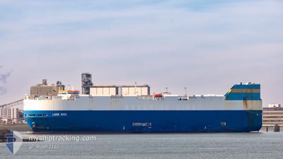
LAKE KIVU
Vehicles Carrier
Current Trip
| Time Travelled | 2 days |
|---|---|
| Remaining Time | --- |
| Distance Travelled | 202.13 nm |
| Remaining Distance | 0.78 nm |
| AVG Speed | 9.5 Knopen |
| MAX Speed | 17 Knopen |
| AVG Wind | 11 knots |
| MAX Wind | 20.5 knots |
| MIN Temp | 8.7°C / 47.66°F |
| MAX Temp | 16.1°C / 60.98°F |
| Diepgang | 7.9 M |
| Positie ontvangen | 2 m geleden |
Current Position
| Lengtegraad | -0.06640° |
|---|---|
| Breedtegraat | 53.58650° |
| Status | Moored |
| Snelheid | |
| Koers | 106° |
| Gebied | North Sea |
| Station | T-AIS |
| Positie ontvangen | 2 m geleden |
Information
The current position of LAKE KIVU is in North Sea with coordinates 53.58650° / -0.06640° as reported on 2025-06-06 15:22 by AIS to our vessel tracker app. The vessel's current speed is 0 Knopen and is heading at the port of GRIMSBY. The estimated time of arrival as calculated by MyShipTracking vessel tracking app is 2025-06-06 12:45 LT
The vessel LAKE KIVU (IMO: 9308792, MMSI: 636015993) is a Vehicles Carrier that was built in 2006 ( 19 Jaar oud ). It's sailing under the flag of [LR] Liberia.
In this page you can find informations about the vessels current position, last detected port calls, and current voyage information. If the vessels is not in coverage by AIS you will find the latest position.
The current position of LAKE KIVU is detected by our AIS receivers and we are not responsible for the reliability of the data. The last position was recorded while the vessel was in Coverage by the Ais receivers of our vessel tracking app.
The current draught of LAKE KIVU as reported by AIS is 7.9 meters
Weather
| Temperature | 14.6°C / 58.28°F |
|---|---|
| Wind Speed | 7 knots |
| Direction | 295° WNW |
| Pressure | 1005.3 hPa |
| Humidity | 57.4 % |
| Cloud Coverage | 60 % |
Featured Company
Last Port Calls
| Port | Arrival | Departure | Time In Port |
|---|---|---|---|
| 2025-06-03 07:18 | 2025-06-04 02:53 | 19 h | |
| 2025-06-01 06:37 | 2025-06-01 23:14 | 16 h | |
| 2025-05-24 05:49 | 2025-05-25 12:05 | 1 d | |
| 2025-05-22 18:10 | 2025-05-22 18:48 | 38 m | |
| 2025-05-18 11:44 | 2025-05-20 03:10 | 1 d | |
| 2025-05-17 15:58 | 2025-05-17 23:30 | 7 h | |
| 2025-05-17 01:08 | 2025-05-17 10:42 | 9 h | |
| 2025-05-15 11:40 | 2025-05-15 19:20 | 7 h | |
| 2025-05-14 03:23 | 2025-05-15 02:01 | 22 h | |
| 2025-05-13 04:32 | 2025-05-13 11:22 | 6 h |
Last Trips
| Origin | Departure | Destination | Arrival | Distance | |
|---|---|---|---|---|---|
| 2025-06-02 00:14 | 2025-06-03 08:18 | 335.90 nm | |||
| 2025-05-25 13:05 | 2025-06-01 07:37 | 1123.50 nm | |||
| 2025-05-22 19:48 | 2025-05-24 06:49 | 94.55 nm | |||
| 2025-05-20 05:10 | 2025-05-22 19:10 | 840.17 nm | |||
| 2025-05-18 01:30 | 2025-05-18 13:44 | 168.80 nm | |||
| 2025-05-17 12:42 | 2025-05-17 17:58 | 74.84 nm | |||
| 2025-05-15 21:20 | 2025-05-17 03:08 | 365.29 nm | |||
| 2025-05-15 04:01 | 2025-05-15 13:40 | 145.02 nm | |||
| 2025-05-13 13:22 | 2025-05-14 05:23 | 117.05 nm | |||
| 2025-05-11 18:38 | 2025-05-13 06:32 | 421.19 nm |
Events
| Tijd | Evenement | Details | Positie / Bestemming | Info |
|---|---|---|---|---|
| 2025-06-06 15:01 | Status Changed | Moored Default |
53.58652 / -.06642
GBGSY
|
Snelheid: 0.1 kn Koers: 105° |
| 2025-06-06 14:58 | Status Changed | Default Moored |
53.58650 / -.06642
GBGSY
|
Snelheid: Koers: 105° |
| 2025-06-06 14:25 | Status Changed | Moored Under way using engine |
53.58648 / -.06643
GBGSY
|
Snelheid: Koers: 104° |
| 2025-06-06 13:48 | Stop beweging | 0.5 nm, North East of GRIMSBY |
53.58597 / -.06155
GBGSY
|
Snelheid: 0.3 kn Koers: 156° |
| 2025-06-06 11:00 | ETA Changed | 2025/06/06 12:45 2025/06/06 11:45 |
53.69788 / .39140
GBGSY
|
Snelheid: 8.4 kn Koers: 167° |
| 2025-06-06 10:50 | Status Changed | Under way using engine Default |
53.71332 / .38555
GBGSY
|
Snelheid: 4.2 kn Koers: 168° |
| 2025-06-06 10:47 | Status Changed | Default Under way using engine |
53.71807 / .38350
GBGSY
|
Snelheid: 2.4 kn Koers: 166° |
| 2025-06-06 07:56 | Status Changed | Under way using engine Default |
54.21207 / .52898
GBGSY
|
Snelheid: 15.9 kn Koers: 215° |
| 2025-06-06 07:47 | Binnenbereik |
54.21207 / .52898
North Sea
GBGSY
|
Snelheid: 16 kn Koers: 218° |
|
| 2025-06-06 06:49 | Buitenbereik |
54.25763 / .57850
North Sea
GBGSY
|
Snelheid: 0.3 kn Koers: 67° |