

LARA S
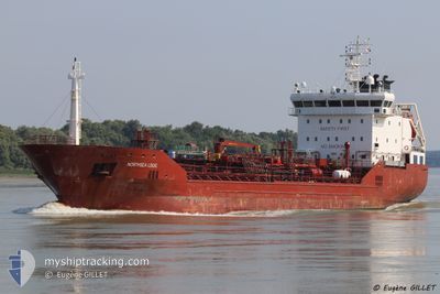
Oil/Chemical Tanker

Current Trip
| Trip Time | 3 days |
|---|---|
| Trip Distance | 320.67 nm |
| AVG Speed | 9.5 Knopen |
| MAX Speed | 9.5 Knopen |
| Diepgang | 4.7 M |
| AVG Wind | 7.8 knots |
| MAX Wind | 12.3 knots |
| MIN Temp | 20.9°C / 69.62°F |
| MAX Temp | 23.7°C / 74.66°F |
| Positie ontvangen | 1 d geleden |
Current Position
| Lengtegraad | 29.72513° |
|---|---|
| Breedtegraat | 31.23833° |
| Status | At anchor |
| Snelheid | 0.1 Knopen |
| Koers | 15° |
| Gebied | Mediterranean Sea - Eastern Basin |
| Station | T-AIS |
| Positie ontvangen | 1 d geleden |
Information
The current position of LARA S is in Mediterranean Sea - Eastern Basin with coordinates 31.23833° / 29.72513° as reported on 2025-05-24 15:31 by AIS to our vessel tracker app. The vessel's current speed is 0.1 Knopen and is currently inside the port of EL DEKHEILA.
The vessel LARA S (IMO: 9334301, MMSI: 249689000) is a Oil/Chemical Tanker that was built in 2007 ( 18 Jaar oud ). It's sailing under the flag of [MT] Malta.
In this page you can find informations about the vessels current position, last detected port calls, and current voyage information. If the vessels is not in coverage by AIS you will find the latest position.
The current position of LARA S is detected by our AIS receivers and we are not responsible for the reliability of the data. The last position was recorded while the vessel was in Coverage by the Ais receivers of our vessel tracking app.
The current draught of LARA S as reported by AIS is 4.7 meters
Weather
| Temperature | 23.7°C / 74.66°F |
|---|---|
| Wind Speed | 13 knots |
| Direction | 262° W |
| Pressure | 1007.7 hPa |
| Humidity | 66.4 % |
| Cloud Coverage | 2 % |


Featured Company
Last Port Calls
| Port | Arrival | Departure | Time In Port |
|---|---|---|---|
| 2025-05-24 21:03 | |||
| 2025-05-19 14:07 | 2025-05-21 14:37 | 2 d | |
| 2025-05-13 08:33 | 2025-05-14 11:41 | 1 d | |
| 2025-05-05 16:22 | 2025-05-06 16:45 | 1 d | |
| 2025-05-04 06:55 | 2025-05-05 06:26 | 23 h | |
| 2025-04-26 00:16 | 2025-04-26 15:09 | 14 h | |
| 2025-04-21 18:03 | 2025-04-22 18:42 | 1 d | |
| 2025-04-17 21:08 | 2025-04-19 16:31 | 1 d | |
| 2025-04-12 09:15 | 2025-04-12 16:33 | 7 h | |
| 2025-04-10 21:56 | 2025-04-11 09:58 | 12 h |
Last Trips
| Origin | Departure | Destination | Arrival | Distance | |
|---|---|---|---|---|---|
| 2025-05-21 14:37 | 2025-05-24 21:03 | 320.67 nm | |||
| 2025-05-14 11:41 | 2025-05-19 14:07 | 1058.55 nm | |||
| 2025-05-06 16:45 | 2025-05-13 08:33 | 311.97 nm | |||
| 2025-05-05 06:26 | 2025-05-05 16:22 | 14.70 nm | |||
| 2025-04-26 15:09 | 2025-05-04 06:55 | 1630.63 nm | |||
| 2025-04-22 18:42 | 2025-04-26 00:16 | 702.95 nm | |||
| 2025-04-19 16:31 | 2025-04-21 18:03 | 441.32 nm | |||
| 2025-04-12 16:33 | 2025-04-17 21:08 | 215.66 nm | |||
| 2025-04-11 09:58 | 2025-04-12 09:15 | 246.49 nm | |||
| 2025-04-09 20:19 | 2025-04-10 21:56 | 285.26 nm |
Events
| Tijd | Evenement | Details | Positie / Bestemming | Info |
|---|---|---|---|---|
| 2025-05-24 19:24 | Stop beweging |
31.13680 / 29.80942
[EG] EL DEKHEILA
|
Snelheid: 0.2 kn Koers: 358° |
|
| 2025-05-24 19:03 | Aankomsthaven |
|
31.14737 / 29.80820
[EG] EL DEKHEILA
|
Snelheid: 6.3 kn Koers: 172° |
| 2025-05-24 18:28 | Start beweging | 2.84 nm, North of EL DEKHEILA |
31.19237 / 29.79245
EGEDK
|
Snelheid: 5.7 kn Koers: 160° |
| 2025-05-24 18:19 | Stop beweging | 3.17 nm, North of EL DEKHEILA |
31.19803 / 29.79243
EGEDK
|
Snelheid: Koers: 202° |
| 2025-05-24 17:44 | Start beweging | 5.73 nm, North West of EL DEKHEILA |
31.23063 / 29.75315
EGEDK
|
Snelheid: 10 kn Koers: 108° |
| 2025-05-24 15:36 | Status Changed | Default At anchor |
31.23840 / 29.72510
EGEDK
|
Snelheid: 0.1 kn Koers: 15° |
| 2025-05-24 15:31 | Status Changed | At anchor Default |
31.23833 / 29.72513
EGEDK
|
Snelheid: Koers: 10° |
| 2025-05-24 15:31 | Buitenbereik |
31.23833 / 29.72513
Mediterranean Sea - Eastern Basin
|
Snelheid: 0.1 kn Koers: 323° |
|
| 2025-05-24 15:21 | Binnenbereik |
31.23833 / 29.72513
Mediterranean Sea - Eastern Basin
|
Snelheid: 0.1 kn Koers: 323° |
|
| 2025-05-24 15:01 | Stop beweging | 6.9 nm, North West of EL DEKHEILA |
31.23830 / 29.72528
EGEDK
|
Snelheid: Koers: 15° |