
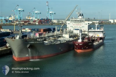
LARGO EVOLUTION
Tanker
Current Trip
| Time Travelled | 9 days |
|---|---|
| Remaining Time | 6 days |
| Distance Travelled | 2555.06 nm |
| Remaining Distance | 1979.01 nm |
| AVG Speed | 11.9 Knopen |
| MAX Speed | 14.1 Knopen |
| AVG Wind | 7.5 knots |
| MAX Wind | 14 knots |
| MIN Temp | 23.7°C / 74.66°F |
| MAX Temp | 28.1°C / 82.58°F |
| Diepgang | 12.4 M |
| Positie ontvangen | 6 d geleden |
Current Position
| Lengtegraad | 56.92238° |
|---|---|
| Breedtegraat | 24.72100° |
| Status | Under way using engine |
| Snelheid | 13 Knopen |
| Koers | 133.3° |
| Gebied | Gulf of Oman |
| Station | T-AIS |
| Positie ontvangen | 6 d geleden |
Info
Information
The current position of LARGO EVOLUTION is in Gulf of Oman with coordinates 24.72100° / 56.92238° as reported on 2025-12-09 08:21 by AIS to our vessel tracker app. The vessel's current speed is 13 Knopen and is heading at the port of DURBAN. The estimated time of arrival as calculated by MyShipTracking vessel tracking app is 2025-12-22 02:34 LT
The vessel LARGO EVOLUTION (IMO: 9687942, MMSI: 538005271) is a Tanker It's sailing under the flag of [MH] Marshall Is.
In this page you can find informations about the vessels current position, last detected port calls, and current voyage information. If the vessels is not in coverage by AIS you will find the latest position.
The current position of LARGO EVOLUTION is detected by our AIS receivers and we are not responsible for the reliability of the data. The last position was recorded while the vessel was in Coverage by the Ais receivers of our vessel tracking app.
The current draught of LARGO EVOLUTION as reported by AIS is 12.4 meters
Weather
| Temperature | 27.6°C / 81.68°F |
|---|---|
| Wind Speed | 7 knots |
| Direction | 355° N |
| Pressure | 1010.3 hPa |
| Humidity | 73.8 % |
| Cloud Coverage | 38 % |
Featured Company
Last Port Calls
| Port | Arrival | Departure | Time In Port |
|---|---|---|---|
| 2025-12-05 11:11 | 2025-12-06 21:32 | 1 d | |
| 2025-11-20 08:59 | 2025-11-24 04:46 | 3 d | |
| 2025-11-07 23:03 | 2025-11-10 19:34 | 2 d | |
| 2025-10-02 07:04 |
Most Visited Ports (Last year)
| Port | Arrivals | |
|---|---|---|
| 2 | ||
| 2 | ||
| 1 | ||
| 1 | ||
| 1 | ||
| 1 |
Last Trips
| Origin | Departure | Destination | Arrival | Distance | |
|---|---|---|---|---|---|
| 2025-11-24 04:46 | 2025-12-05 11:11 | 3329.78 nm | |||
| 2025-11-10 19:34 | 2025-11-20 08:59 | 2815.33 nm | |||
| 2025-10-02 07:04 | 2025-11-07 23:03 | 5143.08 nm |
Events
| Tijd | Evenement | Details | Positie / Bestemming | Info |
|---|---|---|---|---|
| 2025-12-09 08:24 | Status Changed | Default Under way using engine |
24.71355 / 56.93113
ZA DUR
|
Snelheid: 13 kn Koers: 133.3° |
| 2025-12-09 08:21 | Buitenbereik |
24.72100 / 56.92238
Gulf of Oman
ZA DUR
|
Snelheid: 13 kn Koers: 133.3° |
|
| 2025-12-09 08:15 | Status Changed | Under way using engine Default |
24.73748 / 56.90323
ZA DUR
|
Snelheid: 12.9 kn Koers: 133° |
| 2025-12-09 08:10 | Status Changed | Default Under way using engine |
24.74750 / 56.89170
ZA DUR
|
Snelheid: 13.2 kn Koers: 134.3° |
| 2025-12-09 08:02 | Status Changed | Under way using engine Default |
24.76966 / 56.86645
ZA DUR
|
Snelheid: 13.1 kn Koers: 133° |
| 2025-12-09 07:21 | Status Changed | Default Under way using engine |
24.88015 / 56.75938
ZA DUR
|
Snelheid: 13.3 kn Koers: 138° |
| 2025-12-09 06:35 | Gevonden in zee | Omani part of the Gulf of Oman |
25.03261 / 56.69033
Gulf of Oman
ZA DUR
|
Snelheid: 13.4 kn Koers: 174.4° |
| 2025-12-09 06:12 | Destination Changed | ZA DUR AR BUE |
25.11610 / 56.68214
ZA DUR
|
Snelheid: 12.9 kn Koers: 172.8° |
| 2025-12-09 06:12 | ETA Changed | 2025/12/22 06:00 2026/01/07 00:00 |
25.11610 / 56.68214
ZA DUR
|
Snelheid: 12.9 kn Koers: 172.8° |
| 2025-12-09 04:38 | Start beweging | 8.61 nm, East of FUJAIRAH |
25.19962 / 56.51228
AR BUE
|
Snelheid: 3.1 kn Koers: 50° |