
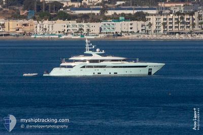
LATONA
Pleasure Craft
Current Trip
MONTENEGRO
| Time Travelled | 18 h, 7 mins |
|---|---|
| Remaining Time | --- |
| Distance Travelled | 13.51 nm |
| Remaining Distance | --- |
| AVG Speed | 11 Knopen |
| MAX Speed | 11.9 Knopen |
| AVG Wind | 10.7 knots |
| MAX Wind | 13.8 knots |
| MIN Temp | 21.3°C / 70.34°F |
| MAX Temp | 22.5°C / 72.5°F |
| Diepgang | 3 M |
| Positie ontvangen | 14 h, 17 m geleden |
Current Position
| Lengtegraad | 17.81409° |
|---|---|
| Breedtegraat | 42.71356° |
| Status | Under way using engine |
| Snelheid | 10.6 Knopen |
| Koers | 294.9° |
| Gebied | Adriatic Sea |
| Station | T-AIS |
| Positie ontvangen | 14 h, 17 m geleden |
Information
The current position of LATONA is in Adriatic Sea with coordinates 42.71356° / 17.81409° as reported on 2025-05-28 13:04 by AIS to our vessel tracker app. The vessel's current speed is 10.6 Knopen
The vessel LATONA (IMO: 9795921, MMSI: 378113036) is a Pleasure Craft It's sailing under the flag of [VG] British Virgin Is.
In this page you can find informations about the vessels current position, last detected port calls, and current voyage information. If the vessels is not in coverage by AIS you will find the latest position.
The current position of LATONA is detected by our AIS receivers and we are not responsible for the reliability of the data. The last position was recorded while the vessel was in Coverage by the Ais receivers of our vessel tracking app.
The current draught of LATONA as reported by AIS is 3 meters
Weather
| Temperature | 22.2°C / 71.96°F |
|---|---|
| Wind Speed | 14 knots |
| Direction | 287° WNW |
| Pressure | 1014.7 hPa |
| Humidity | 53.6 % |
| Cloud Coverage | 9 % |
Featured Company
Last Port Calls
| Port | Arrival | Departure | Time In Port |
|---|---|---|---|
| 2025-05-28 09:14 | |||
| 2025-05-07 22:13 | 2025-05-08 21:53 | 23 h | |
| 2025-04-25 19:47 | 2025-04-30 17:13 | 4 d | |
| 2025-04-23 13:58 | 2025-04-24 12:16 | 22 h | |
| 2025-04-23 05:53 | 2025-04-23 12:01 | 6 h | |
| 2025-04-03 17:18 | 2025-04-21 06:19 | 17 d | |
| 2025-04-03 14:36 |
Last Trips
| Origin | Departure | Destination | Arrival | Distance | |
|---|---|---|---|---|---|
| 2025-04-30 19:13 | 2025-05-08 00:13 | 237.33 nm | |||
| 2025-04-24 14:16 | 2025-04-25 21:47 | 105.74 nm | |||
| 2025-04-23 14:01 | 2025-04-23 15:58 | 20.78 nm | |||
| 2025-04-21 08:19 | 2025-04-23 07:53 | 492.39 nm | |||
| 2025-04-03 16:36 | 2025-04-03 19:18 | 30.97 nm |
Events
| Tijd | Evenement | Details | Positie / Bestemming | Info |
|---|---|---|---|---|
| 2025-05-28 13:04 | Buitenbereik |
42.71356 / 17.81409
Adriatic Sea
|
Snelheid: 10.6 kn Koers: 294.9° |
|
| 2025-05-28 11:50 | Wijzig zee gebeid | Croatian part of the Adriatic Sea Montenegrin part of the Adriatic Sea |
42.61936 / 18.09128
Adriatic Sea
|
Snelheid: 11 kn Koers: 294.8° |
| 2025-05-28 11:50 | Binnenbereik |
42.61936 / 18.09128
Adriatic Sea
|
Snelheid: 11 kn Koers: 294.8° |
|
| 2025-05-28 09:14 | Vertrekhaven |
|
42.61936 / 18.09128
MONTENEGRO
|
Snelheid: Koers: 349° |
| 2025-05-27 12:24 | Buitenbereik |
42.43619 / 18.68834
Adriatic Sea
[ME] TIVAT
|
Snelheid: Koers: 170° |
|
| 2025-05-27 12:12 | Binnenbereik |
42.43615 / 18.68840
Adriatic Sea
[ME] TIVAT
|
Snelheid: Koers: 170° |
|
| 2025-05-26 23:55 | Buitenbereik |
42.43117 / 18.68991
Adriatic Sea
[ME] TIVAT
|
Snelheid: Koers: 229° |
|
| 2025-05-26 23:28 | Binnenbereik |
42.43122 / 18.68981
Adriatic Sea
[ME] TIVAT
|
Snelheid: Koers: 229° |
|
| 2025-05-26 13:52 | Buitenbereik |
42.43123 / 18.68988
Adriatic Sea
[ME] TIVAT
|
Snelheid: Koers: 229° |
|
| 2025-05-26 13:04 | Binnenbereik |
42.43118 / 18.68987
Adriatic Sea
[ME] TIVAT
|
Snelheid: Koers: 229° |