
LENA
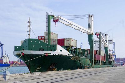
Container Ship
Current Trip
| Time Travelled | 1 day |
|---|---|
| Remaining Time | --- |
| Distance Travelled | 406.25 nm |
| Remaining Distance | 213.73 nm |
| AVG Speed | 13.9 Knopen |
| MAX Speed | 14.8 Knopen |
| AVG Wind | 16.7 knots |
| MAX Wind | 21.9 knots |
| MIN Temp | 23.8°C / 74.84°F |
| MAX Temp | 26.9°C / 80.42°F |
| Diepgang | 8 M |
| Positie ontvangen | 6 d geleden |
Current Position
| Lengtegraad | -79.95817° |
|---|---|
| Breedtegraat | 25.17627° |
| Status | Under way using engine |
| Snelheid | 12.2 Knopen |
| Koers | 205.9° |
| Gebied | North Atlantic Ocean |
| Station | T-AIS |
| Positie ontvangen | 6 d geleden |
Info
Information
The current position of LENA is in North Atlantic Ocean with coordinates 25.17627° / -79.95817° as reported on 2025-02-08 19:27 by AIS to our vessel tracker app. The vessel's current speed is 12.2 Knopen and is heading at the port of PUERTO SANTO TOMAS. The estimated time of arrival as calculated by MyShipTracking vessel tracking app is 2025-02-10 23:59 LT
The vessel LENA (IMO: 9347750, MMSI: 210740000) is a Container Ship that was built in 2006 ( 19 Jaar oud ). It's sailing under the flag of [CY] Cyprus.
In this page you can find informations about the vessels current position, last detected port calls, and current voyage information. If the vessels is not in coverage by AIS you will find the latest position.
The current position of LENA is detected by our AIS receivers and we are not responsible for the reliability of the data. The last position was recorded while the vessel was in Coverage by the Ais receivers of our vessel tracking app.
The current draught of LENA as reported by AIS is 8 meters
Weather
| Temperature | 23.9°C / 75.02°F |
|---|---|
| Wind Speed | 16 knots |
| Direction | 103° ESE |
| Pressure | 1018.6 hPa |
| Humidity | 81.1 % |
| Cloud Coverage | 98 % |
Featured Company
Last Port Calls
| Port | Arrival | Departure | Time In Port |
|---|---|---|---|
| 2025-02-12 11:55 | 2025-02-14 03:56 | 1 d | |
| 2025-02-11 06:50 | 2025-02-12 06:39 | 23 h | |
| 2025-02-07 19:13 | 2025-02-08 16:12 | 20 h | |
| 2025-02-03 21:15 | 2025-02-05 06:31 | 1 d | |
| 2025-01-30 23:22 | 2025-02-01 05:45 | 1 d | |
| 2025-01-27 16:55 | 2025-01-28 10:35 | 17 h | |
| 2025-01-26 03:07 | 2025-01-27 12:02 | 1 d | |
| 2025-01-23 18:43 | 2025-01-24 07:27 | 12 h | |
| 2025-01-20 12:23 | 2025-01-21 11:49 | 23 h | |
| 2024-12-30 00:15 | 2024-12-30 15:23 | 15 h |
Most Visited Ports (Last year)
| Port | Arrivals | |
|---|---|---|
| 25 | ||
| 20 | ||
| 12 | ||
| 11 | ||
| 4 | ||
| 4 |
Last Trips
| Origin | Departure | Destination | Arrival | Distance | |
|---|---|---|---|---|---|
| 2025-02-12 00:39 | 2025-02-12 05:55 | 65.20 nm | |||
| 2025-02-08 11:12 | 2025-02-11 00:50 | 853.12 nm | |||
| 2025-02-05 00:31 | 2025-02-07 14:13 | 857.98 nm | |||
| 2025-02-01 00:45 | 2025-02-03 15:15 | 852.67 nm | |||
| 2025-01-28 04:35 | 2025-01-30 18:22 | 855.52 nm | |||
| 2025-01-27 06:02 | 2025-01-27 10:55 | 62.94 nm | |||
| 2025-01-24 02:27 | 2025-01-25 21:07 | 683.80 nm | |||
| 2025-01-21 06:49 | 2025-01-23 13:43 | 765.45 nm | |||
| 2024-12-30 10:23 | 2025-01-20 07:23 | 4800.10 nm | |||
| 2024-12-16 08:48 | 2024-12-29 19:15 | 1604.13 nm |
Events
| Tijd | Evenement | Details | Positie / Bestemming | Info |
|---|---|---|---|---|
| 2025-02-14 04:07 | Start beweging | 2.4 nm, North of PUERTO CORTES |
15.86827 / -87.96167
GTSTC
|
Snelheid: 12.7 kn Koers: 23° |
| 2025-02-14 03:56 | Vertrekhaven |
|
15.86827 / -87.96167
GTSTC
|
Snelheid: 0.9 kn Koers: 327° |
| 2025-02-12 12:27 | Stop beweging |
15.83348 / -87.94942
[HN] PUERTO CORTES
|
Snelheid: 0.2 kn Koers: 172° |
|
| 2025-02-12 11:55 | Aankomsthaven |
|
15.83305 / -87.95323
[HN] PUERTO CORTES
|
Snelheid: 8.9 kn Koers: 166° |
| 2025-02-12 06:39 | Vertrekhaven |
|
15.70580 / -88.61869
GTSTC
|
Snelheid: 4.2 kn Koers: 300° |
| 2025-02-12 06:35 | Start beweging |
15.70009 / -88.61471
[GT] PUERTO SANTO TOMAS
|
Snelheid: 4.2 kn Koers: 300° |
|
| 2025-02-11 06:50 | Stop beweging |
15.69787 / -88.61381
[GT] PUERTO SANTO TOMAS
|
Snelheid: Koers: 62° |
|
| 2025-02-11 06:50 | Aankomsthaven |
|
15.69787 / -88.61381
[GT] PUERTO SANTO TOMAS
|
Snelheid: 6.2 kn Koers: 186° |
| 2025-02-11 05:47 | Start beweging | 4.55 nm, North of PUERTO BARRIOS |
15.81236 / -88.60856
GTSTC
|
Snelheid: 8.2 kn Koers: 167° |
| 2025-02-11 02:43 | Stop beweging | 5.75 nm, North of PUERTO BARRIOS |
15.83231 / -88.61421
GTSTC
|
Snelheid: 0.1 kn Koers: 94° |