
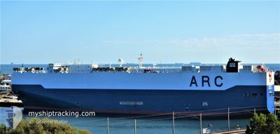
LIBERTY
Vehicles Carrier
Current Trip
| Time Travelled | 4 days |
|---|---|
| Remaining Time | --- |
| Distance Travelled | 1459.19 nm |
| Remaining Distance | 2859.82 nm |
| AVG Speed | 14.4 Knopen |
| MAX Speed | 17.2 Knopen |
| AVG Wind | 12.3 knots |
| MAX Wind | 20.7 knots |
| MIN Temp | 24.3°C / 75.74°F |
| MAX Temp | 27.6°C / 81.68°F |
| Diepgang | 10.1 M |
| Positie ontvangen | 4 d geleden |
Current Position
| Lengtegraad | -46.33099° |
|---|---|
| Breedtegraat | -23.99687° |
| Status | Under way using engine |
| Snelheid | 11.3 Knopen |
| Koers | 224° |
| Gebied | South Atlantic Ocean |
| Station | T-AIS |
| Positie ontvangen | 4 d geleden |
Info
Information
The current position of LIBERTY is in South Atlantic Ocean with coordinates -23.99687° / -46.33099° as reported on 2025-02-03 16:48 by AIS to our vessel tracker app. The vessel's current speed is 11.3 Knopen and is heading at the port of CARTAGENA. The estimated time of arrival as calculated by MyShipTracking vessel tracking app is 2025-02-16 11:00 LT
The vessel LIBERTY (IMO: 9310109, MMSI: 367125000) is a Vehicles Carrier that was built in 2006 ( 19 Jaar oud ). It's sailing under the flag of [US] USA.
In this page you can find informations about the vessels current position, last detected port calls, and current voyage information. If the vessels is not in coverage by AIS you will find the latest position.
The current position of LIBERTY is detected by our AIS receivers and we are not responsible for the reliability of the data. The last position was recorded while the vessel was in Coverage by the Ais receivers of our vessel tracking app.
The current draught of LIBERTY as reported by AIS is 10.1 meters
Weather
| Temperature | 27.5°C / 81.5°F |
|---|---|
| Wind Speed | 13 knots |
| Direction | 136° SE |
| Pressure | 1009.6 hPa |
| Humidity | 73.5 % |
| Cloud Coverage | 3 % |
Featured Company
Last Port Calls
| Port | Arrival | Departure | Time In Port |
|---|---|---|---|
| 2025-02-02 17:35 | 2025-02-03 16:54 | 23 h | |
| 2025-02-01 08:38 | 2025-02-01 21:49 | 13 h | |
| 2025-01-30 11:02 | 2025-01-30 22:34 | 11 h | |
| 2025-01-10 17:45 | 2025-01-11 14:39 | 20 h | |
| 2025-01-07 17:38 | 2025-01-08 11:44 | 18 h | |
| 2025-01-02 18:06 | 2025-01-03 05:49 | 11 h | |
| 2025-01-02 17:55 | |||
| 2024-12-21 01:06 | 2024-12-22 06:34 | 1 d | |
| 2024-12-19 17:44 | 2024-12-20 03:28 | 9 h | |
| 2024-12-03 11:08 | 2024-12-04 19:36 | 1 d |
Last Trips
| Origin | Departure | Destination | Arrival | Distance | |
|---|---|---|---|---|---|
| 2025-02-01 18:49 | 2025-02-02 14:35 | 214.99 nm | |||
| 2025-01-30 19:34 | 2025-02-01 05:38 | 522.42 nm | |||
| 2025-01-11 08:39 | 2025-01-30 08:02 | 6285.90 nm | |||
| 2025-01-08 05:44 | 2025-01-10 11:45 | 739.35 nm | |||
| 2025-01-03 00:49 | 2025-01-07 11:38 | 1598.09 nm | |||
| 2024-12-22 03:34 | 2025-01-02 13:06 | 4573.55 nm | |||
| 2024-12-22 03:34 | 2025-01-02 12:55 | 4573.44 nm | |||
| 2024-12-20 00:28 | 2024-12-20 22:06 | 188.16 nm | |||
| 2024-12-04 13:36 | 2024-12-19 14:44 | 5904.84 nm | |||
| 2024-12-01 13:45 | 2024-12-03 05:08 | 635.46 nm |
Events
| Tijd | Evenement | Details | Positie / Bestemming | Info |
|---|---|---|---|---|
| 2025-02-03 16:54 | Status Changed | Default Under way using engine |
-24.00941 / -46.33833
BRSSZ-COCTG
|
Snelheid: 11.3 kn Koers: 224° |
| 2025-02-03 16:54 | Vertrekhaven |
|
-24.00941 / -46.33833
BRSSZ-COCTG
|
Snelheid: 11.3 kn Koers: 224° |
| 2025-02-03 16:48 | Status Changed | Under way using engine Default |
-23.99687 / -46.33099
[BR] SANTOS
|
Snelheid: 11.3 kn Koers: 242° |
| 2025-02-03 16:48 | Buitenbereik |
-23.99687 / -46.33099
South Atlantic Ocean
BRSSZ-COCTG
|
Snelheid: 11.3 kn Koers: 226.5° |
|
| 2025-02-03 16:38 | Status Changed | Default Under way using engine |
-23.99316 / -46.30100
[BR] SANTOS
|
Snelheid: 8 kn Koers: 195° |
| 2025-02-03 16:18 | Start beweging |
-23.96111 / -46.30058
[BR] SANTOS
|
Snelheid: 3.1 kn Koers: 140° |
|
| 2025-02-03 15:10 | Status Changed | Under way using engine Moored |
-23.95754 / -46.30022
[BR] SANTOS
|
Snelheid: Koers: 317° |
| 2025-02-03 15:05 | Status Changed | Moored Default |
-23.95754 / -46.30022
[BR] SANTOS
|
Snelheid: Koers: 317° |
| 2025-02-03 14:53 | Status Changed | Default Moored |
-23.95754 / -46.30020
[BR] SANTOS
|
Snelheid: Koers: 317° |
| 2025-02-03 14:38 | Status Changed | Moored Default |
-23.95754 / -46.30021
[BR] SANTOS
|
Snelheid: Koers: 317° |