

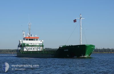
LURO
General Cargo

Current Trip
| Time Travelled | 15 h, 50 mins |
|---|---|
| Remaining Time | --- |
| Distance Travelled | 160.71 nm |
| Remaining Distance | --- |
| AVG Speed | 10.2 Knopen |
| MAX Speed | 11.5 Knopen |
| AVG Wind | 3.6 knots |
| MAX Wind | 10.2 knots |
| MIN Temp | -9.5°C / 14.9°F |
| MAX Temp | 5.3°C / 41.54°F |
| Diepgang | 5.4 M |
| Positie ontvangen | 2 m geleden |
Current Position
| Lengtegraad | 4.61103° |
|---|---|
| Breedtegraat | 59.81135° |
| Status | Under way using engine |
| Snelheid | 10.3 Knopen |
| Koers | 178° |
| Gebied | North Sea |
| Station | T-AIS |
| Positie ontvangen | 2 m geleden |
Information
The current position of LURO is in North Sea with coordinates 59.81135° / 4.61103° as reported on 2025-03-15 07:24 by AIS to our vessel tracker app. The vessel's current speed is 10.3 Knopen and is heading at the port of LIDKOPING. The estimated time of arrival as calculated by MyShipTracking vessel tracking app is 2025-03-17 10:00 LT
The vessel LURO (IMO: 9263588, MMSI: 244059000) is a General Cargo that was built in 2003 ( 22 Jaar oud ). It's sailing under the flag of [NL] Netherlands.
In this page you can find informations about the vessels current position, last detected port calls, and current voyage information. If the vessels is not in coverage by AIS you will find the latest position.
The current position of LURO is detected by our AIS receivers and we are not responsible for the reliability of the data. The last position was recorded while the vessel was in Coverage by the Ais receivers of our vessel tracking app.
The current draught of LURO as reported by AIS is 5.4 meters
Weather
| Temperature | 5.3°C / 41.54°F |
|---|---|
| Wind Speed | 10 knots |
| Direction | 297° WNW |
| Pressure | 1018.8 hPa |
| Humidity | 72.8 % |
| Cloud Coverage | 100 % |


Featured Company
Last Port Calls
| Port | Arrival | Departure | Time In Port |
|---|---|---|---|
| 2025-03-14 06:43 | 2025-03-14 16:37 | 9 h | |
| 2025-03-07 16:29 | 2025-03-08 13:38 | 21 h | |
| 2025-03-06 03:05 | 2025-03-07 11:57 | 1 d | |
| 2025-03-05 06:38 | 2025-03-05 09:43 | 3 h | |
| 2025-03-01 19:41 | 2025-03-02 11:45 | 16 h | |
| 2025-02-26 07:45 | 2025-02-26 19:45 | 12 h | |
| 2025-02-24 20:43 | 2025-02-25 16:49 | 20 h | |
| 2025-02-16 12:23 | 2025-02-18 19:03 | 2 d | |
| 2025-02-10 19:57 | 2025-02-11 16:33 | 20 h | |
| 2025-02-06 17:25 | 2025-02-10 16:29 | 3 d |
Most Visited Ports (Last year)
| Port | Arrivals | |
|---|---|---|
| 11 | ||
| 6 | ||
| 4 | ||
| 4 | ||
| 3 | ||
| 3 |
Last Trips
| Origin | Departure | Destination | Arrival | Distance | |
|---|---|---|---|---|---|
| 2025-03-08 13:38 | 2025-03-14 06:43 | 748.49 nm | |||
| 2025-03-07 11:57 | 2025-03-07 16:29 | 42.29 nm | |||
| 2025-03-05 09:43 | 2025-03-06 03:05 | 118.48 nm | |||
| 2025-03-02 11:45 | 2025-03-05 06:38 | 598.59 nm | |||
| 2025-02-26 19:45 | 2025-03-01 19:41 | 614.36 nm | |||
| 2025-02-25 16:49 | 2025-02-26 07:45 | 169.66 nm | |||
| 2025-02-18 19:03 | 2025-02-24 20:43 | 1219.61 nm | |||
| 2025-02-11 16:33 | 2025-02-16 12:23 | 959.66 nm | |||
| 2025-02-10 16:29 | 2025-02-10 19:57 | 33.46 nm | |||
| 2025-02-05 22:31 | 2025-02-06 17:25 | 125.28 nm |
Events
| Tijd | Evenement | Details | Positie / Bestemming | Info |
|---|---|---|---|---|
| 2025-03-14 23:22 | Wijzig zee gebeid | Norwegian part of the North Sea Norwegian part of the Norwegian Sea |
60.99595 / 4.79003
North Sea
SELDK
|
Snelheid: 11.3 kn Koers: 235.9° |
| 2025-03-14 16:02 | Draught Changed | 5.4 3.7 |
60.94052 / 6.91793
SELDK
|
Snelheid: 8.2 kn Koers: 74.7° |
| 2025-03-14 16:02 | Destination Changed | SELDK NOGUD |
60.94052 / 6.91793
SELDK
|
Snelheid: 8.2 kn Koers: 74.7° |
| 2025-03-14 16:02 | ETA Changed | 2025/03/17 09:00 2025/03/14 05:00 |
60.94052 / 6.91793
SELDK
|
Snelheid: 8.2 kn Koers: 74.7° |
| 2025-03-14 15:37 | Start beweging | 1.05 nm, North East of GUDVANGEN |
60.89712 / 6.86360
NOGUD
|
Snelheid: 9.7 kn Koers: 25° |
| 2025-03-14 15:37 | Vertrekhaven |
|
60.89712 / 6.86360
NOGUD
|
Snelheid: 1.8 kn Koers: 50° |
| 2025-03-14 15:16 | Binnenbereik |
60.88273 / 6.84189
Norwegian Sea
[NO] GUDVANGEN
|
Snelheid: 0.2 kn Koers: 91.7° |
|
| 2025-03-14 10:58 | Buitenbereik |
60.88256 / 6.84147
Norwegian Sea
[NO] GUDVANGEN
|
Snelheid: Koers: 177° |
|
| 2025-03-14 10:58 | Binnenbereik |
60.88256 / 6.84147
Norwegian Sea
[NO] GUDVANGEN
|
Snelheid: Koers: 177° |
|
| 2025-03-14 09:31 | Buitenbereik |
60.88277 / 6.84150
Norwegian Sea
[NO] GUDVANGEN
|
Snelheid: Koers: 357.7° |