
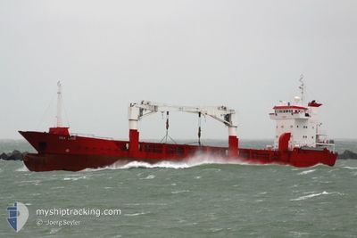
M/V DON ALFONSO SR.2
General Cargo
Current Trip
CEBU
| Time Travelled | 14 h, 56 mins |
|---|---|
| Remaining Time | --- |
| Distance Travelled | 29.76 nm |
| Remaining Distance | --- |
| AVG Speed | 6.4 Knopen |
| MAX Speed | 9.6 Knopen |
| AVG Wind | 9 knots |
| MAX Wind | 10 knots |
| MIN Temp | 27.1°C / 80.78°F |
| MAX Temp | 29.4°C / 84.92°F |
| Diepgang | 5.6 M |
| Positie ontvangen | 13 h, 18 m geleden |
Current Position
| Lengtegraad | 124.03823° |
|---|---|
| Breedtegraat | 10.35692° |
| Status | Under way using engine |
| Snelheid | 9.9 Knopen |
| Koers | 88.2° |
| Gebied | Philippine Sea |
| Station | T-AIS |
| Positie ontvangen | 13 h, 18 m geleden |
Info
Information
The current position of M/V DON ALFONSO SR.2 is in Philippine Sea with coordinates 10.35692° / 124.03823° as reported on 2025-02-08 05:47 by AIS to our vessel tracker app. The vessel's current speed is 9.9 Knopen
The vessel M/V DON ALFONSO SR.2 (IMO: 9050101, MMSI: 548612300) is a General Cargo that was built in 1993 ( 32 Jaar oud ). It's sailing under the flag of [PH] Philippines.
In this page you can find informations about the vessels current position, last detected port calls, and current voyage information. If the vessels is not in coverage by AIS you will find the latest position.
The current position of M/V DON ALFONSO SR.2 is detected by our AIS receivers and we are not responsible for the reliability of the data. The last position was recorded while the vessel was in Coverage by the Ais receivers of our vessel tracking app.
The current draught of M/V DON ALFONSO SR.2 as reported by AIS is 5.6 meters
Weather
| Temperature | 27.5°C / 81.5°F |
|---|---|
| Wind Speed | 13 knots |
| Direction | 69° ENE |
| Pressure | 1009.8 hPa |
| Humidity | 82 % |
| Cloud Coverage | 93 % |
Featured Company
Last Port Calls
| Port | Arrival | Departure | Time In Port |
|---|---|---|---|
| 2025-02-06 21:34 | 2025-02-08 04:10 | 1 d | |
| 2025-02-04 09:05 | 2025-02-05 06:05 | 21 h | |
| 2025-01-31 09:49 | 2025-02-01 23:20 | 1 d | |
| 2025-01-23 14:30 | 2025-01-25 04:19 | 1 d | |
| 2025-01-21 03:56 | 2025-01-21 21:33 | 17 h | |
| 2025-01-18 17:22 | 2025-01-19 09:09 | 15 h |
Most Visited Ports (Last year)
| Port | Arrivals | |
|---|---|---|
| 34 | ||
| 17 | ||
| 11 | ||
| 7 |
Last Trips
| Origin | Departure | Destination | Arrival | Distance | |
|---|---|---|---|---|---|
| 2025-02-05 14:05 | 2025-02-07 05:34 | 374.43 nm | |||
| 2025-02-02 07:20 | 2025-02-04 17:05 | 364.54 nm | |||
| 2025-01-25 12:19 | 2025-01-31 17:49 | 873.34 nm | |||
| 2025-01-22 05:33 | 2025-01-23 22:30 | 378.57 nm | |||
| 2025-01-19 17:09 | 2025-01-21 11:56 | 372.84 nm | |||
| 2024-11-17 06:07 | 2025-01-19 01:22 | 70.98 nm |
Events
| Tijd | Evenement | Details | Positie / Bestemming | Info |
|---|---|---|---|---|
| 2025-02-08 05:47 | Buitenbereik |
10.35692 / 124.03823
Philippine Sea
|
Snelheid: 9.9 kn Koers: 88.2° |
|
| 2025-02-08 05:34 | Start beweging | 6.37 nm, North East of CEBU |
10.35597 / 124.01112
CEBU
|
Snelheid: 3.9 kn Koers: 170° |
| 2025-02-08 04:30 | Stop beweging | 6.26 nm, North East of CEBU |
10.35407 / 124.01032
CEBU
|
Snelheid: 0.3 kn Koers: 511° |
| 2025-02-08 04:10 | Vertrekhaven |
|
10.33544 / 123.98080
CEBU
|
Snelheid: 9.1 kn Koers: 56° |
| 2025-02-08 04:04 | Binnenbereik |
10.32704 / 123.96740
Philippine Sea
[PH] CEBU
|
Snelheid: 9.1 kn Koers: 59.4° |
|
| 2025-02-06 21:35 | Buitenbereik |
10.33115 / 123.97373
Philippine Sea
[PH] CEBU
|
Snelheid: 9.8 kn Koers: 238° |
|
| 2025-02-06 21:34 | Aankomsthaven |
|
10.33309 / 123.97684
[PH] CEBU
|
Snelheid: 9.7 kn Koers: 240.3° |
| 2025-02-06 21:16 | Draught Changed | 5.6 4.2 |
10.35920 / 124.01450
CEBU
|
Snelheid: 9.5 kn Koers: 219.2° |
| 2025-02-06 21:16 | ETA Changed | 2025/02/07 05:00 2026/01/31 10:30 |
10.35920 / 124.01450
CEBU
|
Snelheid: 9.5 kn Koers: 219.2° |
| 2025-02-06 21:11 | Binnenbereik |
10.36977 / 124.02276
Philippine Sea
|
Snelheid: 9.6 kn Koers: 214.5° |