
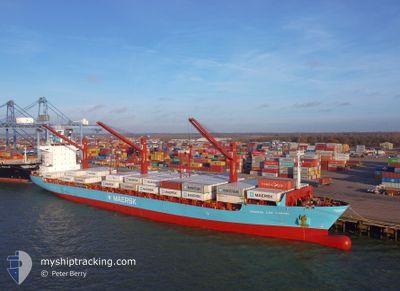
MAERSK CAP CARMEL
Container Ship
Current Trip
| Time Travelled | 16 days |
|---|---|
| Remaining Time | --- |
| Distance Travelled | 2750.46 nm |
| Remaining Distance | --- |
| AVG Speed | 8.9 Knopen |
| MAX Speed | 8.9 Knopen |
| AVG Wind | 16.5 knots |
| MAX Wind | 34 knots |
| MIN Temp | 17.9°C / 64.22°F |
| MAX Temp | 28.8°C / 83.84°F |
| Diepgang | 8.7 M |
| Positie ontvangen | 1 h, 43 m geleden |
Current Position
| Lengtegraad | 17.92381° |
|---|---|
| Breedtegraat | -33.77993° |
| Status | Under way using engine |
| Snelheid | 1.3 Knopen |
| Koers | 105° |
| Gebied | South Atlantic Ocean |
| Station | T-AIS |
| Positie ontvangen | 1 h, 43 m geleden |
Info
Information
The current position of MAERSK CAP CARMEL is in South Atlantic Ocean with coordinates -33.77993° / 17.92381° as reported on 2025-02-28 14:45 by AIS to our vessel tracker app. The vessel's current speed is 1.3 Knopen
The vessel MAERSK CAP CARMEL (IMO: 9273923, MMSI: 563050100) is a Container Ship that was built in 2003 ( 22 Jaar oud ). It's sailing under the flag of [SG] Singapore.
In this page you can find informations about the vessels current position, last detected port calls, and current voyage information. If the vessels is not in coverage by AIS you will find the latest position.
The current position of MAERSK CAP CARMEL is detected by our AIS receivers and we are not responsible for the reliability of the data. The last position was recorded while the vessel was in Coverage by the Ais receivers of our vessel tracking app.
The current draught of MAERSK CAP CARMEL as reported by AIS is 8.7 meters
Weather
| Temperature | 19.2°C / 66.56°F |
|---|---|
| Wind Speed | 6 knots |
| Direction | 220° SW |
| Pressure | 1010.7 hPa |
| Humidity | 90.9 % |
| Cloud Coverage | --- |
Featured Company
Last Port Calls
| Port | Arrival | Departure | Time In Port |
|---|---|---|---|
| 2025-02-11 06:08 | 2025-02-12 13:48 | 1 d | |
| 2025-01-29 13:43 | 2025-01-31 00:18 | 1 d | |
| 2025-01-15 16:58 | 2025-01-17 17:01 | 2 d | |
| 2025-01-01 11:37 | 2025-01-02 18:22 | 1 d | |
| 2024-12-17 18:20 | 2024-12-18 20:26 | 1 d | |
| 2024-12-03 19:53 | 2024-12-05 08:08 | 1 d |
Last Trips
| Origin | Departure | Destination | Arrival | Distance | |
|---|---|---|---|---|---|
| 2025-01-31 02:18 | 2025-02-11 10:08 | 2387.57 nm | |||
| 2025-01-17 21:01 | 2025-01-29 15:43 | 2528.58 nm | |||
| 2025-01-02 20:22 | 2025-01-15 20:58 | 2584.71 nm | |||
| 2024-12-19 00:26 | 2025-01-01 13:37 | 2920.31 nm | |||
| 2024-12-05 10:08 | 2024-12-17 22:20 | 2507.73 nm |
Events
| Tijd | Evenement | Details | Positie / Bestemming | Info |
|---|---|---|---|---|
| 2025-02-28 14:52 | Status Changed | Default Under way using engine |
-33.77753 / 17.92403
MUPLO>ZACPT
|
Snelheid: 1.3 kn Koers: 105° |
| 2025-02-28 14:45 | Buitenbereik |
-33.77993 / 17.92381
South Atlantic Ocean
|
Snelheid: 1.3 kn Koers: 8.7° |
|
| 2025-02-28 14:21 | Status Changed | Under way using engine Default |
-33.78853 / 17.92175
MUPLO>ZACPT
|
Snelheid: 1.3 kn Koers: 123° |
| 2025-02-28 14:16 | Status Changed | Default Under way using engine |
-33.78992 / 17.92122
MUPLO>ZACPT
|
Snelheid: 1.3 kn Koers: 122° |
| 2025-02-28 13:57 | Status Changed | Under way using engine Default |
-33.79637 / 17.91819
MUPLO>ZACPT
|
Snelheid: 1.3 kn Koers: 120° |
| 2025-02-28 13:57 | Status Changed | Default Under way using engine |
-33.79654 / 17.91810
MUPLO>ZACPT
|
Snelheid: 1.3 kn Koers: 115° |
| 2025-02-28 13:40 | Binnenbereik |
-33.80213 / 17.91528
South Atlantic Ocean
|
Snelheid: 1.3 kn Koers: 18.7° |
|
| 2025-02-28 13:39 | Status Changed | Under way using engine Default |
-33.80260 / 17.91508
MUPLO>ZACPT
|
Snelheid: 1.2 kn Koers: 97° |
| 2025-02-28 09:21 | Status Changed | Default Under way using engine |
-33.87654 / 17.91479
MUPLO>ZACPT
|
Snelheid: 1 kn Koers: 99° |
| 2025-02-28 09:13 | Buitenbereik |
-33.87833 / 17.91666
South Atlantic Ocean
|
Snelheid: 1 kn Koers: 321.3° |