
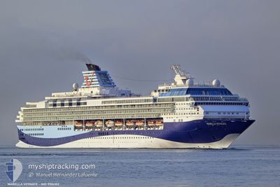
MARELLA VOYAGER
Passengers Ship
Current Trip
| Time Travelled | 18 h, 29 mins |
|---|---|
| Remaining Time | 14 h, 44 mins |
| Distance Travelled | 243.95 nm |
| Remaining Distance | 207.50 nm |
| AVG Speed | 13.7 Knopen |
| MAX Speed | 14.9 Knopen |
| AVG Wind | 14.5 knots |
| MAX Wind | 17 knots |
| MIN Temp | 25.1°C / 77.18°F |
| MAX Temp | 26.5°C / 79.7°F |
| Diepgang | 8.5 M |
| Positie ontvangen | 49 m geleden |
Current Position
| Lengtegraad | -62.26591° |
|---|---|
| Breedtegraat | 16.02291° |
| Status | Under way using engine |
| Snelheid | 12.8 Knopen |
| Koers | 331.2° |
| Gebied | Caribbean Sea |
| Station | T-AIS |
| Positie ontvangen | 49 m geleden |
Info
Information
The current position of MARELLA VOYAGER is in Caribbean Sea with coordinates 16.02291° / -62.26591° as reported on 2025-02-21 18:18 by AIS to our vessel tracker app. The vessel's current speed is 12.8 Knopen and is heading at the port of ROAD TOWN. The estimated time of arrival as calculated by MyShipTracking vessel tracking app is 2025-02-22 09:51 LT
The vessel MARELLA VOYAGER (IMO: 9106302, MMSI: 249053000) is a Passengers Ship that was built in 1997 ( 28 Jaar oud ). It's sailing under the flag of [MT] Malta.
In this page you can find informations about the vessels current position, last detected port calls, and current voyage information. If the vessels is not in coverage by AIS you will find the latest position.
The current position of MARELLA VOYAGER is detected by our AIS receivers and we are not responsible for the reliability of the data. The last position was recorded while the vessel was in Coverage by the Ais receivers of our vessel tracking app.
The current draught of MARELLA VOYAGER as reported by AIS is 8.5 meters
Weather
| Temperature | 26.5°C / 79.7°F |
|---|---|
| Wind Speed | 3 knots |
| Direction | 260° W |
| Pressure | 1015.7 hPa |
| Humidity | 60.9 % |
| Cloud Coverage | 2 % |
Featured Company
Last Port Calls
| Port | Arrival | Departure | Time In Port |
|---|---|---|---|
| 2025-02-20 11:14 | 2025-02-21 00:38 | 13 h | |
| 2025-02-19 11:31 | 2025-02-19 21:58 | 10 h | |
| 2025-02-18 11:22 | 2025-02-18 21:44 | 10 h | |
| 2025-02-16 11:07 | 2025-02-16 23:07 | 11 h | |
| 2025-02-15 11:02 | 2025-02-15 22:21 | 11 h | |
| 2025-02-13 10:37 | 2025-02-13 23:58 | 13 h | |
| 2025-02-12 11:32 | 2025-02-12 20:50 | 9 h | |
| 2025-02-11 11:11 | 2025-02-11 22:14 | 11 h | |
| 2025-02-10 11:13 | 2025-02-11 00:10 | 12 h | |
| 2025-02-09 11:21 | 2025-02-09 21:49 | 10 h |
Most Visited Ports (Last year)
| Port | Arrivals | |
|---|---|---|
| 28 | ||
| 21 | ||
| 15 | ||
| 12 | ||
| 12 | ||
| 12 |
Last Trips
| Origin | Departure | Destination | Arrival | Distance | |
|---|---|---|---|---|---|
| 2025-02-19 17:58 | 2025-02-20 07:14 | 173.12 nm | |||
| 2025-02-18 17:44 | 2025-02-19 07:31 | 105.89 nm | |||
| 2025-02-16 19:07 | 2025-02-18 07:22 | 170.97 nm | |||
| 2025-02-15 18:21 | 2025-02-16 07:07 | 145.98 nm | |||
| 2025-02-13 19:58 | 2025-02-15 07:02 | 256.51 nm | |||
| 2025-02-12 16:50 | 2025-02-13 06:37 | 184.27 nm | |||
| 2025-02-11 18:14 | 2025-02-12 07:32 | 147.87 nm | |||
| 2025-02-10 20:10 | 2025-02-11 07:11 | 80.92 nm | |||
| 2025-02-09 17:49 | 2025-02-10 07:13 | 96.48 nm | |||
| 2025-02-08 17:46 | 2025-02-09 07:21 | 93.04 nm |
Events
| Tijd | Evenement | Details | Positie / Bestemming | Info |
|---|---|---|---|---|
| 2025-02-21 18:23 | Status Changed | Default Under way using engine |
16.03960 / -62.27512
VGRAD
|
Snelheid: 12.8 kn Koers: 331.2° |
| 2025-02-21 18:18 | Status Changed | Under way using engine Default |
16.02291 / -62.26591
VGRAD
|
Snelheid: 13 kn Koers: 331° |
| 2025-02-21 18:00 | Status Changed | Default Under way using engine |
15.96631 / -62.23338
VGRAD
|
Snelheid: 13.1 kn Koers: 331.9° |
| 2025-02-21 17:57 | Status Changed | Under way using engine Default |
15.95619 / -62.22758
VGRAD
|
Snelheid: 13.2 kn Koers: 332° |
| 2025-02-21 17:55 | Status Changed | Default Under way using engine |
15.95020 / -62.22426
VGRAD
|
Snelheid: 12.9 kn Koers: 331° |
| 2025-02-21 17:40 | Status Changed | Under way using engine Default |
15.90399 / -62.19719
VGRAD
|
Snelheid: 13.2 kn Koers: 328° |
| 2025-02-21 17:05 | Status Changed | Default Under way using engine |
15.79051 / -62.12731
VGRAD
|
Snelheid: 13.2 kn Koers: 331.8° |
| 2025-02-21 16:05 | Gevonden in zee | Guadeloupe and Martinique part of the Caribbean Sea |
15.59737 / -62.01692
Caribbean Sea
VGRAD
|
Snelheid: 13.8 kn Koers: 329.7° |
| 2025-02-21 16:05 | Status Changed | Under way using engine Default |
15.59737 / -62.01692
VGRAD
|
Snelheid: 13.1 kn Koers: 330° |
| 2025-02-21 16:05 | Binnenbereik |
15.59737 / -62.01692
Caribbean Sea
VGRAD
|
Snelheid: 13.8 kn Koers: 329.7° |