
MARIE LEHMANN
Cargo
Current Trip
| Time Travelled | 1 day |
|---|---|
| Remaining Time | 4 h, 24 mins |
| Distance Travelled | 416.59 nm |
| Remaining Distance | 52.73 nm |
| AVG Speed | 11.5 Knopen |
| MAX Speed | 12.1 Knopen |
| AVG Wind | 5.8 knots |
| MAX Wind | 12.1 knots |
| MIN Temp | -2.8°C / 26.96°F |
| MAX Temp | 2.6°C / 36.68°F |
| Diepgang | 4 M |
| Positie ontvangen | 2 m geleden |
Current Position
| Lengtegraad | 23.47548° |
|---|---|
| Breedtegraat | 59.47899° |
| Status | Under way using engine |
| Snelheid | 11.8 Knopen |
| Koers | 72.7° |
| Gebied | Gulf of Finland |
| Station | T-AIS |
| Positie ontvangen | 2 m geleden |
Info
Information
The current position of MARIE LEHMANN is in Gulf of Finland with coordinates 59.47899° / 23.47548° as reported on 2025-02-11 14:50 by AIS to our vessel tracker app. The vessel's current speed is 11.8 Knopen and is heading at the port of MUUGA. The estimated time of arrival as calculated by MyShipTracking vessel tracking app is 2025-02-11 19:16 LT
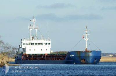
The vessel MARIE LEHMANN (IMO: 9728772, MMSI: 304957000) is a Cargo It's sailing under the flag of [AG] Antigua Barbuda.
In this page you can find informations about the vessels current position, last detected port calls, and current voyage information. If the vessels is not in coverage by AIS you will find the latest position.
The current position of MARIE LEHMANN is detected by our AIS receivers and we are not responsible for the reliability of the data. The last position was recorded while the vessel was in Coverage by the Ais receivers of our vessel tracking app.
The current draught of MARIE LEHMANN as reported by AIS is 4 meters
Weather
| Temperature | 0.7°C / 33.26°F |
|---|---|
| Wind Speed | 10 knots |
| Direction | 219° SW |
| Pressure | 1041.1 hPa |
| Humidity | 83.2 % |
| Cloud Coverage | 9 % |
Featured Company
Last Port Calls
| Port | Arrival | Departure | Time In Port |
|---|---|---|---|
| 2025-02-08 10:41 | 2025-02-10 02:45 | 1 d | |
| 2025-02-03 14:53 | 2025-02-04 22:45 | 1 d | |
| 2025-01-30 11:10 | 2025-02-02 14:29 | 3 d | |
| 2025-01-22 14:07 | 2025-01-24 15:53 | 2 d | |
| 2025-01-14 16:28 | 2025-01-21 07:33 | 6 d | |
| 2025-01-13 16:47 | 2025-01-14 07:28 | 14 h | |
| 2025-01-12 17:07 | 2025-01-13 11:45 | 18 h | |
| 2025-01-12 13:29 | 2025-01-12 13:59 | 29 m | |
| 2025-01-12 11:29 |
Last Trips
| Origin | Departure | Destination | Arrival | Distance | |
|---|---|---|---|---|---|
| 2025-02-05 00:45 | 2025-02-08 12:41 | 532.06 nm | |||
| 2025-02-02 15:29 | 2025-02-03 16:53 | 265.13 nm | |||
| 2025-01-24 15:53 | 2025-01-30 12:10 | 908.90 nm | |||
| 2025-01-21 08:33 | 2025-01-22 14:07 | 317.63 nm | |||
| 2025-01-14 08:28 | 2025-01-14 17:28 | 66.97 nm | |||
| 2025-01-13 12:45 | 2025-01-13 17:47 | 48.88 nm | |||
| 2025-01-12 14:59 | 2025-01-12 18:07 | 11.49 nm | |||
| 2025-01-12 12:29 | 2025-01-12 14:29 | 2.56 nm |
Events
| Tijd | Evenement | Details | Positie / Bestemming | Info |
|---|---|---|---|---|
| 2025-02-11 14:17 | Gevonden in zee | Estonian part of the Gulf of Finland |
59.44845 / 23.26977
Gulf of Finland
MUUGA
|
Snelheid: 11.7 kn Koers: 74.6° |
| 2025-02-11 13:51 | Status Changed | Under way using engine Default |
59.42437 / 23.11110
MUUGA
|
Snelheid: 11.7 kn Koers: 72° |
| 2025-02-11 13:43 | Status Changed | Default Under way using engine |
59.41696 / 23.06322
MUUGA
|
Snelheid: 11.5 kn Koers: 73° |
| 2025-02-11 13:05 | Gevonden in zee | Estonian part of the Baltic Sea |
59.38195 / 22.83284
Baltic Sea
MUUGA
|
Snelheid: 11.4 kn Koers: 74° |
| 2025-02-11 13:04 | Status Changed | Under way using engine Default |
59.38108 / 22.82688
MUUGA
|
Snelheid: 11.5 kn Koers: 73° |
| 2025-02-11 13:04 | Binnenbereik |
59.38195 / 22.83284
Baltic Sea
MUUGA
|
Snelheid: 11.4 kn Koers: 74° |
|
| 2025-02-11 09:43 | Status Changed | Default Under way using engine |
59.48971 / 21.63309
MUUGA
|
Snelheid: 11.6 kn Koers: 108.1° |
| 2025-02-11 09:23 | Buitenbereik |
59.50974 / 21.51024
Baltic Sea
MUUGA
|
Snelheid: 11.6 kn Koers: 108.1° |
|
| 2025-02-11 08:49 | Status Changed | Under way using engine Default |
59.54474 / 21.30588
MUUGA
|
Snelheid: 11.6 kn Koers: 110° |
| 2025-02-11 08:49 | Binnenbereik |
59.54363 / 21.31180
Baltic Sea
MUUGA
|
Snelheid: 11.6 kn Koers: 110.2° |